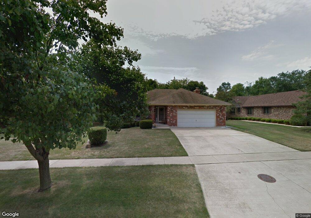
300 Keithland Ct New Lenox, IL 60451
Estimated Value: $379,000 - $485,000
3
Beds
2
Baths
--
Sq Ft
0.35
Acres
About This Home
This home is located at 300 Keithland Ct, New Lenox, IL 60451 and is currently estimated at $422,309. 300 Keithland Ct is a home located in Will County with nearby schools including Oster-Oakview School, Haines Elementary School, and Lincoln Way West.
Ownership History
Date
Name
Owned For
Owner Type
Purchase Details
Closed on
Mar 10, 2017
Sold by
The Chicago Trust Company Na
Bought by
Fazio Brian P
Current Estimated Value
Home Financials for this Owner
Home Financials are based on the most recent Mortgage that was taken out on this home.
Original Mortgage
$249,300
Outstanding Balance
$206,618
Interest Rate
4.15%
Mortgage Type
FHA
Estimated Equity
$215,691
Purchase Details
Closed on
Mar 14, 2002
Sold by
Lapenda James M and Lapenda Joanne M
Bought by
Suburban Bank & Trust Company and Trust #74-3164
Purchase Details
Closed on
Sep 21, 1989
Bought by
Lapenda James M
Create a Home Valuation Report for This Property
The Home Valuation Report is an in-depth analysis detailing your home's value as well as a comparison with similar homes in the area
Home Values in the Area
Average Home Value in this Area
Purchase History
| Date | Buyer | Sale Price | Title Company |
|---|---|---|---|
| Fazio Brian P | $253,900 | Citywide Title Corporation | |
| Suburban Bank & Trust Company | -- | -- | |
| Lapenda James M | $165,500 | -- |
Source: Public Records
Mortgage History
| Date | Status | Borrower | Loan Amount |
|---|---|---|---|
| Open | Fazio Brian P | $249,300 |
Source: Public Records
Tax History Compared to Growth
Tax History
| Year | Tax Paid | Tax Assessment Tax Assessment Total Assessment is a certain percentage of the fair market value that is determined by local assessors to be the total taxable value of land and additions on the property. | Land | Improvement |
|---|---|---|---|---|
| 2024 | $9,255 | $122,039 | $36,367 | $85,672 |
| 2023 | $9,255 | $111,248 | $33,151 | $78,097 |
| 2022 | $8,349 | $102,486 | $30,540 | $71,946 |
| 2021 | $7,921 | $96,385 | $28,722 | $67,663 |
| 2020 | $7,251 | $92,946 | $27,697 | $65,249 |
| 2019 | $6,924 | $90,064 | $26,838 | $63,226 |
| 2018 | $6,745 | $86,960 | $25,913 | $61,047 |
| 2017 | $6,394 | $105,046 | $25,168 | $79,878 |
| 2016 | $7,935 | $102,234 | $24,494 | $77,740 |
| 2015 | $7,631 | $99,016 | $23,723 | $75,293 |
| 2014 | $7,631 | $97,793 | $23,430 | $74,363 |
| 2013 | $7,631 | $99,111 | $23,746 | $75,365 |
Source: Public Records
Map
Nearby Homes
- 217 Aspen Dr
- 1231 Town Crest Dr Unit E
- 224 Hauser Ct
- 203 Fir St
- 125 Kimber Dr
- 200 Redwood Ave
- 208 Redwood Ave
- 133 Barbara Ln
- 1344 N Cedar Rd
- 807 Picardy Place
- 338 Willow St
- 1261 S Regan Rd
- 331 Old Hickory Rd
- 202 Hickory St
- 328 E Lincoln Hwy
- 416 Manor Ct Unit B
- 315 S Pine St
- Vacant W Maple St
- 1125 Georgias Way
- 117 Walona Ave
- 204 Keithland Ct
- 400 Keithland Ct
- 200 Keithland Ct
- 301 Keithland Ct
- 305 Keithland Ct
- 205 Keithland Ct
- 404 Keithland Ct
- 104 Keithland Ct
- 201 Keithland Ct
- 401 Keithland Ct
- 405 Keithland Ct
- 105 Keithland Ct
- 390 Aspen Dr
- 418 Aspen Dr
- 100 Keithland Ct
- 372 Aspen Dr
- 436 Aspen Dr
- 190 Aspen Dr
- 1149 N Cooper Rd
- 1151 N Cooper Rd