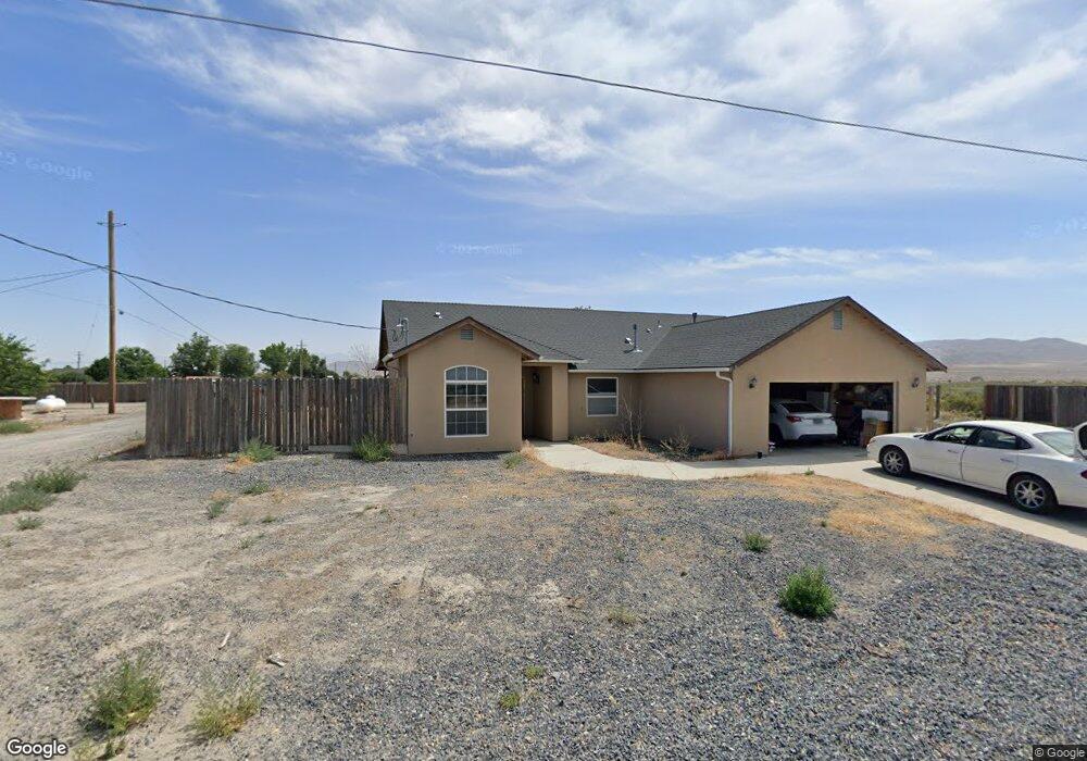
300 Mallard Way Lovelock, NV 89419
Estimated Value: $270,000 - $495,000
3
Beds
2
Baths
1,466
Sq Ft
$242/Sq Ft
Est. Value
About This Home
This home is located at 300 Mallard Way, Lovelock, NV 89419 and is currently estimated at $354,435, approximately $241 per square foot. 300 Mallard Way is a home with nearby schools including Pershing County Middle School and Pershing County High School.
Ownership History
Date
Name
Owned For
Owner Type
Purchase Details
Closed on
Jan 6, 2014
Sold by
Gurdeep Singh
Bought by
Brinkerhoff Kathie
Current Estimated Value
Home Financials for this Owner
Home Financials are based on the most recent Mortgage that was taken out on this home.
Original Mortgage
$132,000
Interest Rate
4.38%
Mortgage Type
New Conventional
Create a Home Valuation Report for This Property
The Home Valuation Report is an in-depth analysis detailing your home's value as well as a comparison with similar homes in the area
Home Values in the Area
Average Home Value in this Area
Purchase History
| Date | Buyer | Sale Price | Title Company |
|---|---|---|---|
| Brinkerhoff Kathie | $165,000 | First American Title |
Source: Public Records
Mortgage History
| Date | Status | Borrower | Loan Amount |
|---|---|---|---|
| Previous Owner | Brinkerhoff Kathie | $132,000 |
Source: Public Records
Tax History Compared to Growth
Tax History
| Year | Tax Paid | Tax Assessment Tax Assessment Total Assessment is a certain percentage of the fair market value that is determined by local assessors to be the total taxable value of land and additions on the property. | Land | Improvement |
|---|---|---|---|---|
| 2025 | $2,326 | $69,068 | $4,900 | $64,168 |
| 2024 | $2,326 | $69,414 | $4,900 | $64,514 |
| 2023 | $2,326 | $65,049 | $4,900 | $60,149 |
| 2022 | $2,033 | $59,977 | $9,277 | $50,700 |
| 2021 | $1,965 | $58,935 | $9,277 | $49,658 |
| 2020 | $1,953 | $59,412 | $9,277 | $50,135 |
| 2019 | $1,901 | $58,124 | $9,277 | $48,847 |
| 2018 | $1,849 | $57,164 | $9,277 | $47,887 |
| 2017 | $1,740 | $55,601 | $9,975 | $45,626 |
| 2016 | $1,694 | $55,607 | $9,975 | $45,632 |
| 2015 | $1,121 | $55,836 | $9,975 | $45,861 |
| 2014 | $1,121 | $56,066 | $9,975 | $46,091 |
Source: Public Records
Map
Nearby Homes
- 135 Cessna Ln
- 58 River Banks Ct
- 68 River Banks Ct
- 200 Raymond Rd
- 750 Airport Rd
- 0 Airport Rd
- 2515 Upper Valley Rd
- 5105 N Meridian Rd
- 1645 Central Ave
- 1605 Central Ave
- 1070 Cornell Ave
- T28 R31 Sec 27
- T33 R37 Sec 3
- 750 16th St
- 1465 Central Ave
- APN 14th St
- 0 None Unit 250052017
- 0 None Unit 250052015
- 595 Taylor Place
- 815 16th St
- 315 Mallard Way
- 500 Quail Ct
- 1 Reservoir Rd Unit 1
- 220 Reservoir Rd
- 400 Mallard Way
- 200 Reservoir Rd
- 0 Resevoir Rd Unit 90001145
- 0 Resevoir Rd Unit 90001144
- 0 Resevoir Rd Unit 90001143
- 0 Resevoir Rd Unit 100011134
- 0 Resevoir Rd Unit 100011133
- 00 Resevoir Rd
- 0 Resevoir Rd Unit 70013578
- 0 Resevoir Rd Unit 60015516
- 0 Resevoir Rd Unit 60015514
- 0 Resevoir Rd Unit 60015464
- 0 Resevoir Rd Unit 60015513
- 0 Resevoir Rd Unit 100011158
- 240 Reservoir Rd
- 160 Reservoir Rd