Estimated Value: $156,000 - $207,000
3
Beds
2
Baths
1,242
Sq Ft
$147/Sq Ft
Est. Value
About This Home
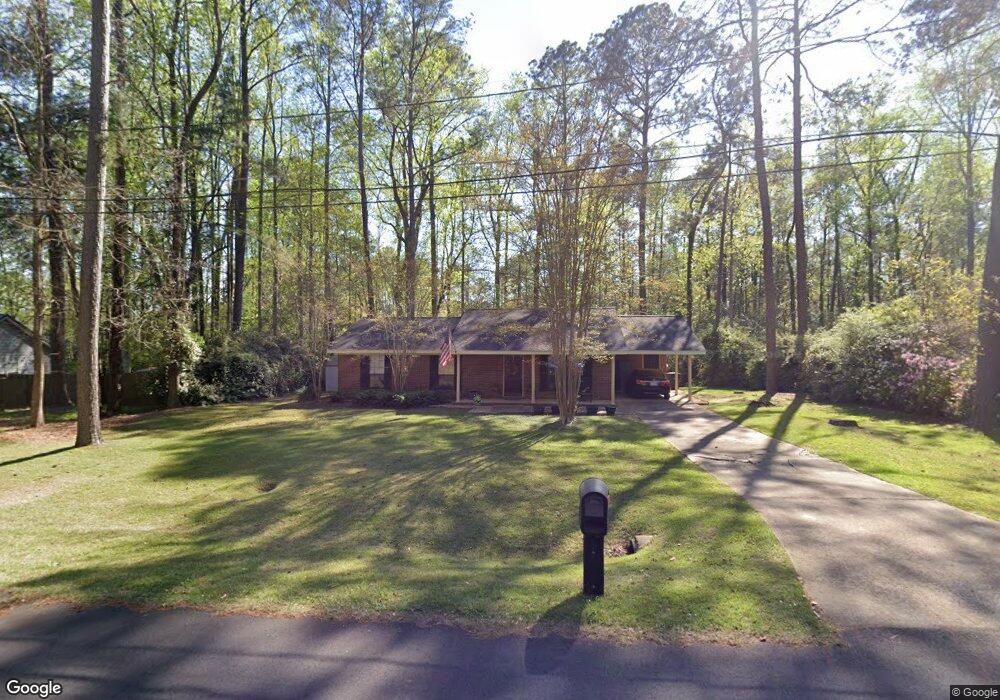
This home is located at 300 Muggridge Ln, Cairo, GA 39828 and is currently estimated at $182,948, approximately $147 per square foot. 300 Muggridge Ln is a home located in Grady County with nearby schools including Cairo High School.
Ownership History
Date
Name
Owned For
Owner Type
Purchase Details
Closed on
Nov 28, 2011
Sold by
Ayre Jason
Bought by
Burks Randy
Current Estimated Value
Purchase Details
Closed on
Oct 26, 2011
Sold by
Ezell Darrien
Bought by
Ayre Jason
Purchase Details
Closed on
Jun 6, 2011
Sold by
Ezell Darrien D
Bought by
Ezell Family Trust
Purchase Details
Closed on
Apr 4, 2001
Sold by
Ausley Carter E
Bought by
Ezell Darrien D
Purchase Details
Closed on
Nov 27, 1991
Bought by
Ausley Carter E
Create a Home Valuation Report for This Property
The Home Valuation Report is an in-depth analysis detailing your home's value as well as a comparison with similar homes in the area
Home Values in the Area
Average Home Value in this Area
Purchase History
| Date | Buyer | Sale Price | Title Company |
|---|---|---|---|
| Burks Randy | $70,000 | -- | |
| Ayre Jason | $54,600 | -- | |
| Ezell Darrien | -- | -- | |
| Ezell Family Trust | -- | -- | |
| Ezell Darrien D | $69,500 | -- | |
| Ausley Carter E | $51,000 | -- |
Source: Public Records
Tax History Compared to Growth
Tax History
| Year | Tax Paid | Tax Assessment Tax Assessment Total Assessment is a certain percentage of the fair market value that is determined by local assessors to be the total taxable value of land and additions on the property. | Land | Improvement |
|---|---|---|---|---|
| 2024 | $2,424 | $61,430 | $6,000 | $55,430 |
| 2023 | $1,402 | $37,877 | $6,000 | $31,877 |
| 2022 | $1,458 | $37,877 | $6,000 | $31,877 |
| 2021 | $1,462 | $37,877 | $6,000 | $31,877 |
| 2020 | $1,466 | $37,877 | $6,000 | $31,877 |
| 2019 | $1,466 | $37,877 | $6,000 | $31,877 |
| 2018 | $1,393 | $37,877 | $6,000 | $31,877 |
| 2017 | $1,340 | $37,877 | $6,000 | $31,877 |
| 2016 | $1,262 | $34,884 | $6,000 | $28,884 |
| 2015 | $1,250 | $34,884 | $6,000 | $28,884 |
| 2014 | $1,250 | $34,884 | $6,000 | $28,884 |
| 2013 | -- | $35,490 | $12,000 | $23,490 |
Source: Public Records
Map
Nearby Homes
- 270 Muggridge Ln
- 1193 S Broad St
- 75 14th Ave SE
- 720 1st St SW
- 109 Oriac Ave SW
- 117 Pine Cir SW
- 112 Pine Cir SW
- 602 4th St SE
- 27 6th Ave SW
- 1310 Stone Ave
- 530 6th Ave SE
- 481 4th St SE
- 530 6th St
- 460 2nd St SW
- 1406 Platt Ave
- 000 S Broad St
- 471 4th St SE
- 40 5th Ave SW
- 000 Hwy 111 South 20 59 Acres
- 309 3rd St SE
- 310 Muggridge Ln
- 312 Horseshoe Bend
- 310 Horseshoe Bend
- 303 Muggridge Ln
- 280 Muggridge Ln
- 320 Muggridge Ln
- 285 Muggridge Ln
- 308 Horseshoe Bend
- 316 Horseshoe Bend
- 306 Horseshoe Bend
- 1090 Brookwood Dr SE
- 1014 3rd St SE
- 315 Horseshoe Bend
- 330 Muggridge Ln
- 1033 3rd St SE
- 111246 N Downs Bend NE
- Lot 33 Horseshoe Bend
- 000 Horseshoe Bend
- 00 Horseshoe Bend Unit 24D
- 00 Horseshoe Bend