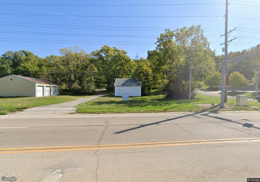
300 N Bluff Rd Collinsville, IL 62234
Estimated Value: $86,000 - $1,655,000
2
Beds
1
Bath
960
Sq Ft
$531/Sq Ft
Est. Value
About This Home
This home is located at 300 N Bluff Rd, Collinsville, IL 62234 and is currently estimated at $510,053, approximately $531 per square foot. 300 N Bluff Rd is a home located in Madison County with nearby schools including Twin Echo Elementary School, Dorris Intermediate School, and Collinsville Middle School.
Ownership History
Date
Name
Owned For
Owner Type
Purchase Details
Closed on
Dec 17, 2021
Sold by
Quatto Trust
Bought by
Gore Creek Capital I Llc
Current Estimated Value
Home Financials for this Owner
Home Financials are based on the most recent Mortgage that was taken out on this home.
Original Mortgage
$1,979,706
Outstanding Balance
$1,308,308
Interest Rate
3.11%
Mortgage Type
Construction
Estimated Equity
-$798,255
Purchase Details
Closed on
Apr 30, 2004
Sold by
Quatto Florence S and Schmidt Florence
Bought by
Quatto Florence S and Florence S Quatto Trust
Create a Home Valuation Report for This Property
The Home Valuation Report is an in-depth analysis detailing your home's value as well as a comparison with similar homes in the area
Home Values in the Area
Average Home Value in this Area
Purchase History
| Date | Buyer | Sale Price | Title Company |
|---|---|---|---|
| Gore Creek Capital I Llc | $1,500,000 | Title Partners Agency Llc | |
| Quatto Florence S | -- | -- |
Source: Public Records
Mortgage History
| Date | Status | Borrower | Loan Amount |
|---|---|---|---|
| Open | Gore Creek Capital I Llc | $1,979,706 |
Source: Public Records
Tax History Compared to Growth
Tax History
| Year | Tax Paid | Tax Assessment Tax Assessment Total Assessment is a certain percentage of the fair market value that is determined by local assessors to be the total taxable value of land and additions on the property. | Land | Improvement |
|---|---|---|---|---|
| 2024 | $2,582 | $40,390 | $12,210 | $28,180 |
| 2023 | $2,582 | $37,380 | $11,300 | $26,080 |
| 2022 | $2,460 | $34,570 | $10,450 | $24,120 |
| 2021 | $2,244 | $32,480 | $9,820 | $22,660 |
| 2020 | $2,163 | $30,990 | $9,370 | $21,620 |
| 2019 | $2,106 | $29,930 | $9,050 | $20,880 |
| 2018 | $1,279 | $28,360 | $8,580 | $19,780 |
| 2017 | $1,262 | $27,800 | $8,410 | $19,390 |
| 2016 | $1,313 | $27,800 | $8,410 | $19,390 |
| 2015 | $1,177 | $27,080 | $8,190 | $18,890 |
| 2014 | $1,177 | $27,080 | $8,190 | $18,890 |
| 2013 | $1,177 | $27,080 | $8,190 | $18,890 |
Source: Public Records
Map
Nearby Homes
- 45 Bellevue Dr
- 100 Debbie Dr
- 1051 Lafayette Ct Unit A
- 1059 Lafayette Ct Unit A
- 1035 Lafayette Ct Unit B
- 101 Westminster Dr
- 108 Westridge Dr
- 1121 Carraway Ct
- 205 Audrey Ave
- 510 N Combs Ave
- 126 Collinsville Ave
- 300 N Combs Ave
- 123 Elliot St
- 2007 Belt Line Rd
- 0 Elm St
- 221 N Hesperia St Unit 221 A and 221 B
- 580 N Guernsey St
- 5 Brookwood Dr
- 119 N Hesperia St
- 611 W Main St
- 604 Beverly Ln
- 606 Beverly Ln
- 602 Beverly Ln
- XXX State Route 157
- XXX State Rt 157
- 1105 Plainview Dr
- 1101 Plainview Dr
- 604 Watch Hill Rd
- 606 Watch Hill Rd
- 602 Watch Hill Rd
- 193 Beverly Ln
- 302 Beverly Ln
- 596 Watch Hill Rd
- 1104 Plainview Dr
- 1102 Plainview Dr
- 1100 Plainview Dr
- 598 Watch Hill Rd
- 600 Watch Hill Rd
- 2 Woodcliffe Dr
- 586 Watch Hill Rd