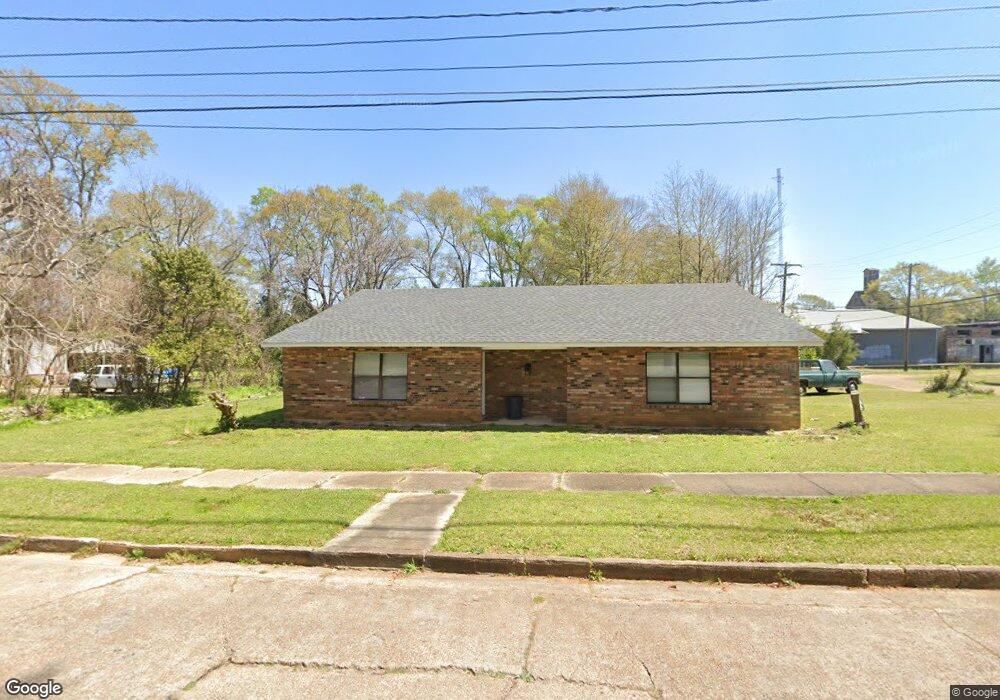
300 N Front St McComb, MS 39648
Estimated Value: $114,774 - $144,000
4
Beds
2
Baths
2,218
Sq Ft
$57/Sq Ft
Est. Value
About This Home
This home is located at 300 N Front St, McComb, MS 39648 and is currently estimated at $126,591, approximately $57 per square foot. 300 N Front St is a home located in Pike County with nearby schools including Higgins Middle School, Otken Elementary School, and Denman Junior High School.
Ownership History
Date
Name
Owned For
Owner Type
Purchase Details
Closed on
Jul 8, 2020
Sold by
Byrd Steve M and Byrd Christa
Bought by
Another Rabbit Trail Llc
Current Estimated Value
Home Financials for this Owner
Home Financials are based on the most recent Mortgage that was taken out on this home.
Original Mortgage
$23,156
Interest Rate
3.1%
Mortgage Type
Commercial
Purchase Details
Closed on
Jul 28, 2008
Sold by
Byrd Dina M and Byrd Dina L
Bought by
Byrd Steve M and Byrd Christa
Create a Home Valuation Report for This Property
The Home Valuation Report is an in-depth analysis detailing your home's value as well as a comparison with similar homes in the area
Purchase History
| Date | Buyer | Sale Price | Title Company |
|---|---|---|---|
| Another Rabbit Trail Llc | -- | None Available | |
| Byrd Steve M | -- | None Available |
Source: Public Records
Mortgage History
| Date | Status | Borrower | Loan Amount |
|---|---|---|---|
| Closed | Another Rabbit Trail Llc | $23,156 |
Source: Public Records
Tax History
| Year | Tax Paid | Tax Assessment Tax Assessment Total Assessment is a certain percentage of the fair market value that is determined by local assessors to be the total taxable value of land and additions on the property. | Land | Improvement |
|---|---|---|---|---|
| 2025 | $2,003 | $11,259 | $0 | $0 |
| 2024 | $1,719 | $9,628 | $0 | $0 |
| 2023 | $1,700 | $9,628 | $0 | $0 |
| 2022 | $1,676 | $9,628 | $0 | $0 |
| 2021 | $1,102 | $6,352 | $0 | $0 |
| 2020 | $996 | $5,737 | $0 | $0 |
| 2019 | $953 | $5,737 | $0 | $0 |
| 2018 | $925 | $5,737 | $0 | $0 |
| 2017 | $930 | $5,737 | $0 | $0 |
| 2016 | $923 | $5,737 | $0 | $0 |
| 2015 | -- | $5,632 | $0 | $0 |
| 2014 | -- | $5,632 | $0 | $0 |
| 2013 | -- | $5,632 | $0 | $0 |
Source: Public Records
Map
Nearby Homes
- 126 N Broadway St
- 136 W New York Ave
- 110 S 4th St
- 333 W Georgia Ave
- 315 Kentucky Ave
- 635 Delaware Ave
- 200-208 5th Ave
- 430 Louisiana Ave
- 134 A & B W New York Ave
- 612 W New York Ave
- 115 Scott St
- 318 S Cherry St
- 143 N Myrtle St
- 605 Virginia Ave
- 721 Minnesota Ave
- 425 S Broadway St
- 415 S 5th St
- 122 Denwiddie Ave
- 133 N Live Oak St
- 310 Burke Ave
- 316 N Front St
- 307 N Front St
- 203 Clark Ave
- 320 N Front St
- 207 Clark Ave
- 319 N Front St
- 211 Clark Ave
- 325 N Front St
- 1077 Hudson Cir
- 124 West Ave
- 206 Maryland Ave
- 213 Clark Ave
- 121 W Michigan Ave
- 219 Clark Ave
- 300 N Broadway St
- 318 N Broadway St
- 216 N Broadway St
- 218 N Broadway
- 320 N Broadway
- 124 W Michigan Ave
Your Personal Tour Guide
Ask me questions while you tour the home.