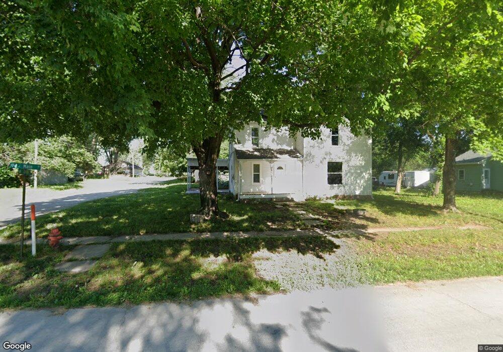
300 N Main St Centerview, MO 64019
Estimated Value: $102,000 - $193,000
3
Beds
2
Baths
1,594
Sq Ft
$90/Sq Ft
Est. Value
About This Home
This home is located at 300 N Main St, Centerview, MO 64019 and is currently estimated at $143,094, approximately $89 per square foot. 300 N Main St is a home located in Johnson County with nearby schools including Crest Ridge Elementary School, Crest Ridge High School, and Johnson County Christian Academy.
Ownership History
Date
Name
Owned For
Owner Type
Purchase Details
Closed on
Jun 26, 2023
Sold by
Millsap & Singer Llc
Bought by
Shippy Mary A and Shippy David E
Current Estimated Value
Purchase Details
Closed on
Jul 9, 2013
Sold by
Parsons Amanda
Bought by
Parsons William G
Purchase Details
Closed on
Oct 16, 2009
Sold by
Martin Stana
Bought by
Parsons William G
Create a Home Valuation Report for This Property
The Home Valuation Report is an in-depth analysis detailing your home's value as well as a comparison with similar homes in the area
Purchase History
| Date | Buyer | Sale Price | Title Company |
|---|---|---|---|
| Shippy Mary A | $40,021 | None Listed On Document | |
| Parsons William G | -- | None Available | |
| Parsons William G | -- | -- |
Source: Public Records
Tax History
| Year | Tax Paid | Tax Assessment Tax Assessment Total Assessment is a certain percentage of the fair market value that is determined by local assessors to be the total taxable value of land and additions on the property. | Land | Improvement |
|---|---|---|---|---|
| 2024 | $606 | $7,890 | $0 | $0 |
| 2023 | $606 | $7,890 | $0 | $0 |
| 2022 | $581 | $7,540 | $0 | $0 |
| 2021 | $578 | $7,540 | $0 | $0 |
| 2020 | $555 | $7,189 | $0 | $0 |
| 2019 | $547 | $7,189 | $0 | $0 |
| 2017 | $519 | $7,189 | $0 | $0 |
| 2016 | $531 | $7,189 | $0 | $0 |
| 2015 | $523 | $7,132 | $0 | $0 |
| 2014 | $523 | $7,132 | $0 | $0 |
Source: Public Records
Map
Nearby Homes
- 65 SW 150th Rd
- 66 SW 150th Rd
- TBD Lot 7 491st Rd
- 0 Tbd Lot 2 491st Rd
- 64 SW 401st Rd
- 507 NW 165th Rd
- 342 SW 701st Rd
- TBD NW 361st Rd
- 245 SW 400th Rd
- 412 NW 701st Rd
- 120 NW 191 Rd
- 125 NW 171 Rd
- 103 SW 95th Rd
- 733 Burlington Rd
- 475 SW 801st Rd
- 708 Burlington Rd
- 704 Mahogany Ct
- 705 Mahogany Ct
- 707 Mahogany Ct
- 629 Oakmont Dr
- 304 N Main St
- 111 E Spring St
- 109 W Spring St
- 305 N Main St
- 307 N Graham St
- 301 N Main St
- 217 N Graham St
- 310 N Main St
- 307 N Main St
- 311 N Graham St
- 218 N Graham St
- 211 N Graham St
- 210 N Main St
- 213 N Main St
- 209 N Main St
- 214 N Graham St
- 206 N Main St
- 400 N Main St
- 304 N Graham St
- 109 W Franklin St
Your Personal Tour Guide
Ask me questions while you tour the home.