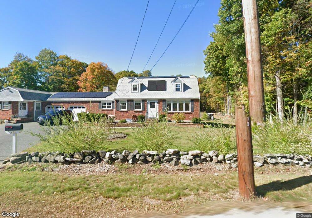
300 Orchard St Millis, MA 02054
Estimated Value: $745,000 - $847,916
5
Beds
4
Baths
3,000
Sq Ft
$272/Sq Ft
Est. Value
About This Home
This home is located at 300 Orchard St, Millis, MA 02054 and is currently estimated at $816,479, approximately $272 per square foot. 300 Orchard St is a home located in Norfolk County with nearby schools including Clyde F Brown, Millis Middle School, and Millis High School.
Ownership History
Date
Name
Owned For
Owner Type
Purchase Details
Closed on
Nov 27, 2024
Sold by
Bratsos Matthew T
Bought by
Matthew T Bratsos Lt and Bratsos
Current Estimated Value
Purchase Details
Closed on
Apr 23, 2018
Sold by
Bratsos Matthew T and Bratsos Diana L
Bought by
Bratsos Matthew T
Purchase Details
Closed on
Jun 7, 2002
Sold by
Moreau Robert L and Moreau Beverly J
Bought by
Bratsos Matthew T and Bratsos Diana L
Home Financials for this Owner
Home Financials are based on the most recent Mortgage that was taken out on this home.
Original Mortgage
$300,000
Interest Rate
6.9%
Mortgage Type
Purchase Money Mortgage
Purchase Details
Closed on
Jan 28, 1988
Sold by
Rogers Randall J
Bought by
Moreau Robert L
Create a Home Valuation Report for This Property
The Home Valuation Report is an in-depth analysis detailing your home's value as well as a comparison with similar homes in the area
Home Values in the Area
Average Home Value in this Area
Purchase History
| Date | Buyer | Sale Price | Title Company |
|---|---|---|---|
| Matthew T Bratsos Lt | -- | None Available | |
| Matthew T Bratsos Lt | -- | None Available | |
| Bratsos Matthew T | -- | -- | |
| Bratsos Matthew T | $358,900 | -- | |
| Bratsos Matthew T | -- | -- | |
| Bratsos Matthew T | $358,900 | -- | |
| Moreau Robert L | $255,000 | -- |
Source: Public Records
Mortgage History
| Date | Status | Borrower | Loan Amount |
|---|---|---|---|
| Previous Owner | Moreau Robert L | $325,000 | |
| Previous Owner | Bratsos Matthew T | $300,000 |
Source: Public Records
Tax History
| Year | Tax Paid | Tax Assessment Tax Assessment Total Assessment is a certain percentage of the fair market value that is determined by local assessors to be the total taxable value of land and additions on the property. | Land | Improvement |
|---|---|---|---|---|
| 2025 | $12,184 | $742,900 | $197,400 | $545,500 |
| 2024 | $11,282 | $687,100 | $197,400 | $489,700 |
| 2023 | $10,991 | $628,400 | $171,600 | $456,800 |
| 2022 | $10,626 | $562,800 | $168,900 | $393,900 |
| 2021 | $10,699 | $545,300 | $168,900 | $376,400 |
| 2020 | $11,166 | $554,400 | $157,900 | $396,500 |
| 2019 | $9,883 | $528,500 | $149,200 | $379,300 |
| 2018 | $9,280 | $515,000 | $135,700 | $379,300 |
| 2017 | $9,223 | $500,700 | $150,900 | $349,800 |
| 2016 | $8,732 | $500,700 | $150,900 | $349,800 |
| 2015 | $8,512 | $500,700 | $150,900 | $349,800 |
Source: Public Records
Map
Nearby Homes
- 6 Rivendell Ln
- 6 Beech St
- 28 Key St Unit 28
- 4 Brookview Rd
- 6 Rosenfeld Rd
- 119 Middlesex St
- 324 Union St Unit 1
- 50 Walnut St
- 2 Towne Lyne Rd
- 22 May Rd
- 21 Spywood Rd
- 6 April Way
- 10 April Way
- 27 Spywood Rd
- 00000 S Main St and Bullard St
- 54 Spywood Rd
- 11 Parnell St
- 59 Spywood Rd
- 6 Glen Ellen Blvd Unit 6
- 20 Hemlock Cir
- 294 Orchard St
- 308 Orchard St
- 292 Orchard St Unit 292
- 288 Orchard St
- 9 Middlesex St
- 11 Middlesex St
- 285 Orchard St
- 307 Orchard St
- 284 Orchard St
- 15 Middlesex St
- 312 Orchard St
- 283 Orchard St
- 10 Middlesex St
- 280 Orchard St
- 279 Orchard St
- 439 Exchange St
- 278 Orchard St
- 315 Orchard St
- 274 Orchard St
- 277 Orchard St
Your Personal Tour Guide
Ask me questions while you tour the home.