Estimated Value: $539,527 - $667,000
3
Beds
4
Baths
3,488
Sq Ft
$167/Sq Ft
Est. Value
About This Home
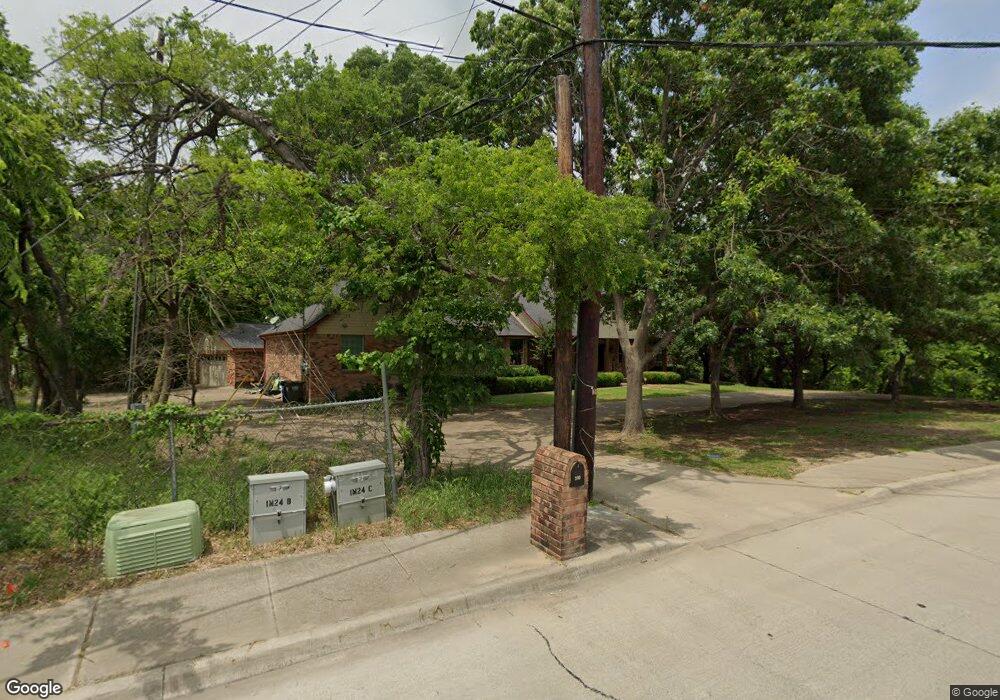
This home is located at 300 S W a Allen Blvd, Wylie, TX 75098 and is currently estimated at $581,132, approximately $166 per square foot. 300 S W a Allen Blvd is a home located in Collin County with nearby schools including P M Akin Elementary School, AB Harrison Intermediate School, and Grady Burnett J High School.
Ownership History
Date
Name
Owned For
Owner Type
Purchase Details
Closed on
Aug 21, 2000
Sold by
Delong David C and Delong Karen L
Bought by
Morrical Gregory R and Morrical Michelle D
Current Estimated Value
Home Financials for this Owner
Home Financials are based on the most recent Mortgage that was taken out on this home.
Original Mortgage
$192,800
Outstanding Balance
$83,338
Interest Rate
10.99%
Estimated Equity
$497,794
Purchase Details
Closed on
Oct 19, 1995
Sold by
Christner Henry E and Christner Dorothy Levon
Bought by
Delong David C and Delong Karen L
Home Financials for this Owner
Home Financials are based on the most recent Mortgage that was taken out on this home.
Original Mortgage
$125,000
Interest Rate
7.62%
Create a Home Valuation Report for This Property
The Home Valuation Report is an in-depth analysis detailing your home's value as well as a comparison with similar homes in the area
Home Values in the Area
Average Home Value in this Area
Purchase History
| Date | Buyer | Sale Price | Title Company |
|---|---|---|---|
| Morrical Gregory R | -- | -- | |
| Delong David C | -- | -- |
Source: Public Records
Mortgage History
| Date | Status | Borrower | Loan Amount |
|---|---|---|---|
| Open | Morrical Gregory R | $192,800 | |
| Previous Owner | Delong David C | $125,000 |
Source: Public Records
Tax History Compared to Growth
Tax History
| Year | Tax Paid | Tax Assessment Tax Assessment Total Assessment is a certain percentage of the fair market value that is determined by local assessors to be the total taxable value of land and additions on the property. | Land | Improvement |
|---|---|---|---|---|
| 2025 | $8,080 | $488,245 | $114,000 | $374,245 |
| 2024 | $8,080 | $476,131 | $114,000 | $366,280 |
| 2023 | $8,080 | $432,846 | $114,000 | $408,891 |
| 2022 | $8,633 | $393,496 | $114,000 | $396,778 |
| 2021 | $8,417 | $357,724 | $66,500 | $291,224 |
| 2020 | $8,941 | $360,088 | $66,500 | $293,588 |
| 2019 | $9,537 | $362,903 | $70,000 | $311,365 |
| 2018 | $8,757 | $325,171 | $70,000 | $285,421 |
| 2017 | $7,961 | $318,558 | $60,000 | $258,558 |
| 2016 | $7,467 | $297,828 | $42,000 | $255,828 |
| 2015 | $6,140 | $244,305 | $42,000 | $202,305 |
Source: Public Records
Map
Nearby Homes
- 306 Foxwood Ct
- 1209 Surrey Cir
- 409 Cedar Ridge Dr
- 312 Maltese Cir
- 1201 E Stone Rd
- 825 Foxwood Ln
- 216 Cedar Ridge St
- 1056 Fairview Dr
- 825 Forest Edge Ln
- 820 Foxwood Ln
- 213 N West A Allen Blvd
- 1115 Nighthawk Dr
- 107 Windy Knoll Ln
- 811 Forest Edge Ln
- 304 Hawthorn Dr
- 104 Rushcreek Dr
- 310 Hawthorn Dr
- 407 Sparrow Dr
- 1320 Cedar Branch Dr
- 114 Liberty Dr
- 301 Foxwood Ln
- 430 Cedar Ridge St
- 430 Cedar Ridge Dr
- 428 Cedar Ridge Dr
- 215 S W a Allen Blvd
- 303 Foxwood Ln
- 226 Lyndhurst Dr
- 426 Cedar Ridge Dr
- 426 Cedar Ridge St
- 304 Foxwood Ln
- 212 S West A Allen Blvd
- 427 Cedar Ridge Dr
- 305 Foxwood Ln
- 225 Lyndhurst Dr
- 424 Cedar Ridge Dr
- 224 Lyndhurst Dr
- 425 Cedar Ridge Dr
- 423 Cedar Ridge Dr
- 223 Lyndhurst Dr
- 1001 Eagle Glen Dr