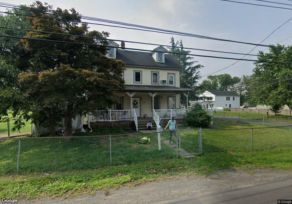
300 State Rd Unit B Croydon, PA 19021
Estimated Value: $364,000 - $494,000
4
Beds
2
Baths
2,116
Sq Ft
$205/Sq Ft
Est. Value
About This Home
This home is located at 300 State Rd Unit B, Croydon, PA 19021 and is currently estimated at $433,539, approximately $204 per square foot. 300 State Rd Unit B is a home located in Bucks County with nearby schools including Truman Senior High School, School Lane Charter School, and St Charles Borromeo School.
Ownership History
Date
Name
Owned For
Owner Type
Purchase Details
Closed on
Mar 30, 2018
Sold by
Bifoullossane Aicha and Abdellatif Issam
Bought by
Diegidio Joseph
Current Estimated Value
Purchase Details
Closed on
Dec 3, 2014
Sold by
Federal Natl Mtg Assn
Bought by
Bifoulloussane Aicha and Abdellatif Issam
Purchase Details
Closed on
Aug 7, 2013
Sold by
Wolf Linda and Sovereign Bank Na
Bought by
Federal National Mortgage Association
Purchase Details
Closed on
Feb 1, 2005
Sold by
Lyons Jack
Bought by
Wolf Linda
Home Financials for this Owner
Home Financials are based on the most recent Mortgage that was taken out on this home.
Original Mortgage
$240,000
Interest Rate
5.77%
Mortgage Type
Fannie Mae Freddie Mac
Purchase Details
Closed on
Aug 31, 1999
Sold by
Carroll Naomi E and Maier Kathleen F
Bought by
Lyons Jack
Create a Home Valuation Report for This Property
The Home Valuation Report is an in-depth analysis detailing your home's value as well as a comparison with similar homes in the area
Home Values in the Area
Average Home Value in this Area
Purchase History
| Date | Buyer | Sale Price | Title Company |
|---|---|---|---|
| Diegidio Joseph | $250,000 | First Platinum Abstract Llc | |
| Bifoulloussane Aicha | $180,000 | -- | |
| Federal National Mortgage Association | $1,042 | None Available | |
| Wolf Linda | $300,000 | -- | |
| Lyons Jack | $130,000 | -- |
Source: Public Records
Mortgage History
| Date | Status | Borrower | Loan Amount |
|---|---|---|---|
| Previous Owner | Wolf Linda | $240,000 |
Source: Public Records
Tax History
| Year | Tax Paid | Tax Assessment Tax Assessment Total Assessment is a certain percentage of the fair market value that is determined by local assessors to be the total taxable value of land and additions on the property. | Land | Improvement |
|---|---|---|---|---|
| 2025 | $6,083 | $22,400 | $4,640 | $17,760 |
| 2024 | $6,083 | $22,400 | $4,640 | $17,760 |
| 2023 | $6,038 | $22,400 | $4,640 | $17,760 |
| 2022 | $6,038 | $22,400 | $4,640 | $17,760 |
| 2021 | $6,038 | $22,400 | $4,640 | $17,760 |
| 2020 | $6,038 | $22,400 | $4,640 | $17,760 |
| 2019 | $4,286 | $22,400 | $4,640 | $17,760 |
| 2018 | $5,919 | $22,400 | $4,640 | $17,760 |
| 2017 | $5,829 | $22,400 | $4,640 | $17,760 |
| 2016 | $5,829 | $22,400 | $4,640 | $17,760 |
| 2015 | $4,520 | $22,400 | $4,640 | $17,760 |
| 2014 | $4,520 | $22,400 | $4,640 | $17,760 |
Source: Public Records
Map
Nearby Homes
- 813 Fifth Ave
- 909 Third Ave
- 601 Fourth Ave
- 619 First Ave
- 618 Cedar Ave
- 530 Main Ave
- 535 Princess Ave
- 1005 Maryland Ave
- 811 Washington Ave
- 716 Rosa Ave
- 730 Excelsior Ave
- 910 Magnolia Ave
- 208 Neshaminy Rd
- 1051 Maple Ave
- 0 Neshaminy St Unit PABU2089046
- 0 Allen Ave
- 311 Neshaminy Rd
- 1000 Stephen Ave
- 3933 Wrexham Ct
- 200 Janet Ave
Your Personal Tour Guide
Ask me questions while you tour the home.