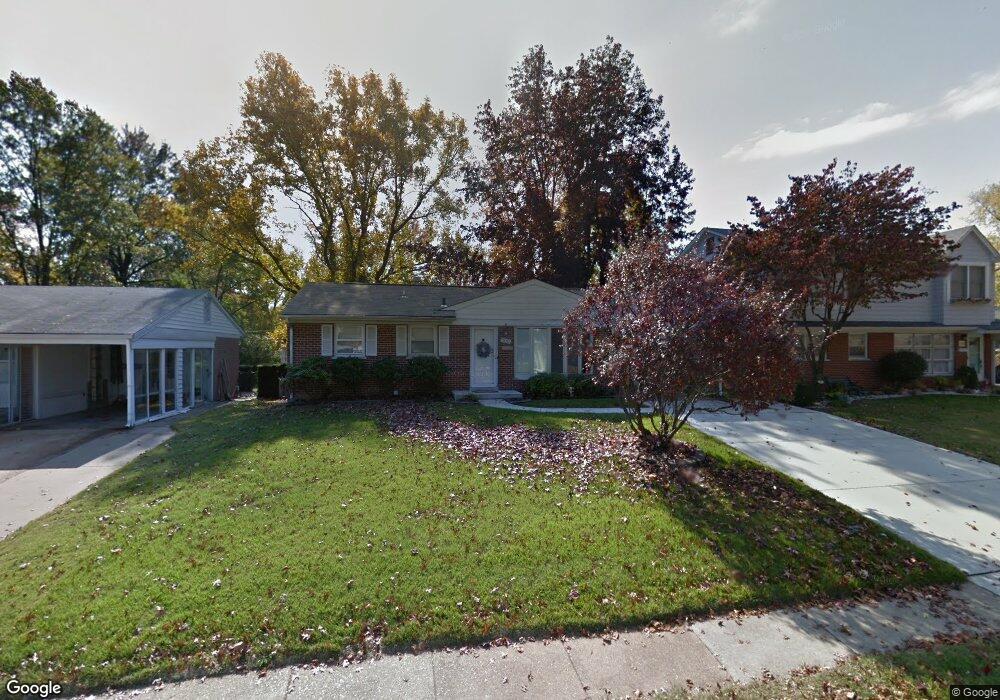
300 W Saint Anthony Ln Florissant, MO 63031
Estimated Value: $159,000 - $174,000
3
Beds
2
Baths
1,050
Sq Ft
$159/Sq Ft
Est. Value
About This Home
This home is located at 300 W Saint Anthony Ln, Florissant, MO 63031 and is currently estimated at $167,221, approximately $159 per square foot. 300 W Saint Anthony Ln is a home located in St. Louis County with nearby schools including Duchesne Elementary School, Cross Keys Middle School, and McCluer North High School.
Ownership History
Date
Name
Owned For
Owner Type
Purchase Details
Closed on
Aug 24, 2022
Sold by
Farley Renee A
Bought by
Renee Farley Living Trust
Current Estimated Value
Purchase Details
Closed on
Jul 30, 1999
Sold by
Schweitzer Ralph J and Schweitzer Dolores
Bought by
Lemley Patricia A
Home Financials for this Owner
Home Financials are based on the most recent Mortgage that was taken out on this home.
Original Mortgage
$66,360
Interest Rate
7.63%
Create a Home Valuation Report for This Property
The Home Valuation Report is an in-depth analysis detailing your home's value as well as a comparison with similar homes in the area
Home Values in the Area
Average Home Value in this Area
Purchase History
| Date | Buyer | Sale Price | Title Company |
|---|---|---|---|
| Renee Farley Living Trust | -- | -- | |
| Lemley Patricia A | $76,700 | -- |
Source: Public Records
Mortgage History
| Date | Status | Borrower | Loan Amount |
|---|---|---|---|
| Previous Owner | Lemley Patricia A | $66,360 |
Source: Public Records
Tax History Compared to Growth
Tax History
| Year | Tax Paid | Tax Assessment Tax Assessment Total Assessment is a certain percentage of the fair market value that is determined by local assessors to be the total taxable value of land and additions on the property. | Land | Improvement |
|---|---|---|---|---|
| 2025 | $2,076 | $30,710 | $4,640 | $26,070 |
| 2024 | $2,076 | $26,750 | $4,030 | $22,720 |
| 2023 | $2,068 | $26,750 | $4,030 | $22,720 |
| 2022 | $1,687 | $19,100 | $3,100 | $16,000 |
| 2021 | $1,659 | $19,100 | $3,100 | $16,000 |
| 2020 | $1,636 | $17,760 | $3,550 | $14,210 |
| 2019 | $1,604 | $17,760 | $3,550 | $14,210 |
| 2018 | $1,368 | $13,490 | $2,050 | $11,440 |
| 2017 | $1,360 | $13,490 | $2,050 | $11,440 |
| 2016 | $1,349 | $13,030 | $2,430 | $10,600 |
| 2015 | $1,356 | $13,030 | $2,430 | $10,600 |
| 2014 | $1,566 | $15,580 | $3,120 | $12,460 |
Source: Public Records
Map
Nearby Homes
- 270 W Saint Anthony Ln
- 250 Maple Dr
- 215 Maple Dr
- 38 Spring Dr
- 24 Valley Dr
- 150 Saint Daniel Ln
- 540 S Jefferson St
- 1205 Saint Matthew Dr
- 215 Derhake Rd
- 50 Saint Walter Ln
- 305 S Lafayette St
- 840 Pershall Rd
- 1375 S New Florissant Rd
- 940 Harrison St
- 630 Graham Rd
- 15 Henson Ln
- 175 Clark St
- 45 Chateau Dr
- 8435 Bridle Spur Dr
- 580 Saint Marie St
- 290 W Saint Anthony Ln
- 310 W Saint Anthony Ln
- 280 W Saint Anthony Ln
- 320 W Saint Anthony Ln
- 285 Maple Dr
- 295 Maple Dr
- 275 Maple Dr
- 315 W Saint Anthony Ln
- 265 Maple Dr
- 305 Maple Dr
- 325 W Saint Anthony Ln
- 19 Elm Dr
- 255 Maple Dr
- 17 Elm Dr
- 305 W Saint Anthony Ln
- 260 W Saint Anthony Ln
- 335 W Saint Anthony Ln
- 365 Saint Patrick Ln
- 245 Maple Dr
- 350 Saint Patrick Ln