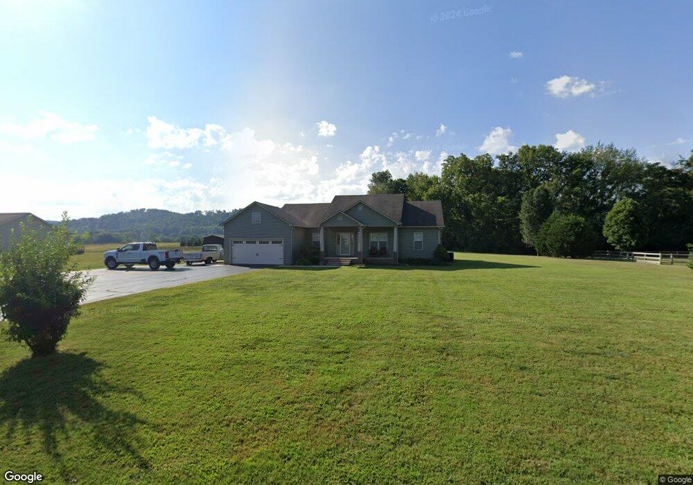
300 Walnut Grove Rd Sparta, TN 38583
Estimated Value: $279,000 - $357,000
3
Beds
2
Baths
1,530
Sq Ft
$207/Sq Ft
Est. Value
About This Home
This home is located at 300 Walnut Grove Rd, Sparta, TN 38583 and is currently estimated at $316,908, approximately $207 per square foot. 300 Walnut Grove Rd is a home located in White County with nearby schools including Northfield Elementary School, White County Middle School, and White County High School.
Ownership History
Date
Name
Owned For
Owner Type
Purchase Details
Closed on
Nov 24, 2009
Sold by
Presley Jody
Bought by
Widman Michael J
Current Estimated Value
Home Financials for this Owner
Home Financials are based on the most recent Mortgage that was taken out on this home.
Original Mortgage
$142,595
Outstanding Balance
$92,400
Interest Rate
5.01%
Estimated Equity
$224,508
Create a Home Valuation Report for This Property
The Home Valuation Report is an in-depth analysis detailing your home's value as well as a comparison with similar homes in the area
Purchase History
| Date | Buyer | Sale Price | Title Company |
|---|---|---|---|
| Widman Michael J | $150,101 | -- |
Source: Public Records
Mortgage History
| Date | Status | Borrower | Loan Amount |
|---|---|---|---|
| Open | Widman Michael J | $142,595 |
Source: Public Records
Tax History
| Year | Tax Paid | Tax Assessment Tax Assessment Total Assessment is a certain percentage of the fair market value that is determined by local assessors to be the total taxable value of land and additions on the property. | Land | Improvement |
|---|---|---|---|---|
| 2025 | $1,103 | $78,200 | $8,750 | $69,450 |
| 2024 | $854 | $41,675 | $4,500 | $37,175 |
| 2023 | $854 | $41,675 | $4,500 | $37,175 |
| 2022 | $854 | $41,675 | $4,500 | $37,175 |
| 2021 | $854 | $41,675 | $4,500 | $37,175 |
| 2020 | $854 | $41,675 | $4,500 | $37,175 |
| 2019 | $744 | $36,300 | $4,250 | $32,050 |
| 2018 | $744 | $36,300 | $4,250 | $32,050 |
| 2017 | $744 | $36,300 | $4,250 | $32,050 |
| 2016 | $744 | $36,300 | $4,250 | $32,050 |
| 2015 | $672 | $36,300 | $4,250 | $32,050 |
| 2014 | -- | $35,025 | $4,250 | $30,775 |
| 2013 | -- | $35,850 | $4,250 | $31,600 |
Source: Public Records
Map
Nearby Homes
- 221 Magnolia Rd
- 748 Brookemeade Dr
- 5 AC Old Cookeville Rd
- 2015 Old Cookeville Rd
- 147 Bob White Dr
- 3300 Roberts Matthews Hwy
- 0 Deer View Dr Unit 46
- 0 Deer View Dr Unit 1337806
- 0 Deer View Dr Unit RTC3181289
- 00 Milk Plant Rd
- 194 Black Oak Rd
- 524 Willie Jarvis Rd
- 195 Ray Cemetery Rd
- 1298 S Bunker Hill Rd
- 791 Old Kentucky Rd
- 123 Cattlemans Dr
- 234 Walnut Trace
- 1545 Roberts Matthews Hwy
- 1200 Duck Pond Rd
- 887 Ray Cemetery Rd
- 320 Walnut Grove Rd
- 288 Walnut Grove Rd
- 275 Walnut Grove Rd
- 337 Walnut Grove Rd
- 245 Walnut Grove Rd
- 141 Hawthorne Rd
- 222 Walnut Grove Rd
- 376 Walnut Grove Rd
- 535 Scott Cemetery Rd
- 555 Scott Cemetery Rd
- 154 Hawthorne Rd
- 493 Scott Cemetery Rd
- 171 Hawthorne Rd
- 31.5 ac Scott Cemetery Rd
- 373 Walnut Grove Rd
- 417 Scott Cemetery Rd
- 417 Scott Cemetery Rd
- 415 Walnut Grove Rd
- 202 Hawthorne Rd
- 149 Walnut Grove Rd
Your Personal Tour Guide
Ask me questions while you tour the home.