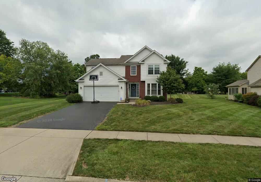
3000 Lexington Dr Powell, OH 43065
Estimated Value: $458,000 - $494,000
4
Beds
3
Baths
2,096
Sq Ft
$229/Sq Ft
Est. Value
About This Home
This home is located at 3000 Lexington Dr, Powell, OH 43065 and is currently estimated at $479,881, approximately $228 per square foot. 3000 Lexington Dr is a home located in Delaware County with nearby schools including Tyler Run Elementary School, Olentangy Liberty Middle School, and Olentangy Liberty High School.
Ownership History
Date
Name
Owned For
Owner Type
Purchase Details
Closed on
Mar 25, 2004
Sold by
Thorn James E and Fullerton Kimberly A
Bought by
Wolfson Gregory P and Kaschulla Martha E
Current Estimated Value
Home Financials for this Owner
Home Financials are based on the most recent Mortgage that was taken out on this home.
Original Mortgage
$172,000
Outstanding Balance
$80,885
Interest Rate
5.65%
Mortgage Type
Purchase Money Mortgage
Estimated Equity
$398,996
Create a Home Valuation Report for This Property
The Home Valuation Report is an in-depth analysis detailing your home's value as well as a comparison with similar homes in the area
Home Values in the Area
Average Home Value in this Area
Purchase History
We collect this data history from publicly available records. To have your information removed, we recommend requesting removal directly through your county’s website.
| Date | Buyer | Sale Price | Title Company |
|---|---|---|---|
| Wolfson Gregory P | $215,000 | Castle Title Agency |
Source: Public Records
Mortgage History
We collect this data history from publicly available records. To have your information removed, we recommend requesting removal directly through your county’s website.
| Date | Status | Borrower | Loan Amount |
|---|---|---|---|
| Open | Wolfson Gregory P | $172,000 | |
| Closed | Wolfson Gregory P | $12,000 |
Source: Public Records
Tax History
| Year | Tax Paid | Tax Assessment Tax Assessment Total Assessment is a certain percentage of the fair market value that is determined by local assessors to be the total taxable value of land and additions on the property. | Land | Improvement |
|---|---|---|---|---|
| 2024 | $6,432 | $119,560 | $33,250 | $86,310 |
| 2023 | $6,457 | $119,560 | $33,250 | $86,310 |
| 2022 | $6,711 | $98,630 | $22,050 | $76,580 |
| 2021 | $6,751 | $98,630 | $22,050 | $76,580 |
| 2020 | $6,783 | $98,630 | $22,050 | $76,580 |
| 2019 | $5,593 | $84,320 | $22,050 | $62,270 |
| 2018 | $5,618 | $84,320 | $22,050 | $62,270 |
| 2017 | $5,093 | $77,040 | $16,030 | $61,010 |
| 2016 | $5,300 | $77,040 | $16,030 | $61,010 |
| 2015 | $4,793 | $77,040 | $16,030 | $61,010 |
| 2014 | $4,859 | $77,040 | $16,030 | $61,010 |
| 2013 | $4,857 | $75,250 | $16,030 | $59,220 |
Source: Public Records
Map
Nearby Homes
- 3033 Jamestown Dr
- 8819 Seabright Dr
- 2659 Unbridled Ct
- 2145 Ladue Dr
- 2087-2089 Summit Row Blvd
- 8648 Seabright Dr
- 2370 Benning Dr
- 164 Stamford Dr
- 10452 Rochelle Dr
- 2393 Cove Point Ct
- 2431 Wyncourtney Ct
- 2357 Hartsdale Dr
- 8669 Ripton Dr
- 1851 Maroon Dr
- 10549 Churchill Dr
- 10561 Churchill Dr
- 1939 Dina Ct
- 432 Zion Dr
- 3832 Southbury Dr
- 8292 Breckenridge Way
- 2988 Lexington Dr
- 3030 Libertydale Dr
- 2978 Lexington Dr
- 3040 Libertydale Dr
- 10599 Liberty Rd S
- 2999 Lexington Dr
- 2981 Lexington Dr
- 3015 Lexington Dr
- 2966 Lexington Dr
- 10551 Liberty Rd S
- 2956 Lexington Dr
- 2945 Lexington Dr
- 2970 Plymouth Ct
- 2944 Lexington Dr
- 3030 Jamestown Dr
- 2929 Lexington Dr
- 3029 Jamestown Dr
- 2934 Lexington Dr
- 2962 Plymouth Ct
- 3020 Jamestown Dr
Your Personal Tour Guide
Ask me questions while you tour the home.