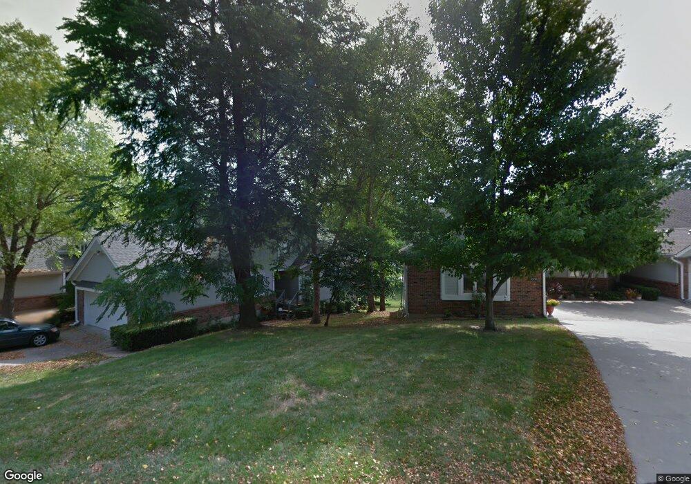
3001 Cedar Crest Dr Unit B Independence, MO 64057
Blackburn NeighborhoodEstimated Value: $238,000 - $366,000
3
Beds
2
Baths
1,704
Sq Ft
$174/Sq Ft
Est. Value
About This Home
This home is located at 3001 Cedar Crest Dr Unit B, Independence, MO 64057 and is currently estimated at $295,812, approximately $173 per square foot. 3001 Cedar Crest Dr Unit B is a home located in Jackson County with nearby schools including Blackburn Elementary School, Bridger Middle School, and Pioneer Ridge Middle School.
Ownership History
Date
Name
Owned For
Owner Type
Purchase Details
Closed on
Oct 18, 2005
Sold by
Cameron Marice Lynn and Cameron Sarah Adeline
Bought by
Cameron Marice Lynn and Cameron Sarah Adeline
Current Estimated Value
Purchase Details
Closed on
Nov 13, 2003
Sold by
Ritchie Richard Morgan and Ritchie Kay Helen
Bought by
Cameron Marice L and Cameron Sarah A
Home Financials for this Owner
Home Financials are based on the most recent Mortgage that was taken out on this home.
Original Mortgage
$90,000
Outstanding Balance
$41,898
Interest Rate
6.06%
Mortgage Type
Purchase Money Mortgage
Estimated Equity
$253,914
Purchase Details
Closed on
Nov 25, 2002
Sold by
Ritchie Richard M and Ritchie Kay
Bought by
The Ritchie Family Trust
Create a Home Valuation Report for This Property
The Home Valuation Report is an in-depth analysis detailing your home's value as well as a comparison with similar homes in the area
Home Values in the Area
Average Home Value in this Area
Purchase History
We collect this data history from publicly available records. To have your information removed, we recommend requesting removal directly through your county’s website.
| Date | Buyer | Sale Price | Title Company |
|---|---|---|---|
| Cameron Marice Lynn | -- | -- | |
| Cameron Marice L | -- | Kansas City Title | |
| The Ritchie Family Trust | -- | -- |
Source: Public Records
Mortgage History
We collect this data history from publicly available records. To have your information removed, we recommend requesting removal directly through your county’s website.
| Date | Status | Borrower | Loan Amount |
|---|---|---|---|
| Open | Cameron Marice L | $90,000 |
Source: Public Records
Tax History
| Year | Tax Paid | Tax Assessment Tax Assessment Total Assessment is a certain percentage of the fair market value that is determined by local assessors to be the total taxable value of land and additions on the property. | Land | Improvement |
|---|---|---|---|---|
| 2025 | $3,744 | $56,341 | $4,729 | $51,612 |
| 2024 | $3,659 | $54,036 | $2,523 | $51,513 |
| 2023 | $3,659 | $54,036 | $4,169 | $49,867 |
| 2022 | $3,158 | $42,750 | $808 | $41,942 |
| 2021 | $3,156 | $42,750 | $808 | $41,942 |
| 2020 | $2,844 | $37,424 | $808 | $36,616 |
| 2019 | $2,798 | $37,424 | $808 | $36,616 |
| 2018 | $2,838 | $36,229 | $3,532 | $32,697 |
| 2017 | $2,794 | $36,229 | $3,532 | $32,697 |
| 2016 | $2,794 | $35,321 | $2,660 | $32,661 |
| 2014 | $2,733 | $35,321 | $2,660 | $32,661 |
Source: Public Records
Map
Nearby Homes
- 17800 E 30th St S
- 2900 S M 291 Hwy
- 2800 S Cedar Crest Terrace
- 2824 Berry Ln
- 17110 E 31st Terrace S
- 3005 S Viking Ct
- 17201 E 32nd St S Unit 9
- 17201 E 32nd St S Unit 3
- 2816 Berry Ln
- 18307 Hanthorne Dr
- 17504 E R D Mize Rd
- 16704 E Ellison Way
- 0 Multi Address N A Unit HMS2588688
- 2505 S Whitney Ave
- 16600 E 31st St S
- 3217 S Elizabeth Ave
- 18719 Gateway Dr
- 18000 E 25th Street Ct S
- 3105 Porter Rd
- 3016 Porter Rd
- 3007 Cedar Crest Dr Unit A
- 3007 Cedar Crest Dr Unit C
- 3007 Cedar Crest Dr Unit B
- 3007 Cedar Crest Dr
- 3001 Cedar Crest Dr Unit A
- 3001 Cedar Crest #B Dr
- 3011 A Cedar Crest Dr
- 3011 Cedar Crest Dr
- 3011 Cedar Crest Dr Unit C
- 3011 Cedar Crest Dr Unit A
- 2911 Cedar Crest Dr
- 2911 Cedar Crest Dr Unit A
- 2911 Cedar Crest Dr Unit B
- 2911 Cedar Crest Dr Unit C
- 2907 Cedar Crest Dr Unit A
- 2907 Cedar Crest Dr Unit B
- 3005 S Redwood Dr Unit B
- 3005 S Redwood Dr Unit A
- 3009 S Redwood Dr
- 3009 S Redwood Dr Unit A
Your Personal Tour Guide
Ask me questions while you tour the home.