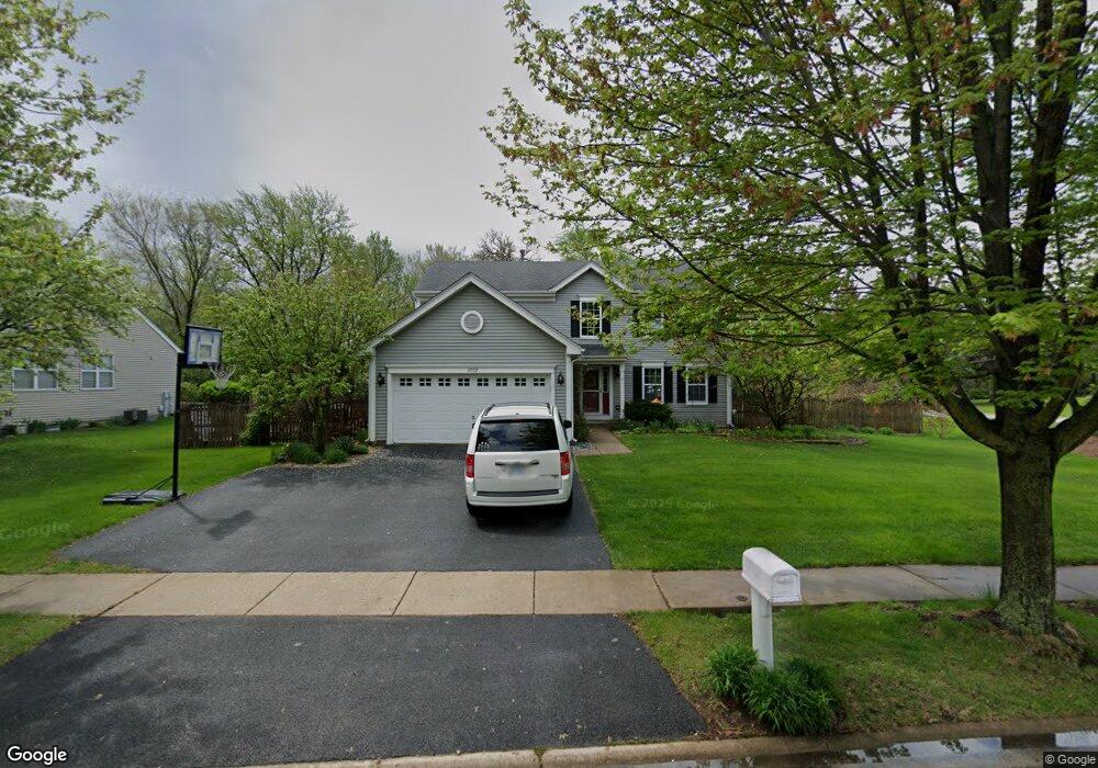
3002 Chestnut Pointe Dr Unit 1 New Lenox, IL 60451
Estimated Value: $394,592 - $453,000
--
Bed
--
Bath
--
Sq Ft
0.35
Acres
About This Home
This home is located at 3002 Chestnut Pointe Dr Unit 1, New Lenox, IL 60451 and is currently estimated at $430,648. 3002 Chestnut Pointe Dr Unit 1 is a home located in Will County with nearby schools including Haines Elementary School, Oster-Oakview School, and Lincoln Way West.
Ownership History
Date
Name
Owned For
Owner Type
Purchase Details
Closed on
Apr 17, 2017
Sold by
Zdych Robert and Zdych Kristen
Bought by
Zdych Robert and Zdych Kristen
Current Estimated Value
Purchase Details
Closed on
Jun 6, 2001
Sold by
First United Bank
Bought by
Zdych Robert and Zdych Kristen
Home Financials for this Owner
Home Financials are based on the most recent Mortgage that was taken out on this home.
Original Mortgage
$180,665
Interest Rate
7.16%
Create a Home Valuation Report for This Property
The Home Valuation Report is an in-depth analysis detailing your home's value as well as a comparison with similar homes in the area
Home Values in the Area
Average Home Value in this Area
Purchase History
| Date | Buyer | Sale Price | Title Company |
|---|---|---|---|
| Zdych Robert | -- | Attorney | |
| Zdych Robert | $213,000 | -- |
Source: Public Records
Mortgage History
| Date | Status | Borrower | Loan Amount |
|---|---|---|---|
| Previous Owner | Zdych Robert | $180,665 |
Source: Public Records
Tax History Compared to Growth
Tax History
| Year | Tax Paid | Tax Assessment Tax Assessment Total Assessment is a certain percentage of the fair market value that is determined by local assessors to be the total taxable value of land and additions on the property. | Land | Improvement |
|---|---|---|---|---|
| 2024 | $9,107 | $117,737 | $31,482 | $86,255 |
| 2023 | $9,107 | $107,326 | $28,698 | $78,628 |
| 2022 | $8,216 | $98,873 | $26,438 | $72,435 |
| 2021 | $7,823 | $92,987 | $24,864 | $68,123 |
| 2020 | $7,582 | $89,669 | $23,977 | $65,692 |
| 2019 | $7,334 | $86,889 | $23,234 | $63,655 |
| 2018 | $7,131 | $83,894 | $22,433 | $61,461 |
| 2017 | $6,931 | $81,482 | $21,788 | $59,694 |
| 2016 | $6,759 | $79,301 | $21,205 | $58,096 |
| 2015 | $6,582 | $76,805 | $20,538 | $56,267 |
| 2014 | $6,582 | $75,856 | $20,284 | $55,572 |
| 2013 | $6,582 | $76,878 | $20,557 | $56,321 |
Source: Public Records
Map
Nearby Homes
- 3301 Irondale Ct
- 1001 Scottsdale Ln
- 506 Navajo Dr
- 1006 Mountain View Dr
- 3420 Avondale Ln
- 1106 Weston Way
- 14119 W Maple Rd
- 937 Saddle Ridge Dr
- 939 Saddle Ridge Dr
- 2602 Timber Springs Dr
- 2417 Fleetwood Dr
- 2412 Fleetwood Dr
- 0 Silver Cross Blvd
- 1999 Silver Cross Blvd
- 1111 Colonial Dr Unit 1
- 1301 Silver Cross Blvd
- 2208 Fiesta Dr
- 2202 Tamarack Dr
- 200 Montieth St
- The Grace Plan at Prairie Ridge of New Lenox
- 3004 Chestnut Pointe Dr
- 3006 Chestnut Pointe Dr
- 3001 Chestnut Pointe Dr
- 3003 Chestnut Pointe Dr
- 3008 Chestnut Pointe Dr
- 841 Gougar Rd
- 3005 Chestnut Pointe Dr
- 861 Gougar Rd
- 851 Gougar Rd
- 3007 Chestnut Pointe Dr Unit 1
- 1980 Gougar Rd
- 3004 Carlyle Ct
- 3010 Chestnut Pointe Dr
- 2913 Hoberg Dr
- 2909 Hoberg Dr
- 2905 Hoberg Dr
- 3006 Carlyle Ct
- 825 Gougar Rd
- 2901 Hoberg Dr
- 3009 Chestnut Pointe Dr