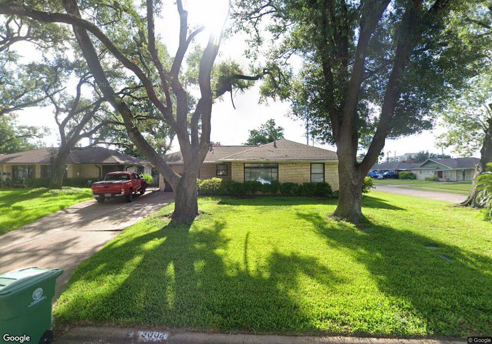
3002 Moonstone Cir Houston, TX 77018
Oak Forest-Garden Oaks NeighborhoodEstimated Value: $340,695 - $387,000
2
Beds
1
Bath
1,210
Sq Ft
$301/Sq Ft
Est. Value
About This Home
This home is located at 3002 Moonstone Cir, Houston, TX 77018 and is currently estimated at $364,174, approximately $300 per square foot. 3002 Moonstone Cir is a home located in Harris County with nearby schools including Oak Forest Elementary School, Frank Black Middle School, and Waltrip High School.
Ownership History
Date
Name
Owned For
Owner Type
Purchase Details
Closed on
May 30, 2000
Sold by
Ayo Lois D
Bought by
Davis Eduardo R
Current Estimated Value
Home Financials for this Owner
Home Financials are based on the most recent Mortgage that was taken out on this home.
Original Mortgage
$90,250
Outstanding Balance
$31,703
Interest Rate
8.17%
Estimated Equity
$332,471
Create a Home Valuation Report for This Property
The Home Valuation Report is an in-depth analysis detailing your home's value as well as a comparison with similar homes in the area
Home Values in the Area
Average Home Value in this Area
Purchase History
| Date | Buyer | Sale Price | Title Company |
|---|---|---|---|
| Davis Eduardo R | -- | Regency Title |
Source: Public Records
Mortgage History
| Date | Status | Borrower | Loan Amount |
|---|---|---|---|
| Open | Davis Eduardo R | $90,250 |
Source: Public Records
Tax History Compared to Growth
Tax History
| Year | Tax Paid | Tax Assessment Tax Assessment Total Assessment is a certain percentage of the fair market value that is determined by local assessors to be the total taxable value of land and additions on the property. | Land | Improvement |
|---|---|---|---|---|
| 2025 | $94 | $333,496 | $277,760 | $55,736 |
| 2024 | $94 | $330,201 | $277,760 | $52,441 |
| 2023 | $94 | $305,700 | $243,040 | $62,660 |
| 2022 | $5,111 | $258,812 | $208,320 | $50,492 |
| 2021 | $5,741 | $246,309 | $173,600 | $72,709 |
| 2020 | $5,660 | $233,722 | $173,600 | $60,122 |
| 2019 | $5,766 | $227,861 | $173,600 | $54,261 |
| 2018 | $1,184 | $232,000 | $138,880 | $93,120 |
| 2017 | $5,180 | $239,748 | $138,880 | $100,868 |
| 2016 | $4,709 | $239,748 | $138,880 | $100,868 |
| 2015 | $1,296 | $230,000 | $138,880 | $91,120 |
| 2014 | $1,296 | $171,772 | $104,160 | $67,612 |
Source: Public Records
Map
Nearby Homes
- 1919 Ansbury Dr
- 3042 Oak Forest Dr
- 1726 Ansbury Dr
- 1635 Wilde Rock Way
- 2203 Bron Holly Dr
- 2215 Ansbury Dr
- 2532 Ohsfeldt St
- 1906 W 25th St
- 1902 W 25th St
- 2006 Lou Ellen Ln Unit H
- 2323 Wilde Rock Way
- 3506 Oak Forest Dr
- 2403 Ansbury Dr
- 2402 Bron Holly Dr
- 1821 W 24th St
- 2411 Stonecrest Dr
- 2116 Oatfield Dr
- 2206 Lou Ellen Ln Unit C
- 2122 Oatfield Dr
- 2210 Lou Ellen Ln Unit F
- 3006 Moonstone Cir
- 3003 Topham Cir
- 3007 Topham Cir
- 3009 Topham Cir
- 1911 Ansbury Dr
- 1915 Ansbury Dr
- 3003 Moonstone Cir
- 1907 Ansbury Dr
- 3010 Moonstone Cir
- 3007 Moonstone Cir
- 1903 Ansbury Dr
- 3666 Topha
- 3014 Moonstone Cir
- 3011 Topham Cir
- 1923 Ansbury Dr
- 3002 Carlford Cir
- 3002 Topham Cir
- 1827 Ansbury Dr
- 3006 Carlford Cir
- 1927 Ansbury Dr