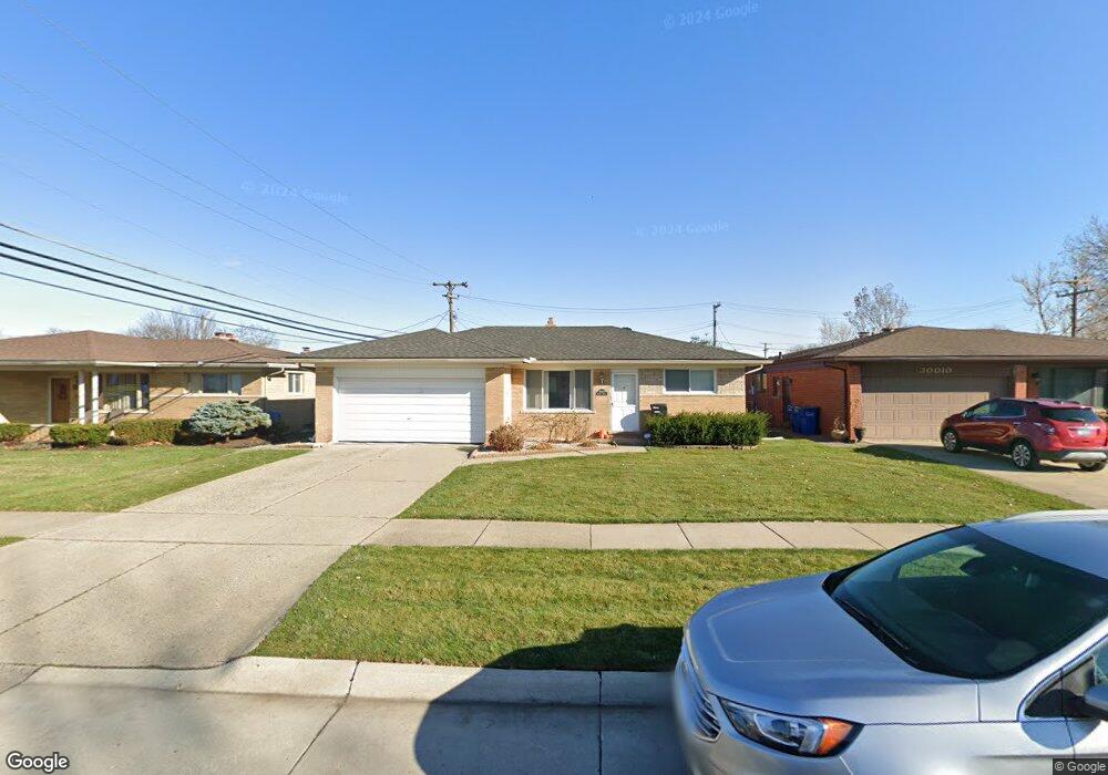
30024 Moulin Ave Warren, MI 48088
Northeast Warren NeighborhoodEstimated Value: $235,633 - $282,000
3
Beds
2
Baths
1,059
Sq Ft
$242/Sq Ft
Est. Value
About This Home
This home is located at 30024 Moulin Ave, Warren, MI 48088 and is currently estimated at $256,658, approximately $242 per square foot. 30024 Moulin Ave is a home located in Macomb County with nearby schools including Wilkerson Elementary School, Carter Middle School, and Paul K. Cousino High School.
Ownership History
Date
Name
Owned For
Owner Type
Purchase Details
Closed on
Aug 24, 2012
Sold by
Meyers John D and Meyers Rose M
Bought by
Fell Lawrence V and Fell Ruth A
Current Estimated Value
Purchase Details
Closed on
Jan 4, 2002
Sold by
Poupart Sharon E
Bought by
Meyers John D
Home Financials for this Owner
Home Financials are based on the most recent Mortgage that was taken out on this home.
Original Mortgage
$129,650
Interest Rate
7.23%
Mortgage Type
Purchase Money Mortgage
Purchase Details
Closed on
Jun 30, 2000
Sold by
Barnes Christopher
Bought by
Poupart Sharon E
Home Financials for this Owner
Home Financials are based on the most recent Mortgage that was taken out on this home.
Original Mortgage
$110,400
Interest Rate
8.26%
Mortgage Type
Purchase Money Mortgage
Purchase Details
Closed on
Sep 26, 1997
Sold by
Pizzimenti J and Pizzimenti V
Bought by
Barnes C
Create a Home Valuation Report for This Property
The Home Valuation Report is an in-depth analysis detailing your home's value as well as a comparison with similar homes in the area
Home Values in the Area
Average Home Value in this Area
Purchase History
| Date | Buyer | Sale Price | Title Company |
|---|---|---|---|
| Fell Lawrence V | $87,000 | Sterling Title Agency | |
| Meyers John D | $136,500 | -- | |
| Poupart Sharon E | $138,000 | -- | |
| Barnes C | $112,500 | -- |
Source: Public Records
Mortgage History
| Date | Status | Borrower | Loan Amount |
|---|---|---|---|
| Previous Owner | Meyers John D | $129,650 | |
| Previous Owner | Poupart Sharon E | $110,400 |
Source: Public Records
Tax History Compared to Growth
Tax History
| Year | Tax Paid | Tax Assessment Tax Assessment Total Assessment is a certain percentage of the fair market value that is determined by local assessors to be the total taxable value of land and additions on the property. | Land | Improvement |
|---|---|---|---|---|
| 2025 | $2,941 | $106,970 | $0 | $0 |
| 2024 | $2,858 | $106,610 | $0 | $0 |
| 2023 | $2,709 | $105,950 | $0 | $0 |
| 2022 | $2,617 | $93,040 | $0 | $0 |
| 2021 | $2,663 | $74,840 | $0 | $0 |
| 2020 | $2,568 | $70,630 | $0 | $0 |
| 2019 | $2,476 | $67,310 | $0 | $0 |
| 2018 | $2,515 | $56,160 | $0 | $0 |
| 2017 | $2,483 | $50,090 | $9,170 | $40,920 |
| 2016 | $2,480 | $50,090 | $0 | $0 |
| 2015 | -- | $48,840 | $0 | $0 |
| 2013 | $4,653 | $42,650 | $0 | $0 |
Source: Public Records
Map
Nearby Homes
- 13325 Iowa Dr
- 30052 Schoenherr Rd
- 30040 Schoenherr Rd
- 30252 Newport Dr
- 13740 Iowa Dr
- 29365 Dover Ave
- 29667 Newport Dr
- 30806 Ridgefield Ave
- 30419 Iroquois Dr
- 30139 Flanders Ave
- 29266 Moulin Ave
- 29359 Yorkshire Ln
- 29820 Palomino Dr
- 13265 Geoffry Dr
- 29259 Fairfield Dr
- 29161 Schoenherr Rd
- 13264 Geoffry Dr
- 30834 Iroquois Dr
- 30154 Pinto Dr
- 29251 Bon Mar Dr
- 30036 Moulin Ave
- 13287 Common Rd
- 13358 Cromie Dr
- 30050 Moulin Ave
- 13301 Common Rd
- 30025 Moulin Ave
- 13370 Cromie Dr
- 30037 Moulin Ave
- 30011 Moulin Ave
- 13315 Common Rd
- 30104 Moulin Ave
- 13215 Common Rd
- 13329 Common Rd
- 13266 Common Rd
- 13254 Common Rd
- 13341 Cromie Dr
- 13290 Common Rd
- 13353 Cromie Dr
- 13329 Cromie Dr
- 13242 Common Rd