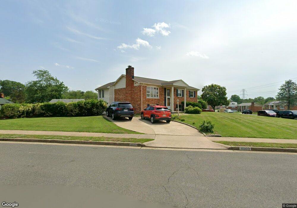
3003 Adams St Woodbridge, VA 22193
Ashdale NeighborhoodEstimated Value: $491,000 - $515,304
3
Beds
3
Baths
1,170
Sq Ft
$433/Sq Ft
Est. Value
About This Home
This home is located at 3003 Adams St, Woodbridge, VA 22193 and is currently estimated at $506,076, approximately $432 per square foot. 3003 Adams St is a home located in Prince William County with nearby schools including Dale City Elementary School, Rippon Middle School, and Freedom High School.
Ownership History
Date
Name
Owned For
Owner Type
Purchase Details
Closed on
Aug 31, 2000
Sold by
Murane David M
Bought by
Briggs Leslie A
Current Estimated Value
Purchase Details
Closed on
Jul 15, 1996
Sold by
Price Edward T
Bought by
Briggs Leslie A
Home Financials for this Owner
Home Financials are based on the most recent Mortgage that was taken out on this home.
Original Mortgage
$137,050
Interest Rate
7.98%
Create a Home Valuation Report for This Property
The Home Valuation Report is an in-depth analysis detailing your home's value as well as a comparison with similar homes in the area
Home Values in the Area
Average Home Value in this Area
Purchase History
| Date | Buyer | Sale Price | Title Company |
|---|---|---|---|
| Briggs Leslie A | -- | -- | |
| Briggs Leslie A | $138,000 | -- |
Source: Public Records
Mortgage History
| Date | Status | Borrower | Loan Amount |
|---|---|---|---|
| Previous Owner | Briggs Leslie A | $137,050 |
Source: Public Records
Tax History Compared to Growth
Tax History
| Year | Tax Paid | Tax Assessment Tax Assessment Total Assessment is a certain percentage of the fair market value that is determined by local assessors to be the total taxable value of land and additions on the property. | Land | Improvement |
|---|---|---|---|---|
| 2025 | $4,390 | $500,200 | $145,600 | $354,600 |
| 2024 | $4,390 | $441,400 | $135,600 | $305,800 |
| 2023 | $4,435 | $426,200 | $132,700 | $293,500 |
| 2022 | $4,752 | $418,800 | $122,900 | $295,900 |
| 2021 | $4,786 | $390,500 | $110,800 | $279,700 |
| 2020 | $5,267 | $339,800 | $104,500 | $235,300 |
| 2019 | $5,241 | $338,100 | $100,400 | $237,700 |
| 2018 | $3,946 | $326,800 | $97,600 | $229,200 |
| 2017 | $3,863 | $311,100 | $92,100 | $219,000 |
| 2016 | $3,678 | $298,600 | $89,500 | $209,100 |
| 2015 | $3,209 | $276,200 | $86,400 | $189,800 |
| 2014 | $3,209 | $253,900 | $84,000 | $169,900 |
Source: Public Records
Map
Nearby Homes
- 14595 Charity Ct
- 14496 Aurora Dr
- 3017 Arkendale St
- 3206 Burbank Ln
- 14809 Ashdale Ave
- 3213 Bradford St
- 14404 Birchdale Ave
- 14413 Brook Dr
- 14308 Belleville Ave
- 15019 Ashdale Cir
- 14717 Barksdale St
- 14748 Barksdale St
- 14657 Cloverdale Rd
- 14204 Bremerton Dr
- 14648 Bakersfield St
- 14184 Cuddy Loop Unit 201
- 14184 Cuddy Loop Unit 101
- 14151 Cuddy Loop Unit 301
- 14154 Cuddy Loop Unit 102
- 3615 Felmore Ct
- 14603 Aurora Dr
- 14606 Ashdale Ave
- 14608 Ashdale Ave
- 3002 Adams St
- 14605 Aurora Dr
- 3005 Adams St
- 14604 Ashdale Ave
- 14602 Aurora Dr
- 14610 Ashdale Ave
- 3004 Adams St
- 14604 Aurora Dr
- 14507 Aurora Dr
- 14607 Aurora Dr
- 14612 Ashdale Ave
- 2905 Adams St
- 14606 Aurora Dr
- 14508 Aurora Dr
- 14607 Ashdale Ave
- 14603 Ashdale Ave
- 14505 Aurora Dr