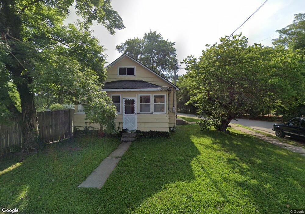
3003 Darr St Hannibal, MO 63401
Estimated Value: $93,000 - $149,000
2
Beds
1
Bath
1,224
Sq Ft
$102/Sq Ft
Est. Value
About This Home
This home is located at 3003 Darr St, Hannibal, MO 63401 and is currently estimated at $124,903, approximately $102 per square foot. 3003 Darr St is a home with nearby schools including Hannibal Senior High School, St. John's Lutheran School, and Holy Family School.
Ownership History
Date
Name
Owned For
Owner Type
Purchase Details
Closed on
Oct 20, 2006
Sold by
Fannie Mae
Bought by
Neisen Ryan J and Neisen Sheri L
Current Estimated Value
Home Financials for this Owner
Home Financials are based on the most recent Mortgage that was taken out on this home.
Original Mortgage
$30,000
Outstanding Balance
$17,720
Interest Rate
6.75%
Mortgage Type
Adjustable Rate Mortgage/ARM
Estimated Equity
$107,183
Purchase Details
Closed on
Jul 31, 2006
Sold by
Cates Waylon R and Swartz Ashley N
Bought by
Federal National Mortgage Association
Create a Home Valuation Report for This Property
The Home Valuation Report is an in-depth analysis detailing your home's value as well as a comparison with similar homes in the area
Home Values in the Area
Average Home Value in this Area
Purchase History
| Date | Buyer | Sale Price | Title Company |
|---|---|---|---|
| Neisen Ryan J | -- | None Available | |
| Federal National Mortgage Association | $40,215 | None Available |
Source: Public Records
Mortgage History
| Date | Status | Borrower | Loan Amount |
|---|---|---|---|
| Open | Neisen Ryan J | $30,000 |
Source: Public Records
Tax History
| Year | Tax Paid | Tax Assessment Tax Assessment Total Assessment is a certain percentage of the fair market value that is determined by local assessors to be the total taxable value of land and additions on the property. | Land | Improvement |
|---|---|---|---|---|
| 2025 | $457 | $7,060 | $580 | $6,480 |
| 2024 | $428 | $6,410 | $520 | $5,890 |
| 2023 | $400 | $6,410 | $520 | $5,890 |
| 2022 | $400 | $6,410 | $520 | $5,890 |
| 2021 | $397 | $6,410 | $520 | $5,890 |
| 2020 | $371 | $5,840 | $480 | $5,360 |
| 2019 | $370 | $5,840 | $480 | $5,360 |
| 2018 | $369 | $5,840 | $480 | $5,360 |
| 2017 | $360 | $5,840 | $480 | $5,360 |
| 2015 | $307 | $5,840 | $480 | $5,360 |
| 2014 | $307 | $5,840 | $480 | $5,360 |
| 2012 | -- | $5,830 | $0 | $0 |
Source: Public Records
Map
Nearby Homes
- 1716 36th St
- 2815 Marion St
- 73 New London Gravel Rd
- 5 S Park Dr
- 1212 Lindell Ave
- 1204 Lindell Ave
- 0 Lot 50 Minnow Creek Subdvsn Unit MIS26004415
- 0 Lot 48 Minnow Creek Subdvsn Unit MIS26004410
- 12 Hillcrest Dr
- 2606 Hope St
- 115 Stone Ridge Dr
- 27 Kitlaw Dr
- 26 Kitlaw Dr
- 19 Kitlaw Dr
- 22 Kitlaw Dr
- 18 Kitlaw Dr
- 3 Kitlaw Dr
- 4 Kitlaw Dr
- 28 Kitlaw Dr
- 29 Kitlaw Dr
- 3025 Kenwood Ave
- 3019 Darr St
- 3005 Kenwood Ave
- 3021 Kenwood Ave
- 3019 Kenwood Ave
- 3020 Kenwood Ave
- 3007 Kenwood Ave
- 3236 Moberly Ave
- 3100 Moberly Ave
- 2935 Kenwood Ave
- 2934 Kenwood Ave
- 2932 Kenwood Ave
- 2931 Kenwood Ave
- 2103 Prince Ave
- 3101 Moberly Ave
- 2930 Kenwood Ave
- 1911 Prince Ave Unit A
- 2924 Kenwood Ave
- 3102 Moberly Ave
- 2923 Kenwood Ave
Your Personal Tour Guide
Ask me questions while you tour the home.