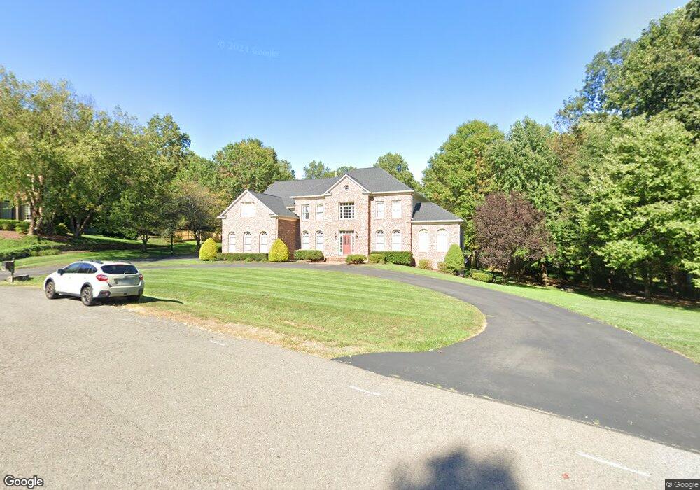
3003 Havencrest St Herndon, VA 20171
Foxvale NeighborhoodEstimated Value: $1,351,207 - $1,465,000
4
Beds
5
Baths
4,480
Sq Ft
$315/Sq Ft
Est. Value
About This Home
This home is located at 3003 Havencrest St, Herndon, VA 20171 and is currently estimated at $1,409,552, approximately $314 per square foot. 3003 Havencrest St is a home located in Fairfax County with nearby schools including Navy Elementary, Franklin Middle, and Oakton High.
Ownership History
Date
Name
Owned For
Owner Type
Purchase Details
Closed on
Dec 2, 2014
Sold by
Peterson William A
Bought by
Peterson William A
Current Estimated Value
Purchase Details
Closed on
Sep 29, 1994
Sold by
Prospect Development
Bought by
Peterson William A
Home Financials for this Owner
Home Financials are based on the most recent Mortgage that was taken out on this home.
Original Mortgage
$436,000
Interest Rate
8.5%
Create a Home Valuation Report for This Property
The Home Valuation Report is an in-depth analysis detailing your home's value as well as a comparison with similar homes in the area
Home Values in the Area
Average Home Value in this Area
Purchase History
| Date | Buyer | Sale Price | Title Company |
|---|---|---|---|
| Peterson William A | -- | -- | |
| Peterson William A | $545,000 | -- |
Source: Public Records
Mortgage History
| Date | Status | Borrower | Loan Amount |
|---|---|---|---|
| Previous Owner | Peterson William A | $436,000 |
Source: Public Records
Tax History
| Year | Tax Paid | Tax Assessment Tax Assessment Total Assessment is a certain percentage of the fair market value that is determined by local assessors to be the total taxable value of land and additions on the property. | Land | Improvement |
|---|---|---|---|---|
| 2025 | $12,174 | $1,153,340 | $483,000 | $670,340 |
| 2024 | $12,174 | $1,050,880 | $473,000 | $577,880 |
| 2023 | $11,859 | $1,050,880 | $473,000 | $577,880 |
| 2022 | $11,028 | $964,400 | $453,000 | $511,400 |
| 2021 | $11,200 | $954,400 | $443,000 | $511,400 |
| 2020 | $12,233 | $1,033,630 | $443,000 | $590,630 |
| 2019 | $11,479 | $969,940 | $433,000 | $536,940 |
| 2018 | $11,154 | $969,940 | $433,000 | $536,940 |
| 2017 | $11,261 | $969,940 | $433,000 | $536,940 |
| 2016 | $11,778 | $1,016,630 | $433,000 | $583,630 |
| 2015 | $11,346 | $1,016,630 | $433,000 | $583,630 |
| 2014 | $10,672 | $958,450 | $413,000 | $545,450 |
Source: Public Records
Map
Nearby Homes
- 11608 Helmont Dr
- 11607 Helmont Dr
- 3140 Searsmont Place
- 3142 Searsmont Place
- 3144 Searsmont Place
- 11813 Vale Rd
- 12614 Oxon Rd
- 11704 Foxvale Ct
- 11820 Wayland St
- 3406 Lyrac St
- 12016 Wayland St
- 12511 Glenbrooke Woods Dr
- 2700 Reign St
- 12205 Waples Mill Rd
- 3727 W Ox Rd
- 11671 Fox Glen Dr
- 3494 Audubon Cove
- 3498 Audubon Cove
- 12105 Wedgeway Place
- 3813 Wheatgrain Ln
- 12019 Bennett Rd
- 3001 Havencrest St
- 12004 Berry Farm Ct
- 12000 Berry Farm Ct
- 3000 Havencrest St
- 3002 Havencrest St
- 11931 Bennett Rd
- 3057 Crosen Ct
- 3055 Crosen Ct
- 12001 Berry Farm Ct
- 3056 Crosen Ct
- 3004 Havencrest St
- 3101 Pine Oaks Way
- 12005 Berry Farm Ct
- 11929 Bennett Rd
- 12003 Berry Farm Ct
- 3103 Pine Oaks Way
- 11936 Bennett Rd
- 3107 Pine Oaks Way
- 3053 Crosen Ct