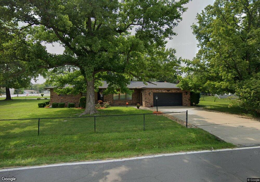
3003 N University Ave Decatur, IL 62526
Greendell NeighborhoodEstimated Value: $144,318 - $175,000
3
Beds
2
Baths
1,484
Sq Ft
$108/Sq Ft
Est. Value
About This Home
This home is located at 3003 N University Ave, Decatur, IL 62526 and is currently estimated at $159,580, approximately $107 per square foot. 3003 N University Ave is a home located in Macon County with nearby schools including Parsons Elementary School, Stephen Decatur Middle School, and Our Lady of Lourdes School.
Ownership History
Date
Name
Owned For
Owner Type
Purchase Details
Closed on
Oct 15, 2010
Sold by
Squires Dorothy M
Bought by
Brumett Lloyd E and Brumett Mary K
Current Estimated Value
Home Financials for this Owner
Home Financials are based on the most recent Mortgage that was taken out on this home.
Original Mortgage
$41,000
Outstanding Balance
$297
Interest Rate
3.74%
Mortgage Type
New Conventional
Estimated Equity
$159,283
Create a Home Valuation Report for This Property
The Home Valuation Report is an in-depth analysis detailing your home's value as well as a comparison with similar homes in the area
Home Values in the Area
Average Home Value in this Area
Purchase History
| Date | Buyer | Sale Price | Title Company |
|---|---|---|---|
| Brumett Lloyd E | $113,000 | None Available |
Source: Public Records
Mortgage History
| Date | Status | Borrower | Loan Amount |
|---|---|---|---|
| Open | Brumett Lloyd E | $41,000 |
Source: Public Records
Tax History
| Year | Tax Paid | Tax Assessment Tax Assessment Total Assessment is a certain percentage of the fair market value that is determined by local assessors to be the total taxable value of land and additions on the property. | Land | Improvement |
|---|---|---|---|---|
| 2024 | $2,036 | $39,795 | $6,398 | $33,397 |
| 2023 | $2,077 | $36,583 | $5,882 | $30,701 |
| 2022 | $2,130 | $33,930 | $5,456 | $28,474 |
| 2021 | $2,139 | $32,269 | $5,101 | $27,168 |
| 2020 | $2,739 | $36,682 | $5,799 | $30,883 |
| 2019 | $2,739 | $36,682 | $5,799 | $30,883 |
| 2018 | $2,717 | $36,944 | $5,840 | $31,104 |
| 2017 | $2,711 | $37,151 | $5,873 | $31,278 |
| 2016 | $2,731 | $37,240 | $5,887 | $31,353 |
| 2015 | $2,639 | $36,798 | $5,817 | $30,981 |
| 2014 | $2,473 | $36,798 | $5,817 | $30,981 |
| 2013 | $2,463 | $36,798 | $5,817 | $30,981 |
Source: Public Records
Map
Nearby Homes
- 1351 W Pershing Rd
- 36 N Lynette Dr
- 2926 N Primrose Ln
- 17 Montez Dr
- 1555 W Highland Place
- 1607 W Melrose Ct
- 23 Greenridge Dr
- 12 Diane Rd
- 18 Maple Ct
- 3105 Colorado Dr
- 68 Maple Ct
- 2420 N Summit Ave
- 1225 W Pineview Ct
- 2127 Riedel Ave
- 16 Arizona Dr
- 681 W Karen Ct
- 665 Crestline Dr
- 30 Colorado Dr
- 2320 N Kenwood Ct
- 139 Wisconsin Dr
- 1212 W Pershing Rd
- 3033 N University Ave
- 1222 W Pershing Rd
- 3043 N University Ave
- 675 W Pershing Rd
- 1232 W Pershing Rd
- 1201 W Pershing Rd
- 1235 W Pershing Rd
- 3053 N University Ave
- 7 Green Oak Dr
- 3040 N University Ave
- 1242 W Pershing Rd
- 2976 N Wilson Ave
- 915 W Pershing Rd
- 11 Green Oak Dr
- 2966 N Wilson Ave
- 2951 N University Ave
- 19 Green Oak Ct
- 3050 N University Ave
- 6 Green Oak Dr
Your Personal Tour Guide
Ask me questions while you tour the home.