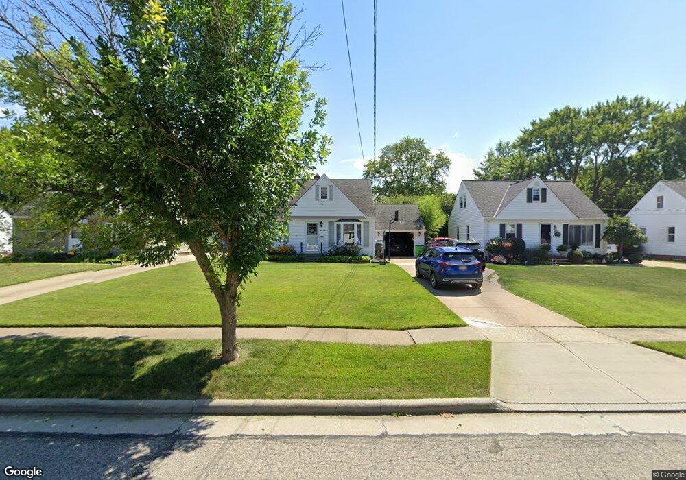
30032 Dorothy Dr Wickliffe, OH 44092
Estimated Value: $178,000 - $199,000
3
Beds
2
Baths
783
Sq Ft
$241/Sq Ft
Est. Value
About This Home
This home is located at 30032 Dorothy Dr, Wickliffe, OH 44092 and is currently estimated at $188,424, approximately $240 per square foot. 30032 Dorothy Dr is a home located in Lake County with nearby schools including Wickliffe Elementary School, Wickliffe Middle School, and Wickliffe High School.
Ownership History
Date
Name
Owned For
Owner Type
Purchase Details
Closed on
May 2, 2000
Sold by
Frate Bruno U and Kuhar Patricia L
Bought by
Svagerko T Corey and Bechtel Rebecca L
Current Estimated Value
Home Financials for this Owner
Home Financials are based on the most recent Mortgage that was taken out on this home.
Original Mortgage
$105,650
Outstanding Balance
$36,814
Interest Rate
8.26%
Estimated Equity
$151,610
Purchase Details
Closed on
Dec 26, 1989
Bought by
Minarich George
Create a Home Valuation Report for This Property
The Home Valuation Report is an in-depth analysis detailing your home's value as well as a comparison with similar homes in the area
Home Values in the Area
Average Home Value in this Area
Purchase History
| Date | Buyer | Sale Price | Title Company |
|---|---|---|---|
| Svagerko T Corey | $117,400 | Realty Title Agency Inc | |
| Minarich George | -- | -- |
Source: Public Records
Mortgage History
| Date | Status | Borrower | Loan Amount |
|---|---|---|---|
| Open | Svagerko T Corey | $105,650 |
Source: Public Records
Tax History Compared to Growth
Tax History
| Year | Tax Paid | Tax Assessment Tax Assessment Total Assessment is a certain percentage of the fair market value that is determined by local assessors to be the total taxable value of land and additions on the property. | Land | Improvement |
|---|---|---|---|---|
| 2024 | -- | $51,540 | $17,310 | $34,230 |
| 2023 | $5,411 | $44,000 | $14,970 | $29,030 |
| 2022 | $3,157 | $44,000 | $14,970 | $29,030 |
| 2021 | $3,169 | $44,000 | $14,970 | $29,030 |
| 2020 | $2,984 | $35,200 | $11,980 | $23,220 |
| 2019 | $2,983 | $35,200 | $11,980 | $23,220 |
| 2018 | $2,414 | $32,060 | $14,150 | $17,910 |
| 2017 | $2,256 | $32,060 | $14,150 | $17,910 |
| 2016 | $2,245 | $32,060 | $14,150 | $17,910 |
| 2015 | $2,206 | $32,060 | $14,150 | $17,910 |
| 2014 | $1,943 | $32,060 | $14,150 | $17,910 |
| 2013 | $1,942 | $32,060 | $14,150 | $17,910 |
Source: Public Records
Map
Nearby Homes
- 1719 E 300th St
- 1616 Lee Terrace Dr Unit C9
- 1842 Eldon Dr
- 1847 Eldon Dr
- 1526 E 298th St
- 1834 Robindale St
- 1824 Robindale St
- 1737 Drenik Dr
- 30200 Ridge Rd
- 1711 Rush Rd
- 30530 Grant St
- 1590 Dennis Dr
- 1820 Rockefeller Rd
- 30705 Grant St
- 1807 E 294th St
- 2131 Country Club Dr
- 30335 Euclid Ave Unit 7
- 30335 Euclid Ave Unit 50
- 1836 E 294th St
- 1648 Douglas Rd
- 30042 Dorothy Dr
- 30022 Dorothy Dr
- 30012 Dorothy Dr
- 30041 Frank Dr
- 30031 Frank Dr
- 30051 Frank Dr
- 30062 Dorothy Dr
- 30021 Frank Dr
- 30061 Frank Dr
- 30031 Dorothy Dr
- 30041 Dorothy Dr
- 30021 Dorothy Dr
- 30051 Dorothy Dr
- 1741 E 300th St
- 30071 Frank Dr
- 1735 E 300th St
- 1745 E 300th St
- 30072 Dorothy Dr
- 30011 Dorothy Dr
- 30061 Dorothy Dr