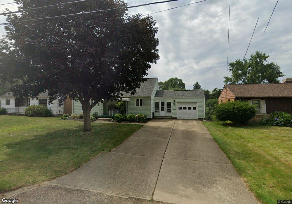
3004 21st St NW Canton, OH 44708
Meyers Lake NeighborhoodEstimated Value: $155,000 - $270,000
3
Beds
1
Bath
1,371
Sq Ft
$138/Sq Ft
Est. Value
About This Home
This home is located at 3004 21st St NW, Canton, OH 44708 and is currently estimated at $189,320, approximately $138 per square foot. 3004 21st St NW is a home located in Stark County with nearby schools including Avondale Elementary School, Oakwood Middle School, and GlenOak High School.
Ownership History
Date
Name
Owned For
Owner Type
Purchase Details
Closed on
Jul 31, 2014
Sold by
Thomas Shawn C
Bought by
Ault Richard
Current Estimated Value
Purchase Details
Closed on
Jun 28, 2012
Sold by
Ault Richard
Bought by
Thomas Shawn C
Purchase Details
Closed on
Jun 1, 2012
Sold by
Ault Richard
Bought by
Thomas Shawn C
Purchase Details
Closed on
Jul 28, 2005
Sold by
Ault Steven J and Ault Stephanie J
Bought by
Ault Richard
Purchase Details
Closed on
May 13, 2005
Sold by
Estate Of William F Ault
Bought by
Ault Richard and Ault Steven
Purchase Details
Closed on
Nov 16, 2004
Sold by
Estate Of Verena M Ault
Bought by
Ault William
Create a Home Valuation Report for This Property
The Home Valuation Report is an in-depth analysis detailing your home's value as well as a comparison with similar homes in the area
Home Values in the Area
Average Home Value in this Area
Purchase History
| Date | Buyer | Sale Price | Title Company |
|---|---|---|---|
| Ault Richard | -- | None Available | |
| Thomas Shawn C | -- | None Available | |
| Thomas Shawn C | -- | None Available | |
| Ault Richard | -- | -- | |
| Ault Richard | -- | -- | |
| Ault William | -- | -- |
Source: Public Records
Tax History Compared to Growth
Tax History
| Year | Tax Paid | Tax Assessment Tax Assessment Total Assessment is a certain percentage of the fair market value that is determined by local assessors to be the total taxable value of land and additions on the property. | Land | Improvement |
|---|---|---|---|---|
| 2025 | -- | $44,110 | $15,510 | $28,600 |
| 2024 | -- | $44,110 | $15,510 | $28,600 |
| 2023 | $1,368 | $38,510 | $11,100 | $27,410 |
| 2022 | $835 | $38,510 | $11,100 | $27,410 |
| 2021 | $868 | $38,510 | $11,100 | $27,410 |
| 2020 | $1,273 | $33,330 | $9,560 | $23,770 |
| 2019 | $262 | $33,330 | $9,560 | $23,770 |
| 2018 | $1,247 | $33,330 | $9,560 | $23,770 |
| 2017 | $1,167 | $29,860 | $8,190 | $21,670 |
| 2016 | $1,169 | $29,860 | $8,190 | $21,670 |
| 2015 | $1,240 | $35,770 | $8,190 | $27,580 |
| 2014 | $961 | $34,230 | $7,840 | $26,390 |
| 2013 | $939 | $34,230 | $7,840 | $26,390 |
Source: Public Records
Map
Nearby Homes
- 2923 21st St NW
- 3038 20th St NW
- 3112 21st St NW
- 3222 25th St NW
- 3012 16th St NW
- 1642 N Park Ave NW
- 2524 Ridgedale Ave NW
- 425 Fulton Dr NW
- 3118 Fulton Dr NW
- 3431 Enfield Ave NW
- 3045 Parkway St NW
- 3016 Croydon Dr NW
- 3034 12th St NW
- 1314 S Park Ave NW
- 0 Harrison Ave NW
- 2818 Marlin Ave NW
- 1610 20th St NW
- 0 Brandt Ave NW
- 1614 17th St NW
- 3200 10th St NW
- 3012 21st St NW
- 2936 21st St NW
- 2945 20th St NW
- 2941 20th St NW
- 2930 21st St NW
- 2000 Homedale Ave NW
- 2935 20th St NW
- 2931 20th St NW
- 3024 21st St NW
- 2013 Homedale Ave NW
- 2922 21st St NW
- 3005 21st St NW
- 2925 20th St NW
- 3011 21st St NW
- 2937 21st St NW
- 2944 20th St NW
- 2931 21st St NW
- 3003 20th St NW
- 2938 20th St NW
- 2950 20th St NW