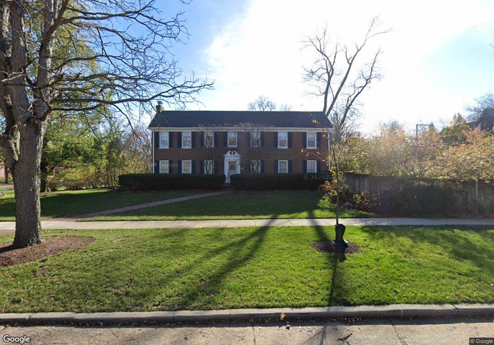
3004 Normandy Place Evanston, IL 60201
North Evanston NeighborhoodEstimated Value: $1,075,864 - $1,306,000
3
Beds
3
Baths
2,354
Sq Ft
$490/Sq Ft
Est. Value
About This Home
This home is located at 3004 Normandy Place, Evanston, IL 60201 and is currently estimated at $1,154,216, approximately $490 per square foot. 3004 Normandy Place is a home located in Cook County with nearby schools including Lincolnwood Elementary School, Haven Middle School, and Evanston Township High School.
Ownership History
Date
Name
Owned For
Owner Type
Purchase Details
Closed on
Aug 26, 1996
Sold by
Blanchard John A and Sugar Joan O
Bought by
Dupuis Gary A and Mann Virginia V
Current Estimated Value
Home Financials for this Owner
Home Financials are based on the most recent Mortgage that was taken out on this home.
Original Mortgage
$375,000
Outstanding Balance
$32,687
Interest Rate
8.37%
Estimated Equity
$1,121,529
Create a Home Valuation Report for This Property
The Home Valuation Report is an in-depth analysis detailing your home's value as well as a comparison with similar homes in the area
Home Values in the Area
Average Home Value in this Area
Purchase History
| Date | Buyer | Sale Price | Title Company |
|---|---|---|---|
| Dupuis Gary A | $420,000 | First American Title |
Source: Public Records
Mortgage History
| Date | Status | Borrower | Loan Amount |
|---|---|---|---|
| Open | Dupuis Gary A | $375,000 |
Source: Public Records
Tax History Compared to Growth
Tax History
| Year | Tax Paid | Tax Assessment Tax Assessment Total Assessment is a certain percentage of the fair market value that is determined by local assessors to be the total taxable value of land and additions on the property. | Land | Improvement |
|---|---|---|---|---|
| 2024 | $18,419 | $82,052 | $26,827 | $55,225 |
| 2023 | $18,029 | $83,771 | $26,827 | $56,944 |
| 2022 | $18,029 | $83,771 | $26,827 | $56,944 |
| 2021 | $17,130 | $67,878 | $16,208 | $51,670 |
| 2020 | $16,961 | $67,878 | $16,208 | $51,670 |
| 2019 | $17,836 | $79,554 | $16,208 | $63,346 |
| 2018 | $14,181 | $55,197 | $13,413 | $41,784 |
| 2017 | $14,800 | $58,845 | $13,413 | $45,432 |
| 2016 | $16,125 | $66,213 | $13,413 | $52,800 |
| 2015 | $16,325 | $63,507 | $11,178 | $52,329 |
| 2014 | $16,184 | $63,507 | $11,178 | $52,329 |
| 2013 | $15,796 | $63,507 | $11,178 | $52,329 |
Source: Public Records
Map
Nearby Homes
- 2221 Lincolnwood Dr
- 2951 Colfax St
- 2113 Forestview Rd
- 2422 Grant St
- 2518 Ridgeway Ave
- 2022 Mcdaniel Ave
- 2633 Crawford Ave
- 2440 Simpson St
- 3131 Central St
- 9833 Keystone Ave
- 2730 Central St Unit 3A
- 2726 Central St Unit 3D
- 9628 Keystone Ave
- 2720 Central St Unit 4C
- 2501 Crawford Ave
- 3233 Central St
- 3500 Church St Unit 204
- 2101 Pioneer Rd
- 2555 Gross Point Rd Unit 112
- 1808 Laurel Ave
- 2202 Central Park Ave
- 2150 Central Park Ave
- 3016 Normandy Place
- 3001 Normandy Place
- 2146 Central Park Ave
- 3020 Normandy Place
- 2228 Central Park Ave
- 3015 Normandy Place
- 2209 Central Park Ave
- 2205 Central Park Ave
- 2215 Central Park Ave
- 3015 Payne St
- 2140 Central Park Ave
- 2153 Central Park Ave
- 3026 Normandy Place
- 3025 Normandy Place
- 2219 Central Park Ave
- 2232 Central Park Ave
- 3023 Payne St
- 2149 Central Park Ave