Estimated Value: $490,000 - $526,000
5
Beds
4
Baths
2,600
Sq Ft
$197/Sq Ft
Est. Value
About This Home
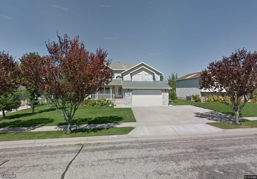
This home is located at 3004 W 4450 S, Roy, UT 84067 and is currently estimated at $512,072, approximately $196 per square foot. 3004 W 4450 S is a home located in Weber County with nearby schools including Midland School, Sand Ridge Junior High School, and Roy High School.
Ownership History
Date
Name
Owned For
Owner Type
Purchase Details
Closed on
Mar 10, 2016
Bought by
Walters Clay Cameron
Current Estimated Value
Home Financials for this Owner
Home Financials are based on the most recent Mortgage that was taken out on this home.
Original Mortgage
$255,272
Outstanding Balance
$202,248
Interest Rate
3.68%
Estimated Equity
$309,824
Purchase Details
Closed on
Nov 30, 2012
Sold by
Stark Lynda S
Bought by
Stark Lynda S
Purchase Details
Closed on
Sep 20, 1996
Sold by
K D Apartments Llc
Bought by
Stark Lynda S
Home Financials for this Owner
Home Financials are based on the most recent Mortgage that was taken out on this home.
Original Mortgage
$60,000
Interest Rate
7.39%
Create a Home Valuation Report for This Property
The Home Valuation Report is an in-depth analysis detailing your home's value as well as a comparison with similar homes in the area
Home Values in the Area
Average Home Value in this Area
Purchase History
| Date | Buyer | Sale Price | Title Company |
|---|---|---|---|
| Walters Clay Cameron | -- | -- | |
| Stark Lynda S | -- | None Available | |
| Stark Lynda S | -- | First American Title |
Source: Public Records
Mortgage History
| Date | Status | Borrower | Loan Amount |
|---|---|---|---|
| Open | Walters Clay Cameron | $255,272 | |
| Closed | Walters Clay Cameron | -- | |
| Previous Owner | Stark Lynda S | $60,000 |
Source: Public Records
Tax History
| Year | Tax Paid | Tax Assessment Tax Assessment Total Assessment is a certain percentage of the fair market value that is determined by local assessors to be the total taxable value of land and additions on the property. | Land | Improvement |
|---|---|---|---|---|
| 2025 | $3,110 | $501,897 | $137,106 | $364,791 |
| 2024 | $3,033 | $271,149 | $75,408 | $195,741 |
| 2023 | $2,930 | $262,350 | $70,156 | $192,194 |
| 2022 | $2,821 | $258,500 | $59,475 | $199,025 |
| 2021 | $2,427 | $367,000 | $83,609 | $283,391 |
| 2020 | $2,218 | $307,000 | $83,609 | $223,391 |
| 2019 | $2,162 | $282,000 | $48,835 | $233,165 |
| 2018 | $2,121 | $261,000 | $45,000 | $216,000 |
| 2017 | $1,949 | $224,000 | $45,000 | $179,000 |
| 2016 | $1,900 | $117,578 | $23,890 | $93,688 |
| 2015 | $1,697 | $106,967 | $23,890 | $83,077 |
| 2014 | $1,712 | $106,967 | $23,890 | $83,077 |
Source: Public Records
Map
Nearby Homes
- 2979 W 4275 S
- 4374 S 2900 W
- 2953 W 4650 S
- 4270 S 2900 W
- 2815 W 4275 S
- 3022 W 4750 S
- 4435 Cross Creek Rd Unit 29C
- 4510 Stone Creek Rd Unit F
- 4793 S 3025 W
- 4491 Haven Creek Rd Unit A
- 4324 S 3350 W
- 4732 S West Park Dr
- 4317 S 3350 W
- 2778 W 4175 S Unit 237
- 4322 S 3450 W
- 3405 W 4525 S
- 4891 S 2875 W
- 2602 W 4600 S
- 3931 S 2950 W
- 3610 W 4475 S
Your Personal Tour Guide
Ask me questions while you tour the home.