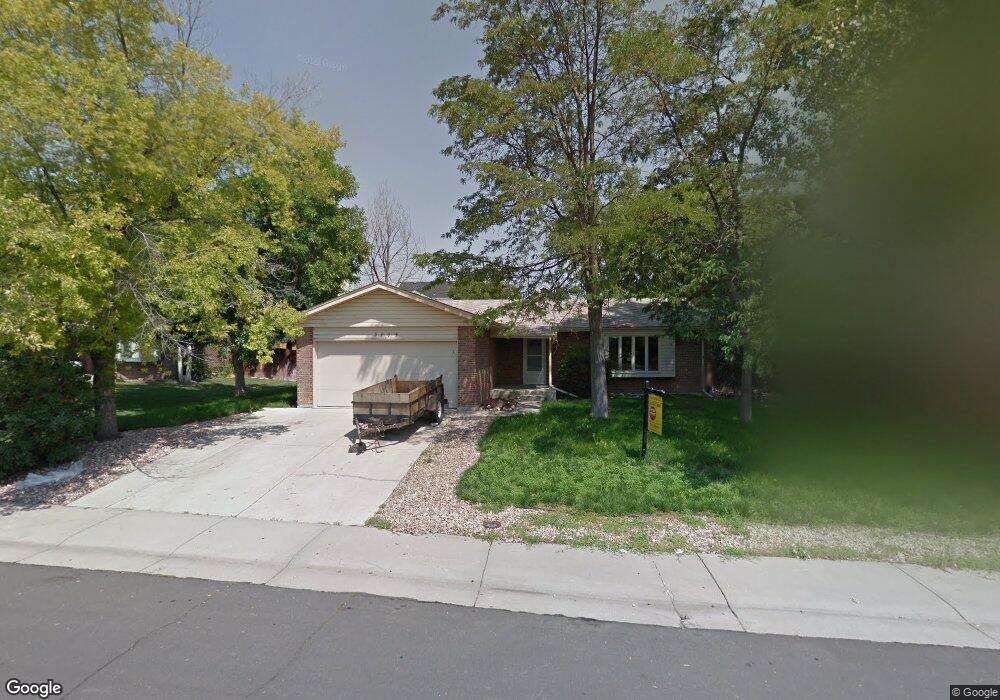
3005 E 132nd Ave Thornton, CO 80241
Estimated Value: $512,000 - $562,000
4
Beds
3
Baths
2,700
Sq Ft
$199/Sq Ft
Est. Value
About This Home
This home is located at 3005 E 132nd Ave, Thornton, CO 80241 and is currently estimated at $538,093, approximately $199 per square foot. 3005 E 132nd Ave is a home located in Adams County with nearby schools including Tarver Elementary School, Century Middle School, and Horizon High School.
Ownership History
Date
Name
Owned For
Owner Type
Purchase Details
Closed on
Jun 23, 2022
Sold by
Bing Woodhouse Danney
Bought by
Freeman Rebecca
Current Estimated Value
Home Financials for this Owner
Home Financials are based on the most recent Mortgage that was taken out on this home.
Original Mortgage
$220,000
Outstanding Balance
$208,190
Interest Rate
5.3%
Mortgage Type
New Conventional
Estimated Equity
$329,903
Purchase Details
Closed on
Jun 11, 2022
Sold by
Rebecca Ruby-Woodhouse
Bought by
Freeman Rebecca and Freeman Damon
Home Financials for this Owner
Home Financials are based on the most recent Mortgage that was taken out on this home.
Original Mortgage
$220,000
Outstanding Balance
$208,190
Interest Rate
5.3%
Mortgage Type
New Conventional
Estimated Equity
$329,903
Purchase Details
Closed on
Apr 19, 2013
Sold by
Nelson Stephen C
Bought by
Woodhouse Danney B and Woodhouse Ruby Rebecca
Home Financials for this Owner
Home Financials are based on the most recent Mortgage that was taken out on this home.
Original Mortgage
$225,000
Interest Rate
3.67%
Mortgage Type
VA
Purchase Details
Closed on
Jun 13, 2012
Sold by
Strong Tabiatha and Bottomley Tabiatha
Bought by
Nelson Stephen C
Purchase Details
Closed on
Aug 4, 2006
Sold by
Dinkel Donald L and Dinkel Sherry A
Bought by
Bottomley Tabiatha L
Home Financials for this Owner
Home Financials are based on the most recent Mortgage that was taken out on this home.
Original Mortgage
$186,400
Interest Rate
7.15%
Mortgage Type
Balloon
Purchase Details
Closed on
Dec 16, 2005
Sold by
Woolf Family Partnership I Trust
Bought by
Dinkel Donald L and Dinkel Sherry A
Home Financials for this Owner
Home Financials are based on the most recent Mortgage that was taken out on this home.
Original Mortgage
$171,000
Interest Rate
6.33%
Mortgage Type
Fannie Mae Freddie Mac
Purchase Details
Closed on
Nov 7, 2000
Sold by
Marietta Woolf and Mc Collum J
Bought by
Woolf Family Partnership I Trust
Purchase Details
Closed on
Aug 6, 1992
Create a Home Valuation Report for This Property
The Home Valuation Report is an in-depth analysis detailing your home's value as well as a comparison with similar homes in the area
Purchase History
| Date | Buyer | Sale Price | Title Company |
|---|---|---|---|
| Freeman Rebecca | -- | -- | |
| Freeman Rebecca | -- | Cherry Creek Title Services | |
| Woodhouse Danney B | $225,000 | None Available | |
| Nelson Stephen C | $159,500 | None Available | |
| Bottomley Tabiatha L | $233,000 | Title America | |
| Dinkel Donald L | $180,000 | Title America | |
| Woolf Family Partnership I Trust | -- | -- | |
| -- | $106,000 | -- |
Source: Public Records
Mortgage History
| Date | Status | Borrower | Loan Amount |
|---|---|---|---|
| Open | Freeman Rebecca | $220,000 | |
| Previous Owner | Woodhouse Danney B | $225,000 | |
| Previous Owner | Bottomley Tabiatha L | $186,400 | |
| Previous Owner | Dinkel Donald L | $171,000 |
Source: Public Records
Tax History
| Year | Tax Paid | Tax Assessment Tax Assessment Total Assessment is a certain percentage of the fair market value that is determined by local assessors to be the total taxable value of land and additions on the property. | Land | Improvement |
|---|---|---|---|---|
| 2025 | $3,698 | $36,110 | $7,140 | $28,970 |
| 2024 | $3,698 | $33,190 | $6,560 | $26,630 |
| 2023 | $3,660 | $39,440 | $6,770 | $32,670 |
| 2022 | $3,038 | $27,580 | $6,460 | $21,120 |
| 2021 | $3,140 | $27,580 | $6,460 | $21,120 |
| 2020 | $3,108 | $27,860 | $6,650 | $21,210 |
| 2019 | $3,114 | $27,860 | $6,650 | $21,210 |
| 2018 | $3,018 | $26,230 | $7,490 | $18,740 |
| 2017 | $2,744 | $26,230 | $7,490 | $18,740 |
| 2016 | $2,304 | $21,440 | $3,660 | $17,780 |
| 2015 | $2,301 | $21,440 | $3,660 | $17,780 |
| 2014 | $1,925 | $17,440 | $3,420 | $14,020 |
Source: Public Records
Map
Nearby Homes
- 2973 E 133rd Ln
- 2746 E 132nd Place
- 13064 Garfield Dr
- 12829 Cook Dr
- 13055 Harrison Dr
- 3670 E 128th Place
- 13068 Harrison Dr
- 13064 Harrison Dr
- 2615 Signal Creek Dr
- 13488 Monroe St
- 58 Blue Heron Dr
- 3715 E 127th Way
- 3765 E 127th Way
- 2942 E 135th Place
- 4087 E 133rd Cir
- 4061 E 129th Way
- 2945 E 135th Place
- 2275 E 129th Ave
- 2263 E 129th Ave Unit 2263
- 12992 Bellaire St
- 2985 E 132nd Ave
- 3045 E 132nd Ave
- 3064 E 133rd Cir
- 3074 Signal Creek Blvd
- 3084 Signal Creek Blvd
- 3054 E 133rd Cir
- 13198 Milwaukee St
- 2945 E 132nd Ave
- 3085 E 132nd Ave
- 3094 Signal Creek Blvd
- 3044 E 132nd Ave
- 3044 E 133rd Cir
- 2944 E 132nd Ave
- 3098 Signal Creek Blvd
- 3084 E 132nd Ave
- 3034 E 133rd Cir
- 2905 E 132nd Ave
- 13194 Milwaukee St
- 13191 Milwaukee St
- 13188 Milwaukee Ct
Your Personal Tour Guide
Ask me questions while you tour the home.