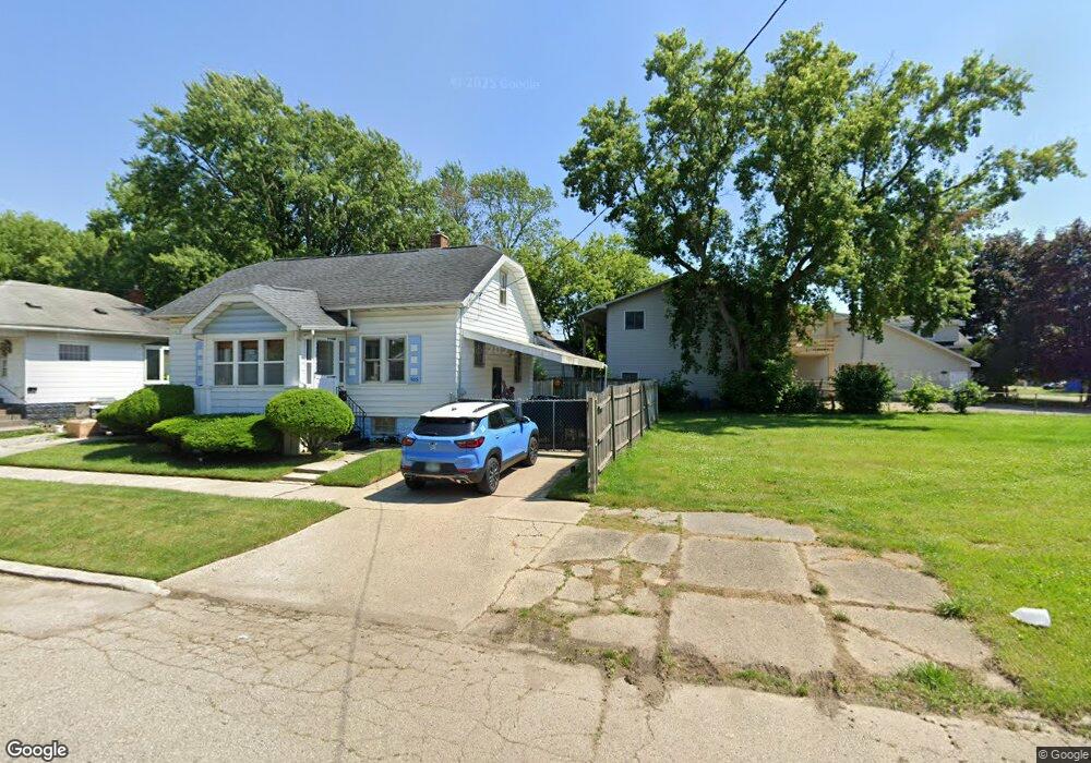
3005 Fenton Rd Flint, MI 48507
South Side NeighborhoodEstimated Value: $75,000 - $278,000
4
Beds
2
Baths
1,218
Sq Ft
$125/Sq Ft
Est. Value
About This Home
This home is located at 3005 Fenton Rd, Flint, MI 48507 and is currently estimated at $151,667, approximately $124 per square foot. 3005 Fenton Rd is a home located in Genesee County with nearby schools including Eisenhower School, Flint Southwestern Classical Academy, and International Academy of Flint (K-12).
Ownership History
Date
Name
Owned For
Owner Type
Purchase Details
Closed on
Aug 6, 2018
Sold by
Gennesee County Land Bank Authority
Bought by
Cheff Joshua
Current Estimated Value
Purchase Details
Closed on
Dec 20, 2016
Sold by
Cherry Deborah L
Bought by
Genesee County Land Bnak
Purchase Details
Closed on
Sep 30, 2013
Sold by
Brown Pamela
Bought by
Flagg Larry
Purchase Details
Closed on
Nov 29, 2012
Sold by
Cherry Deborah L
Bought by
Brown Pamela
Purchase Details
Closed on
Jan 30, 2008
Sold by
Pike Robert A
Bought by
Hsbc Bank Usa
Create a Home Valuation Report for This Property
The Home Valuation Report is an in-depth analysis detailing your home's value as well as a comparison with similar homes in the area
Home Values in the Area
Average Home Value in this Area
Purchase History
| Date | Buyer | Sale Price | Title Company |
|---|---|---|---|
| Cheff Joshua | -- | None Available | |
| Genesee County Land Bnak | -- | None Available | |
| Flagg Larry | -- | None Available | |
| Brown Pamela | $800 | None Available | |
| Hsbc Bank Usa | $48,900 | None Available |
Source: Public Records
Tax History Compared to Growth
Tax History
| Year | Tax Paid | Tax Assessment Tax Assessment Total Assessment is a certain percentage of the fair market value that is determined by local assessors to be the total taxable value of land and additions on the property. | Land | Improvement |
|---|---|---|---|---|
| 2025 | $341 | $4,100 | $0 | $0 |
| 2024 | $314 | $3,900 | $0 | $0 |
| 2023 | $243 | $3,300 | $0 | $0 |
| 2022 | $0 | $2,500 | $0 | $0 |
| 2021 | $288 | $3,000 | $0 | $0 |
| 2020 | $267 | $2,600 | $0 | $0 |
| 2019 | $269 | $2,500 | $0 | $0 |
| 2018 | $71 | $0 | $0 | $0 |
| 2017 | $372 | $0 | $0 | $0 |
| 2016 | $957 | $0 | $0 | $0 |
| 2015 | $0 | $0 | $0 | $0 |
| 2014 | -- | $0 | $0 | $0 |
| 2012 | -- | $14,500 | $0 | $0 |
Source: Public Records
Map
Nearby Homes
- 909 Barrie Ave
- 930 Bloor Ave
- 839 SiMcOe Ave
- 839 Barrie Ave
- 843 Ossington Ave
- 936 Lincoln Ave
- 842 Ossington Ave
- 820 Vermilya Ave
- 825 Vermilya Ave
- 805 Vermilya Ave
- 1101 Lincoln Ave
- 741 Barrie Ave
- 745 Freeman Ave
- 812 Remington Ave
- 734 Barrie Ave
- 730 Freeman Ave
- 1225 Vermilya Ave
- 1209 Lincoln Ave
- 657 Barrie Ave
- 1130 W Atherton Rd
- 955 SiMcOe Ave
- 2917 Fenton Rd
- 949 SiMcOe Ave
- 942 Victoria Ave
- 942 SiMcOe Ave
- 940 Victoria Ave
- 938 SiMcOe Ave
- 943 SiMcOe Ave
- 2902 Fenton Rd
- 934 SiMcOe Ave
- 938 Victoria Ave
- 937 SiMcOe Ave
- 941 Barrie Ave
- 1014 SiMcOe Ave
- 930 SiMcOe Ave
- 937 Barrie Ave
- 934 Victoria Ave
- 931 SiMcOe Ave
- 1011 Barrie Ave
- 933 Barrie Ave