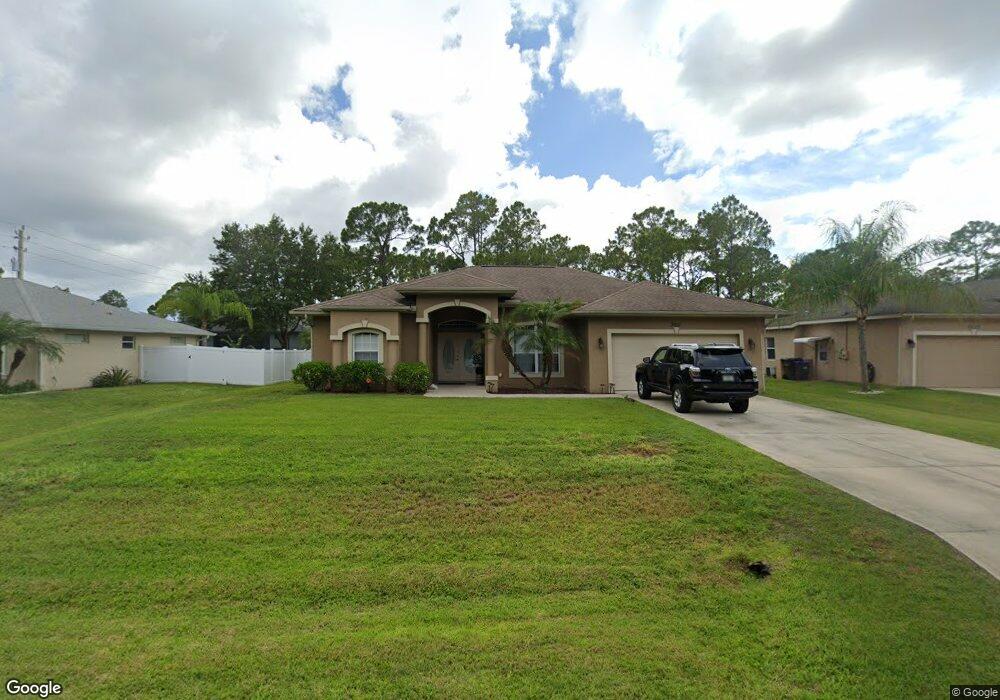
3007 Barry Rd North Port, FL 34286
Estimated Value: $338,000 - $370,000
3
Beds
2
Baths
1,808
Sq Ft
$198/Sq Ft
Est. Value
About This Home
This home is located at 3007 Barry Rd, North Port, FL 34286 and is currently estimated at $357,285, approximately $197 per square foot. 3007 Barry Rd is a home located in Sarasota County with nearby schools including North Port High School, Lamarque Elementary School, and Woodland Middle School.
Ownership History
Date
Name
Owned For
Owner Type
Purchase Details
Closed on
Dec 15, 2006
Sold by
Windemere Homes Inc
Bought by
Monday Robert P and Monday Alicia E
Current Estimated Value
Home Financials for this Owner
Home Financials are based on the most recent Mortgage that was taken out on this home.
Original Mortgage
$53,760
Outstanding Balance
$32,142
Interest Rate
6.31%
Mortgage Type
Credit Line Revolving
Estimated Equity
$325,143
Purchase Details
Closed on
Jun 11, 2004
Sold by
Jolly Land Inc
Bought by
Windemere Homes Inc
Create a Home Valuation Report for This Property
The Home Valuation Report is an in-depth analysis detailing your home's value as well as a comparison with similar homes in the area
Home Values in the Area
Average Home Value in this Area
Purchase History
| Date | Buyer | Sale Price | Title Company |
|---|---|---|---|
| Monday Robert P | $268,800 | Chelsea Title Company | |
| Windemere Homes Inc | $29,800 | Chelsea Title Company |
Source: Public Records
Mortgage History
| Date | Status | Borrower | Loan Amount |
|---|---|---|---|
| Open | Monday Robert P | $53,760 | |
| Open | Monday Robert P | $215,040 |
Source: Public Records
Tax History Compared to Growth
Tax History
| Year | Tax Paid | Tax Assessment Tax Assessment Total Assessment is a certain percentage of the fair market value that is determined by local assessors to be the total taxable value of land and additions on the property. | Land | Improvement |
|---|---|---|---|---|
| 2024 | $2,189 | $133,845 | -- | -- |
| 2023 | $2,189 | $129,947 | $0 | $0 |
| 2022 | $2,129 | $126,162 | $0 | $0 |
| 2021 | $2,067 | $122,487 | $0 | $0 |
| 2020 | $2,036 | $120,796 | $0 | $0 |
| 2019 | $1,972 | $118,080 | $0 | $0 |
| 2018 | $1,814 | $115,878 | $0 | $0 |
| 2017 | $1,780 | $113,495 | $0 | $0 |
| 2016 | $1,771 | $169,300 | $4,800 | $164,500 |
| 2015 | $1,786 | $143,200 | $4,300 | $138,900 |
| 2014 | $1,761 | $107,894 | $0 | $0 |
Source: Public Records
Map
Nearby Homes
- 2967 Barry Rd
- 4610 Clarke St
- 2931 Barry Rd
- 2969 Wells Ave
- 0958-11-4215 Natural St
- 8 Lummus St
- 0 Lummus St Unit 2025005676
- 0 Lummus St Unit MFRC7497102
- 0 Lummus St Unit 225049848
- 0 Maximo Rd Unit MFRC7505206
- 0 Maximo Rd Unit Lot 27, MFRC7509333
- 0 Moncrief Ave Unit MFRC7514999
- 1135 Moncrief Blk 50 Ave
- 0 Moncrief Ave Unit MFRC7502334
- 0 Tahiti St Unit MFRC7515012
- 3276 Chipley Ave
- 4343 Carver St
- 0 Carthage St Unit MFRC7493998
- 0 Carthage St Unit MFRD6144545
- 2718 Chipley Ave
- 3001 Barry Rd
- 3013 Barry Rd
- 3010 Maximo Rd
- 3019 Barry Rd
- 3018 Barry Rd
- 3025 Barry Rd
- 4694 Clarke St
- 3110 Maximo Rd
- 4666 Clarke St
- 2979 Barry Rd
- 4667 N Cranberry Blvd
- 2978 Maximo Rd
- Lot 1 Maximo Rd
- 0 Clarke St
- 2989 Maximo Rd
- 2980 Barry Rd
- 4710 Big St
- 0 Sawmill Ave
- 3144 Maximo Rd
- 4639 N Cranberry Blvd