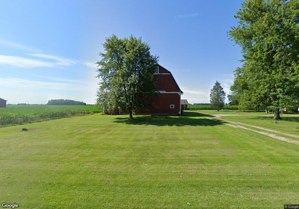
30080 Coressel Rd Defiance, OH 43512
Estimated Value: $239,000 - $351,000
3
Beds
2
Baths
2,248
Sq Ft
$127/Sq Ft
Est. Value
About This Home
This home is located at 30080 Coressel Rd, Defiance, OH 43512 and is currently estimated at $285,520, approximately $127 per square foot. 30080 Coressel Rd is a home located in Defiance County with nearby schools including Tinora Elementary School, Noble Elementary School, and Tinora Middle School.
Ownership History
Date
Name
Owned For
Owner Type
Purchase Details
Closed on
Sep 25, 2013
Sold by
Buchhop Timothy and Buchhop Becky
Bought by
Parsons Andrew S and Parsons Emilie Buchhop
Current Estimated Value
Home Financials for this Owner
Home Financials are based on the most recent Mortgage that was taken out on this home.
Original Mortgage
$120,000
Outstanding Balance
$31,481
Interest Rate
4.39%
Mortgage Type
New Conventional
Estimated Equity
$254,039
Purchase Details
Closed on
Jan 1, 1992
Bought by
Parsons Andrew S and Emilie Buchhop P
Create a Home Valuation Report for This Property
The Home Valuation Report is an in-depth analysis detailing your home's value as well as a comparison with similar homes in the area
Home Values in the Area
Average Home Value in this Area
Purchase History
| Date | Buyer | Sale Price | Title Company |
|---|---|---|---|
| Parsons Andrew S | $150,000 | None Available | |
| Parsons Andrew S | -- | -- |
Source: Public Records
Mortgage History
| Date | Status | Borrower | Loan Amount |
|---|---|---|---|
| Open | Parsons Andrew S | $120,000 |
Source: Public Records
Tax History Compared to Growth
Tax History
| Year | Tax Paid | Tax Assessment Tax Assessment Total Assessment is a certain percentage of the fair market value that is determined by local assessors to be the total taxable value of land and additions on the property. | Land | Improvement |
|---|---|---|---|---|
| 2024 | $2,384 | $68,900 | $5,890 | $63,010 |
| 2023 | $2,384 | $68,900 | $5,890 | $63,010 |
| 2022 | $2,039 | $49,900 | $5,460 | $44,440 |
| 2021 | $2,039 | $49,900 | $5,460 | $44,440 |
| 2020 | $2,047 | $49,900 | $5,460 | $44,440 |
| 2019 | $1,883 | $46,920 | $5,420 | $41,500 |
| 2018 | $1,903 | $46,920 | $5,420 | $41,500 |
| 2017 | $1,713 | $46,918 | $5,418 | $41,500 |
| 2016 | $1,502 | $40,327 | $5,334 | $34,993 |
| 2015 | $797 | $40,327 | $5,334 | $34,993 |
| 2014 | $797 | $40,327 | $5,334 | $34,993 |
| 2013 | $797 | $40,327 | $5,334 | $34,993 |
| 2012 | $797 | $40,327 | $5,334 | $34,993 |
Source: Public Records
Map
Nearby Homes
- 29232 Coressel Rd
- 6767 Independence Rd
- 26825 Behrens Rd
- 26761 Behrens Rd
- 20401 U S 6
- 19972 County Road X
- 19950 County Road X
- 19913 County Road X
- 405 W High St
- 75 Capri Dr
- 212 E High St
- 0 Westmoreland Ave
- 23648 County Rd S
- 00 Westmoreland Ave
- 1374 Clairmont Ave
- 1113 Clairmont Ave
- 1314 Clairmont Ave
- 1214 Clairmont Ave
- 1354 Clairmont Ave
- 16052 State Route 424