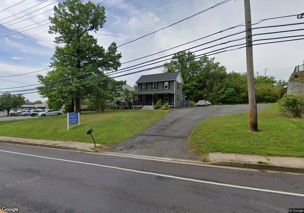
3009 Abingdon Rd Abingdon, MD 21009
Estimated Value: $399,623
Studio
1
Bath
1,336
Sq Ft
$299/Sq Ft
Est. Value
About This Home
This home is located at 3009 Abingdon Rd, Abingdon, MD 21009 and is currently estimated at $399,623, approximately $299 per square foot. 3009 Abingdon Rd is a home located in Harford County with nearby schools including Abingdon Elementary School, Edgewood Middle School, and Edgewood High School.
Ownership History
Date
Name
Owned For
Owner Type
Purchase Details
Closed on
Mar 8, 2018
Sold by
Ridge Properties Llc
Bought by
Dc Holdings Llc
Current Estimated Value
Purchase Details
Closed on
Dec 18, 2015
Sold by
Hb Trust
Bought by
Ridge Properties Llc
Purchase Details
Closed on
Feb 21, 2014
Sold by
Hicks Elizabeth P
Bought by
Hb Trust
Purchase Details
Closed on
Oct 23, 2001
Sold by
Mc New Michael W
Bought by
Hicks Elizabeth P
Purchase Details
Closed on
Jan 13, 1986
Sold by
Linder Emory J
Bought by
Mc New Michael W
Home Financials for this Owner
Home Financials are based on the most recent Mortgage that was taken out on this home.
Original Mortgage
$67,600
Interest Rate
10.77%
Purchase Details
Closed on
Dec 31, 1984
Sold by
Stinchcomb Norman P and Stinchcomb Wf
Bought by
Linder Emory J
Create a Home Valuation Report for This Property
The Home Valuation Report is an in-depth analysis detailing your home's value as well as a comparison with similar homes in the area
Home Values in the Area
Average Home Value in this Area
Purchase History
| Date | Buyer | Sale Price | Title Company |
|---|---|---|---|
| Dc Holdings Llc | $275,000 | Key Title Inc | |
| Ridge Properties Llc | $80,000 | Getz Title Group Llc | |
| Hb Trust | $74,750 | None Available | |
| Hicks Elizabeth P | $220,000 | -- | |
| Mc New Michael W | $84,500 | -- | |
| Linder Emory J | $68,000 | -- |
Source: Public Records
Mortgage History
| Date | Status | Borrower | Loan Amount |
|---|---|---|---|
| Previous Owner | Mc New Michael W | $67,600 |
Source: Public Records
Tax History
| Year | Tax Paid | Tax Assessment Tax Assessment Total Assessment is a certain percentage of the fair market value that is determined by local assessors to be the total taxable value of land and additions on the property. | Land | Improvement |
|---|---|---|---|---|
| 2025 | $3,358 | $308,100 | $269,600 | $38,500 |
| 2024 | $3,358 | $308,100 | $269,600 | $38,500 |
| 2023 | $4,021 | $368,900 | $269,600 | $99,300 |
| 2022 | $4,001 | $367,067 | $0 | $0 |
| 2021 | $0 | $365,233 | $0 | $0 |
| 2020 | $4,194 | $363,400 | $269,600 | $93,800 |
| 2019 | $4,029 | $349,100 | $0 | $0 |
| 2018 | $3,864 | $334,800 | $0 | $0 |
| 2017 | $3,665 | $320,500 | $0 | $0 |
| 2016 | $117 | $320,500 | $0 | $0 |
| 2015 | $3,777 | $320,500 | $0 | $0 |
| 2014 | $3,777 | $320,500 | $0 | $0 |
Source: Public Records
Map
Nearby Homes
- 2930 Haddington Ct
- 2923 Alconbury Ct
- 2917 Brightwater Ln
- 20 Huxley Cir
- 104 Singer Rd
- 2902 Preston Ln
- 115 Hastings Ct
- 2934 Strathaven Ln
- 2961 Harrogate Way
- 2818 Singer Woods Dr
- 3172 Hidden Ridge Terrace
- 2802 Haddaway Ct
- 3303 Trellis Ln
- 221 Glen View Terrace
- 311 Laurel Woods Dr
- 236 Lodgecliff Ct
- 2712 Parallel Path
- 201 Star Pointe Ct Unit 1A
- 205 Star Pointe Ct Unit 1D
- 201 Windmille Pointe Ct Unit 2C
- 232 Hig
- 3005 Emmorton Rd
- 2954 Burnley Ct
- 3007 Emmorton Rd Unit 4
- 3007 Emmorton Rd Unit 3-4
- 3007 Emmorton Rd
- 2953 Box Hill Ct
- 2955 Burnley Ct
- 2952 Burnley Ct
- 3105C Emmorton Rd
- 3105C Emmorton Rd Unit C2E
- 3105C Emmorton Rd Unit 2D
- 3105C Emmorton Rd Unit C1A
- 3105C Emmorton Rd Unit C2A
- 3101 Emmorton Rd Unit A9-10
- 3101 Emmorton Rd Unit A4
- 3101 Emmorton Rd Unit A-6
- 3101 Emmorton Rd Unit A-8
- 3101 Emmorton Rd Unit A-5
- 3101 Emmorton Rd Unit A-9
Your Personal Tour Guide
Ask me questions while you tour the home.