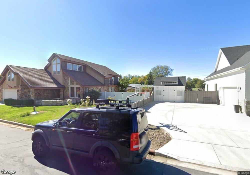
3009 Marrcrest W Provo, UT 84604
Riverside NeighborhoodEstimated Value: $419,000 - $443,000
3
Beds
3
Baths
1,400
Sq Ft
$306/Sq Ft
Est. Value
About This Home
This home is located at 3009 Marrcrest W, Provo, UT 84604 and is currently estimated at $428,742, approximately $306 per square foot. 3009 Marrcrest W is a home located in Utah County with nearby schools including Canyon Crest Elementary School, Centennial Middle School, and Timpview High School.
Ownership History
Date
Name
Owned For
Owner Type
Purchase Details
Closed on
Jun 20, 2025
Sold by
Candland David N and Noel Candland D
Bought by
Mcgee Carter R and Halsey Joan T
Current Estimated Value
Home Financials for this Owner
Home Financials are based on the most recent Mortgage that was taken out on this home.
Original Mortgage
$335,600
Outstanding Balance
$334,738
Interest Rate
6.81%
Mortgage Type
New Conventional
Estimated Equity
$94,004
Purchase Details
Closed on
Mar 7, 2022
Sold by
Noel Candland D and Noel Wendy W
Bought by
D Noel Candland Sr Family Trust
Purchase Details
Closed on
Nov 15, 2019
Sold by
Noel Candland D and Noel Wendy W
Bought by
D Noel Candland Sr Family Trust
Purchase Details
Closed on
Oct 17, 2018
Sold by
Candland D Noel and Candland Wendy W
Bought by
Candland D Noel and Candland Wendy W
Create a Home Valuation Report for This Property
The Home Valuation Report is an in-depth analysis detailing your home's value as well as a comparison with similar homes in the area
Home Values in the Area
Average Home Value in this Area
Purchase History
| Date | Buyer | Sale Price | Title Company |
|---|---|---|---|
| Mcgee Carter R | -- | Inwest Title | |
| D Noel Candland Sr Family Trust | -- | None Listed On Document | |
| D Noel Candland Sr Family Trust | -- | None Listed On Document | |
| Candland D Noel | -- | None Available |
Source: Public Records
Mortgage History
| Date | Status | Borrower | Loan Amount |
|---|---|---|---|
| Open | Mcgee Carter R | $335,600 |
Source: Public Records
Tax History Compared to Growth
Tax History
| Year | Tax Paid | Tax Assessment Tax Assessment Total Assessment is a certain percentage of the fair market value that is determined by local assessors to be the total taxable value of land and additions on the property. | Land | Improvement |
|---|---|---|---|---|
| 2025 | $2,034 | $197,670 | $52,800 | $306,600 |
| 2024 | $2,034 | $200,200 | $0 | $0 |
| 2023 | $1,795 | $174,185 | $0 | $0 |
| 2022 | $1,756 | $171,820 | $0 | $0 |
| 2021 | $1,376 | $234,900 | $35,200 | $199,700 |
| 2020 | $1,375 | $220,000 | $47,000 | $173,000 |
| 2019 | $1,322 | $220,000 | $47,000 | $173,000 |
| 2018 | $1,254 | $211,600 | $47,000 | $164,600 |
| 2017 | $1,207 | $111,925 | $0 | $0 |
| 2016 | $1,177 | $101,750 | $0 | $0 |
| 2015 | $1,058 | $92,400 | $0 | $0 |
| 2014 | -- | $77,000 | $0 | $0 |
Source: Public Records
Map
Nearby Homes
- 3013 N 100 W
- 2939 N Marrcrest Dr W
- 3057 N 100 W
- 2888 Marrcrest W
- 2823 N Marrcrest E
- 96 Marrcrest S
- 3240 Shadowbrook Dr
- 1636 N 320 E Unit 5
- 1660 N 320 E Unit 3
- 1648 N 320 E Unit 4
- 1625 N 320 E Unit 1
- 1624 N 320 E Unit 6
- 1615 N 320 E Unit 1
- 1612 N 320 E Unit RES
- 3430 Brookside Dr
- 2774 N 370 E
- 3477 Brookside Dr
- 3535 N 160 St W
- 1360 S Carterville Rd
- 1237 S 1000 E
- 2999 Marrcrest W
- 3029 Marrcrest W
- 2979 Marrcrest W
- 2959 N Marrcrest Dr W
- 2959 Marrcrest W
- 2939 Marrcrest W
- 2998 Marrcrest W
- 3018 Marrcrest W
- 3018 Marrcrest W
- 2982 Marrcrest W
- 2960 Marrcrest W
- 2919 Marrcrest W
- 2932 Marrcrest W
- 2899 Marrcrest W
- 2942 Marrcrest W
- 2918 Marrcrest W
- 2918 Marrcrest W Unit 2918
- 2908 Marrcrest W
- 2891 Marrcrest W
- 2993 N 100 W