Estimated Value: $179,408 - $228,000
4
Beds
1
Bath
1,715
Sq Ft
$112/Sq Ft
Est. Value
About This Home
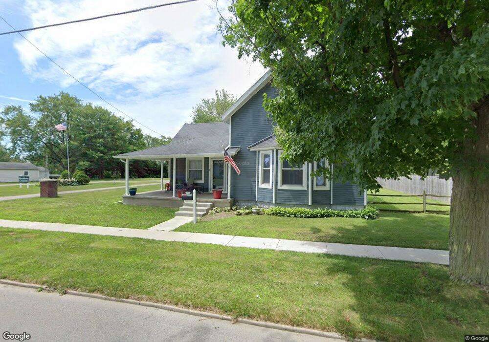
This home is located at 301 Adrian St, Delta, OH 43515 and is currently estimated at $192,602, approximately $112 per square foot. 301 Adrian St is a home located in Fulton County with nearby schools including Delta Elementary School, Pike-Delta-York Middle School, and Pike-Delta-York High School.
Ownership History
Date
Name
Owned For
Owner Type
Purchase Details
Closed on
Oct 24, 2025
Sold by
Druschel Robert L and Druschel Virginia D
Bought by
Druschel Virginia
Current Estimated Value
Home Financials for this Owner
Home Financials are based on the most recent Mortgage that was taken out on this home.
Original Mortgage
$186,400
Outstanding Balance
$186,400
Interest Rate
6.26%
Mortgage Type
New Conventional
Estimated Equity
$6,202
Purchase Details
Closed on
May 5, 2017
Sold by
Ford Douglas John and Ford Alicia Nochole
Bought by
Druschel Robert L and Druschel Virginia D
Home Financials for this Owner
Home Financials are based on the most recent Mortgage that was taken out on this home.
Original Mortgage
$116,059
Interest Rate
3.75%
Mortgage Type
FHA
Purchase Details
Closed on
Mar 1, 2006
Sold by
Miller Douglas P and Miller Lorraine J
Bought by
Ford Douglas John and Ford Alicia Nichole
Home Financials for this Owner
Home Financials are based on the most recent Mortgage that was taken out on this home.
Original Mortgage
$102,500
Interest Rate
6.2%
Mortgage Type
Fannie Mae Freddie Mac
Purchase Details
Closed on
Jan 1, 1990
Bought by
Miller Douglas P
Create a Home Valuation Report for This Property
The Home Valuation Report is an in-depth analysis detailing your home's value as well as a comparison with similar homes in the area
Home Values in the Area
Average Home Value in this Area
Purchase History
| Date | Buyer | Sale Price | Title Company |
|---|---|---|---|
| Druschel Virginia | -- | None Listed On Document | |
| Druschel Robert L | $118,200 | Attorney | |
| Ford Douglas John | $102,500 | None Available | |
| Miller Douglas P | -- | -- |
Source: Public Records
Mortgage History
| Date | Status | Borrower | Loan Amount |
|---|---|---|---|
| Open | Druschel Virginia | $186,400 | |
| Previous Owner | Druschel Robert L | $116,059 | |
| Previous Owner | Ford Douglas John | $102,500 |
Source: Public Records
Tax History Compared to Growth
Tax History
| Year | Tax Paid | Tax Assessment Tax Assessment Total Assessment is a certain percentage of the fair market value that is determined by local assessors to be the total taxable value of land and additions on the property. | Land | Improvement |
|---|---|---|---|---|
| 2024 | $2,084 | $49,180 | $8,230 | $40,950 |
| 2023 | $2,089 | $49,180 | $8,230 | $40,950 |
| 2022 | $2,235 | $40,150 | $6,860 | $33,290 |
| 2021 | $2,312 | $40,150 | $6,860 | $33,290 |
| 2020 | $2,298 | $40,150 | $6,860 | $33,290 |
| 2019 | $2,225 | $39,760 | $6,860 | $32,900 |
| 2018 | $2,067 | $39,760 | $6,860 | $32,900 |
| 2017 | $2,084 | $39,760 | $6,860 | $32,900 |
| 2016 | $1,982 | $33,180 | $6,860 | $26,320 |
| 2015 | $1,850 | $33,180 | $6,860 | $26,320 |
| 2014 | $1,847 | $33,180 | $6,860 | $26,320 |
| 2013 | $1,920 | $34,860 | $5,250 | $29,610 |
Source: Public Records
Map
Nearby Homes
- 308 Monroe St
- 207 Wood St
- 413 Fernwood St
- 305 Mckinley St
- 701 Palmwood St
- 518 Providence St
- 908 Fernwood St
- 810 Greenview Ave
- Integrity 1880 Plan at Oregon Town Center
- Integrity 2060 Plan at Oregon Town Center
- Integrity 2000 Plan at Oregon Town Center
- Elements 2700 Plan at Oregon Town Center
- Integrity 2060 Plan at Hidden Ridge Estates
- integrity 1800 Plan at Hidden Ridge Estates
- Integrity 2061 V8.1a Plan at Hidden Ridge Estates
- Integrity 2060 Plan at Three Meadows North
- Integrity 2080 Plan at Oregon Town Center
- Elements 2390 Plan at Oregon Town Center
- Integrity 2061 V8.1a Plan at Oregon Town Center
- Integrity 1460 Plan at Hidden Ridge Estates