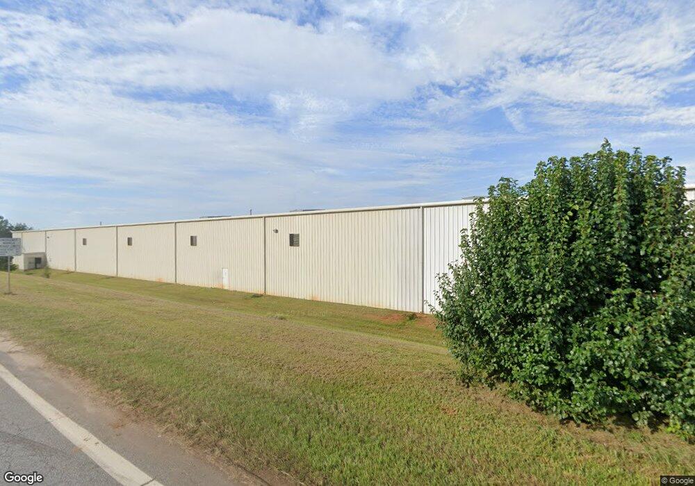
301 Alliance Pkwy Williamston, SC 29697
Williamston-Pelzer NeighborhoodEstimated Value: $2,349,208
--
Bed
--
Bath
33,680
Sq Ft
$70/Sq Ft
Est. Value
About This Home
This home is located at 301 Alliance Pkwy, Williamston, SC 29697 and is currently estimated at $2,349,208, approximately $69 per square foot. 301 Alliance Pkwy is a home located in Anderson County with nearby schools including Spearman Elementary School, Wren Middle School, and Wren High School.
Ownership History
Date
Name
Owned For
Owner Type
Purchase Details
Closed on
Apr 14, 2020
Sold by
Terry Family I Llc
Bought by
Martin Bridge Properties Llc
Current Estimated Value
Purchase Details
Closed on
Sep 15, 2004
Sold by
Cox John A
Bought by
Terry Family I Llc
Purchase Details
Closed on
Sep 14, 2004
Sold by
Highview Properties Llc
Bought by
Cox John A and Terry Gerald R
Purchase Details
Closed on
Aug 31, 2003
Sold by
Hilltop Collections Llc
Bought by
Highview Props Llc
Purchase Details
Closed on
Dec 14, 2001
Sold by
5 W Associates Llp
Bought by
Hilltop Collections Llc
Create a Home Valuation Report for This Property
The Home Valuation Report is an in-depth analysis detailing your home's value as well as a comparison with similar homes in the area
Home Values in the Area
Average Home Value in this Area
Purchase History
| Date | Buyer | Sale Price | Title Company |
|---|---|---|---|
| Martin Bridge Properties Llc | $1,400,000 | None Available | |
| Terry Family I Llc | $727,579 | -- | |
| Cox John A | $869,600 | -- | |
| Highview Props Llc | $215,000 | -- | |
| Hilltop Collections Llc | $150,000 | -- |
Source: Public Records
Mortgage History
| Date | Status | Borrower | Loan Amount |
|---|---|---|---|
| Closed | Cox John A | -- |
Source: Public Records
Tax History Compared to Growth
Tax History
| Year | Tax Paid | Tax Assessment Tax Assessment Total Assessment is a certain percentage of the fair market value that is determined by local assessors to be the total taxable value of land and additions on the property. | Land | Improvement |
|---|---|---|---|---|
| 2024 | $29,111 | $85,920 | $11,810 | $74,110 |
| 2023 | $29,111 | $85,920 | $11,810 | $74,110 |
| 2022 | $27,287 | $85,920 | $11,810 | $74,110 |
| 2021 | $18,330 | $0 | $0 | $0 |
| 2020 | $17,979 | $0 | $0 | $0 |
| 2019 | $19,777 | $0 | $0 | $0 |
| 2018 | $0 | $0 | $0 | $0 |
| 2017 | $0 | $0 | $0 | $0 |
| 2016 | $0 | $0 | $0 | $0 |
| 2015 | -- | $0 | $0 | $0 |
| 2014 | -- | $0 | $0 | $0 |
Source: Public Records
Map
Nearby Homes
- 000 Anderson Business Park
- 98 Turkey Trot Rd
- 121 Garden Park Dr
- 327 Partridge Dr
- 105 Wild Turkey Rd
- 105 Garden Park Dr
- 140 Turnberry Rd
- 643 Fern Hollow Trail
- 203 Turkey Trot Rd
- 653 Fern Hollow Trail
- 126 Turnberry Rd
- 703 Fern Hollow Trail
- 124 Turnberry Rd
- 131 Turnberry Rd
- 118 Turnberry Rd
- 123 Turnberry Rd
- 5 Leber Dr
- 1002 Princeton Rd
- 5314 Midway Rd
- 28 Ione Cir
- 301 Alliance Pkwy
- 760 Hampton Rd
- 736 Hampton Rd
- 730 Hampton Rd
- 733 Hampton Rd
- 4538 Highway 81 N
- 4555 N Highway 81
- 4601 N Highway 81
- 4500 Highway 81 N
- 321 Alliance Pkwy
- 330 Webb Rd
- 4505 Williamsburg Rd
- 4809 N Highway 81
- 4900 N Highway 81
- 217 Paulan Rd
- 4831 Highway 81 N
- 155 Paulan Rd
- 520 Hampton Rd
- 4805 N Highway 81
- 1140 Martin Rd