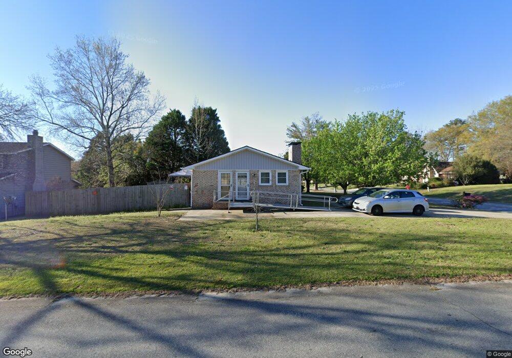
301 Angus Blvd Warner Robins, GA 31088
Estimated Value: $177,681 - $192,000
Studio
2
Baths
1,709
Sq Ft
$109/Sq Ft
Est. Value
About This Home
This home is located at 301 Angus Blvd, Warner Robins, GA 31088 and is currently estimated at $185,670, approximately $108 per square foot. 301 Angus Blvd is a home located in Houston County with nearby schools including Russell Elementary School, Warner Robins Middle School, and Warner Robins High School.
Ownership History
Date
Name
Owned For
Owner Type
Purchase Details
Closed on
Apr 17, 2024
Sold by
Gauthier David R and Gauthier Jacquelyn M
Bought by
Gauthier David R and Gauthier James R
Current Estimated Value
Purchase Details
Closed on
Dec 13, 1991
Sold by
Maurizi Rudolph and Maurizi Elda M
Bought by
Gauthier David R and Jacqueline M*
Purchase Details
Closed on
Mar 22, 1990
Sold by
Smith Robet V and Smith Josephine M
Bought by
Maurizi Rudolph and Maurizi Elda M
Purchase Details
Closed on
Apr 17, 1978
Sold by
Griffin Larry D and Griffin Judy L
Bought by
Smith Robet V and Smith Josephine M
Purchase Details
Closed on
Feb 7, 1975
Sold by
Brand & Howell Realty Co Inc
Bought by
Griffin Larry D and Griffin Judy L
Purchase Details
Closed on
Aug 21, 1973
Sold by
S&W Development Co
Bought by
Brand & Howell Realty Co Inc
Create a Home Valuation Report for This Property
The Home Valuation Report is an in-depth analysis detailing your home's value as well as a comparison with similar homes in the area
Home Values in the Area
Average Home Value in this Area
Purchase History
| Date | Buyer | Sale Price | Title Company |
|---|---|---|---|
| Gauthier David R | -- | None Listed On Document | |
| Gauthier David R | $63,500 | -- | |
| Maurizi Rudolph | $52,000 | -- | |
| Smith Robet V | -- | -- | |
| Griffin Larry D | $33,000 | -- | |
| Brand & Howell Realty Co Inc | -- | -- |
Source: Public Records
Tax History
| Year | Tax Paid | Tax Assessment Tax Assessment Total Assessment is a certain percentage of the fair market value that is determined by local assessors to be the total taxable value of land and additions on the property. | Land | Improvement |
|---|---|---|---|---|
| 2024 | $1,852 | $62,960 | $8,000 | $54,960 |
| 2023 | $1,287 | $45,400 | $8,000 | $37,400 |
| 2022 | $634 | $36,720 | $5,200 | $31,520 |
| 2021 | $504 | $30,920 | $5,200 | $25,720 |
| 2020 | $505 | $30,880 | $5,200 | $25,680 |
| 2019 | $505 | $30,880 | $5,200 | $25,680 |
| 2018 | $671 | $30,880 | $5,200 | $25,680 |
| 2017 | $721 | $33,000 | $5,200 | $27,800 |
| 2016 | $722 | $33,000 | $5,200 | $27,800 |
| 2015 | -- | $33,000 | $5,200 | $27,800 |
| 2014 | -- | $33,000 | $5,200 | $27,800 |
| 2013 | -- | $33,000 | $5,200 | $27,800 |
Source: Public Records
Map
Nearby Homes
- 223 Highland Dr
- 305 Bonnie Dr
- 82 Oliver Dr
- 77 Oliver Dr
- 107 Woodfield Dr
- 223 Randy Cir
- 201 Bayside Dr
- 302 Creek Ridge Dr
- 205 Sonja Dr
- 211 Palomino Ln
- 213 Self St
- 616 Woods Edge Way
- 102 Williamsburg Ave
- 236 Tallulah Trail
- 122 Tallulah Trail
- 1850 Russell Pkwy
- 0 Russell Pkwy Unit 10656199
- 118 Fox Glove Ct
- 102 Tallulah Trail
- 510 Arrowhead Trail
Your Personal Tour Guide
Ask me questions while you tour the home.