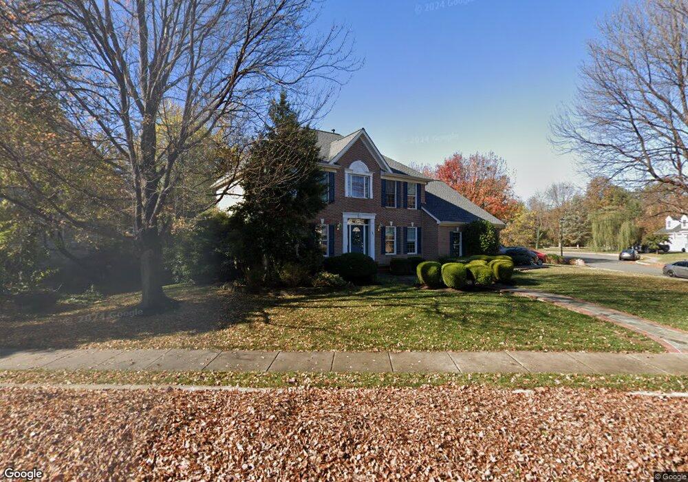
301 Ariel Dr NE Leesburg, VA 20176
Estimated Value: $816,215 - $918,000
4
Beds
4
Baths
2,408
Sq Ft
$365/Sq Ft
Est. Value
About This Home
This home is located at 301 Ariel Dr NE, Leesburg, VA 20176 and is currently estimated at $879,304, approximately $365 per square foot. 301 Ariel Dr NE is a home located in Loudoun County with nearby schools including Leesburg Elementary School, Smart's Mill Middle School, and Tuscarora High School.
Ownership History
Date
Name
Owned For
Owner Type
Purchase Details
Closed on
Mar 6, 2019
Sold by
Mcerlean Davis Harry Lloyd and Mcerlean Davis Mary
Bought by
Mcerlean Davis Harry Lloyd and Mcerlean Davis Mary
Current Estimated Value
Purchase Details
Closed on
Oct 22, 1993
Sold by
Rivermead Homes Inc
Bought by
Davis Mary M
Home Financials for this Owner
Home Financials are based on the most recent Mortgage that was taken out on this home.
Original Mortgage
$158,000
Interest Rate
6.73%
Create a Home Valuation Report for This Property
The Home Valuation Report is an in-depth analysis detailing your home's value as well as a comparison with similar homes in the area
Home Values in the Area
Average Home Value in this Area
Purchase History
| Date | Buyer | Sale Price | Title Company |
|---|---|---|---|
| Mcerlean Davis Harry Lloyd | -- | None Available | |
| Davis Mary M | $234,940 | -- |
Source: Public Records
Mortgage History
| Date | Status | Borrower | Loan Amount |
|---|---|---|---|
| Closed | Davis Mary M | $158,000 |
Source: Public Records
Tax History Compared to Growth
Tax History
| Year | Tax Paid | Tax Assessment Tax Assessment Total Assessment is a certain percentage of the fair market value that is determined by local assessors to be the total taxable value of land and additions on the property. | Land | Improvement |
|---|---|---|---|---|
| 2025 | $6,402 | $795,310 | $262,300 | $533,010 |
| 2024 | $6,416 | $741,750 | $242,300 | $499,450 |
| 2023 | $6,328 | $723,160 | $227,300 | $495,860 |
| 2022 | $5,907 | $663,680 | $202,300 | $461,380 |
| 2021 | $5,692 | $580,820 | $200,300 | $380,520 |
| 2020 | $5,340 | $515,910 | $180,300 | $335,610 |
| 2019 | $5,252 | $502,600 | $180,300 | $322,300 |
| 2018 | $5,298 | $488,300 | $150,300 | $338,000 |
| 2017 | $5,414 | $481,210 | $150,300 | $330,910 |
| 2016 | $5,496 | $479,960 | $0 | $0 |
| 2015 | $869 | $324,630 | $0 | $324,630 |
| 2014 | $809 | $291,970 | $0 | $291,970 |
Source: Public Records
Map
Nearby Homes
- 293 Ariel Dr NE
- 216 Wildman St NE
- 276 Ariel Dr NE
- 222 Wirt St NW
- 412 Blue Ridge Ave NE
- 108 Stoneledge Place NE
- 710 North St NE
- BIRKHALL Plan at Brickyard
- BALMORAL Plan at Brickyard
- HIGHGROVE Plan at Brickyard
- 2 Stationmaster St SE Unit 302
- 5 Stationmaster St SE Unit 202
- 706 Amber Ct NE
- 3 Stationmaster St SE Unit 402
- 514 Covington Terrace NE
- 523 Currant Terrace NE
- 0 Loudoun St SW Unit VALO2106424
- 414 Madison Ct SE
- 411 Bicksler Square SE
- 265 High Rail Terrace SE
- 299 Ariel Dr NE
- 103 Barbara Ct NE
- 297 Ariel Dr NE
- 305 Ariel Dr NE
- 490 Marshall Dr NE
- 302 Ariel Dr NE
- 304 Ariel Dr NE
- 300 Ariel Dr NE
- 105 Barbara Ct NE
- 104 Barbara Ct NE
- 306 Ariel Dr NE
- 298 Ariel Dr NE
- 307 Ariel Dr NE
- 486 Marshall Dr NE
- 308 Ariel Dr NE
- 295 Ariel Dr NE
- 107 Oakcrest Manor Dr NE
- 303 Wildman St NE
- 301 Wildman St NE
- 296 Ariel Dr NE