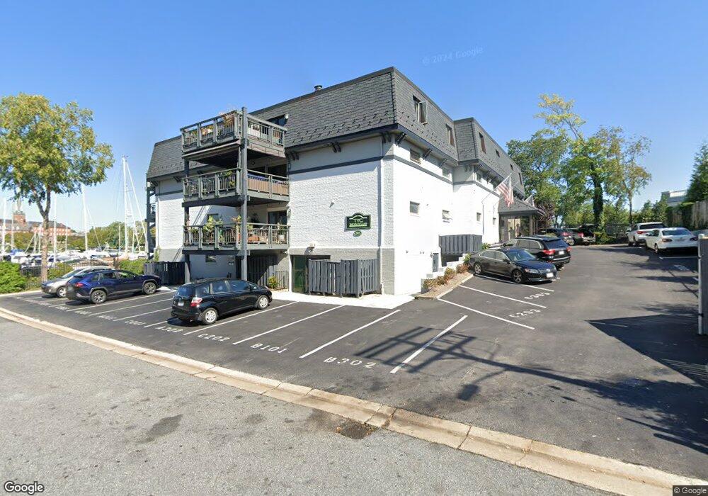
301 Burnside St Unit A301 Annapolis, MD 21403
Eastport NeighborhoodEstimated Value: $616,000 - $720,000
--
Bed
--
Bath
759
Sq Ft
$886/Sq Ft
Est. Value
About This Home
This home is located at 301 Burnside St Unit A301, Annapolis, MD 21403 and is currently estimated at $672,390, approximately $885 per square foot. 301 Burnside St Unit A301 is a home located in Anne Arundel County with nearby schools including Eastport Elementary School, Annapolis Middle School, and Annapolis High School.
Ownership History
Date
Name
Owned For
Owner Type
Purchase Details
Closed on
May 1, 2020
Sold by
Klasson Leif Knut Inge
Bought by
Klasson Leif Knut Inge and Klasson Maria Paoola
Current Estimated Value
Purchase Details
Closed on
Aug 21, 1985
Bought by
Klasson Leif
Home Financials for this Owner
Home Financials are based on the most recent Mortgage that was taken out on this home.
Original Mortgage
$101,200
Interest Rate
12.24%
Create a Home Valuation Report for This Property
The Home Valuation Report is an in-depth analysis detailing your home's value as well as a comparison with similar homes in the area
Home Values in the Area
Average Home Value in this Area
Purchase History
| Date | Buyer | Sale Price | Title Company |
|---|---|---|---|
| Klasson Leif Knut Inge | -- | None Available | |
| Klasson Leif | $126,500 | -- |
Source: Public Records
Mortgage History
| Date | Status | Borrower | Loan Amount |
|---|---|---|---|
| Closed | Klasson Leif | $101,200 |
Source: Public Records
Tax History Compared to Growth
Tax History
| Year | Tax Paid | Tax Assessment Tax Assessment Total Assessment is a certain percentage of the fair market value that is determined by local assessors to be the total taxable value of land and additions on the property. | Land | Improvement |
|---|---|---|---|---|
| 2025 | $8,380 | $703,267 | -- | -- |
| 2024 | $8,380 | $624,833 | $0 | $0 |
| 2023 | $7,846 | $546,400 | $273,200 | $273,200 |
| 2022 | $7,699 | $546,400 | $273,200 | $273,200 |
| 2021 | $15,398 | $546,400 | $273,200 | $273,200 |
| 2020 | $15,408 | $546,400 | $273,200 | $273,200 |
| 2019 | $13,318 | $498,333 | $0 | $0 |
| 2018 | $6,263 | $450,267 | $0 | $0 |
| 2017 | $4,752 | $402,200 | $0 | $0 |
| 2016 | -- | $363,000 | $0 | $0 |
| 2015 | -- | $323,800 | $0 | $0 |
| 2014 | -- | $284,600 | $0 | $0 |
Source: Public Records
Map
Nearby Homes
- 301 Burnside St Unit C 202
- 289 State St Unit 4
- 287 State St Unit 3
- 287 State St Unit 2
- 316 Burnside St Unit 101
- 9 Shipwright St
- 1 Shipwright Harbor
- 10 Sailors Way
- 312 Severn Ave Unit W-401
- 168 Green St
- 412 Jefferson St
- 179 Green St
- 1007 Park Ave
- 200 Chesapeake Ave
- 320 Chester Ave
- 2 Southgate Ave Unit 10
- 120 Chesapeake Ave
- 934 Bay Ridge Ave Unit 308
- 192 Duke of Gloucester St
- 41 Cornhill St
- 301 Burnside St Unit B101
- 301 Burnside St
- 301 Burnside St
- 301 Burnside St
- 301 Burnside St
- 301 Burnside St
- 301 Burnside St
- 301 Burnside St
- 301 Burnside St
- 301 Burnside St
- 301 Burnside St
- 301 Burnside St
- 301 Burnside St
- 301 Burnside St
- 301 Burnside St
- 301 Burnside St
- 301 Burnside St
- 301 Burnside St
- 301 Burnside St
- 301 Burnside St