
Seller's Agent in 2025
Joan Eisenhardt
RE/MAX
(410) 979-2590
2 in this area
71 Total Sales
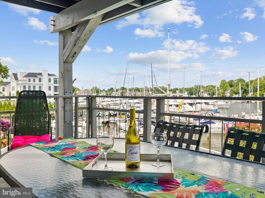
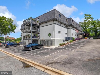
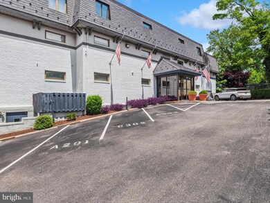
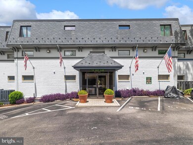
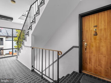

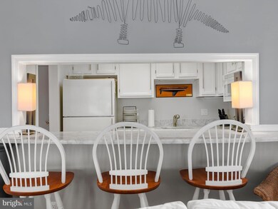
THE BEST OF WATERFRONT LIVING AND THE BEST VIEWS IN THE DEVELOPMENT with year-round views of Spa Creek in the Sought After, Gated Community, THE YACHT CLUB CONDOMINIUMS! Enjoy the ultimate Annapolis Lifestyle where you can dine dockside, paddleboard at sunrise, take a dip in the waterside pool or catch the water taxi to downtown Annapolis. Step inside to this immaculate unit and call it home. The Community Amenities elevate the experience with a clubroom, fitness area with shower facilities, waterside pool, grilling area, deep water marina access, assigned parking, secure storage area and pet-friendly!
This spectacular 2 Bedroom, 1 Bath unit was converted to a 1 Bedroom to add a Dining Room to boast the spectacular views and could be easily converted back to 2 Bedrooms. You will LOVE the open floorplan, the Bright Kitchen and water views from every angle! This unit is being sold furnished, don't wait, schedule your tour today! Condo bylaws require a 15 day right of refusal before settlement.
Last Agent to Sell the Property
(443) 274-1900 jeisen407@aol.com RE/MAX Executive Listed on: 07/24/2025
Last Buyer's Agent
(410) 778-0330 murphy@cbchesapeake.com Coldwell Banker Chesapeake Real Estate Company License #5010912
| Date | Type | Sale Price | Title Company |
|---|---|---|---|
| Deed | $795,000 | Old Republic National Title In | |
| Deed | $162,000 | -- | |
| Deed | $145,000 | -- |
| Date | Status | Loan Amount | Loan Type |
|---|---|---|---|
| Previous Owner | $130,500 | No Value Available | |
| Closed | -- | No Value Available |
| Date | Event | Price | List to Sale | Price per Sq Ft |
|---|---|---|---|---|
| 08/25/2025 08/25/25 | Sold | $795,000 | -3.6% | $994 / Sq Ft |
| 07/30/2025 07/30/25 | Pending | -- | -- | -- |
| 07/24/2025 07/24/25 | For Sale | $825,000 | -- | $1,031 / Sq Ft |
| Year | Tax Paid | Tax Assessment Tax Assessment Total Assessment is a certain percentage of the fair market value that is determined by local assessors to be the total taxable value of land and additions on the property. | Land | Improvement |
|---|---|---|---|---|
| 2025 | $8,979 | $703,267 | -- | -- |
| 2024 | $8,979 | $624,833 | -- | -- |
| 2023 | $7,846 | $546,400 | $273,200 | $273,200 |
| 2022 | $7,699 | $546,400 | $273,200 | $273,200 |
| 2020 | $7,704 | $546,400 | $273,200 | $273,200 |
| 2019 | $7,031 | $498,333 | $0 | $0 |
| 2018 | $6,263 | $450,267 | $0 | $0 |
| 2017 | $4,752 | $402,200 | $0 | $0 |
| 2016 | -- | $363,000 | $0 | $0 |
| 2015 | -- | $323,800 | $0 | $0 |
| 2014 | -- | $284,600 | $0 | $0 |
Seller's Agent in 2025
Joan Eisenhardt
RE/MAX
(410) 979-2590
2 in this area
71 Total Sales
Buyer's Agent in 2025
Murphy ONeill
Coldwell Banker Chesapeake Real Estate Company
(443) 480-4275
3 in this area
63 Total Sales
Source: Bright MLS
MLS Number: MDAA2120968
APN: 06-993-90011297
Disclaimer: Certain information contained herein is derived from information provided by parties other than Homes.com. All information provided is deemed reliable, but is not guaranteed to be accurate and should be independently verified.
![]() The data relating to real estate for sale on this website appears in part through the BRIGHT Internet Data Exchange program, a voluntary cooperative exchange of property listing data between licensed real estate brokerage firms, and is provided by BRIGHT through a licensing agreement.
The data relating to real estate for sale on this website appears in part through the BRIGHT Internet Data Exchange program, a voluntary cooperative exchange of property listing data between licensed real estate brokerage firms, and is provided by BRIGHT through a licensing agreement.
Listing information is from various brokers who participate in the Bright MLS IDX program and not all listings may be visible on the site.
The property information being provided on or through the website is for the personal, non-commercial use of consumers and such information may not be used for any purpose other than to identify prospective properties consumers may be interested in purchasing.
Some properties which appear for sale on the website may no longer be available because they are for instance, under contract, sold or are no longer being offered for sale.
Property information displayed is deemed reliable but is not guaranteed.
Copyright 2026 Bright MLS, Inc.
Ask me questions while you tour the home.