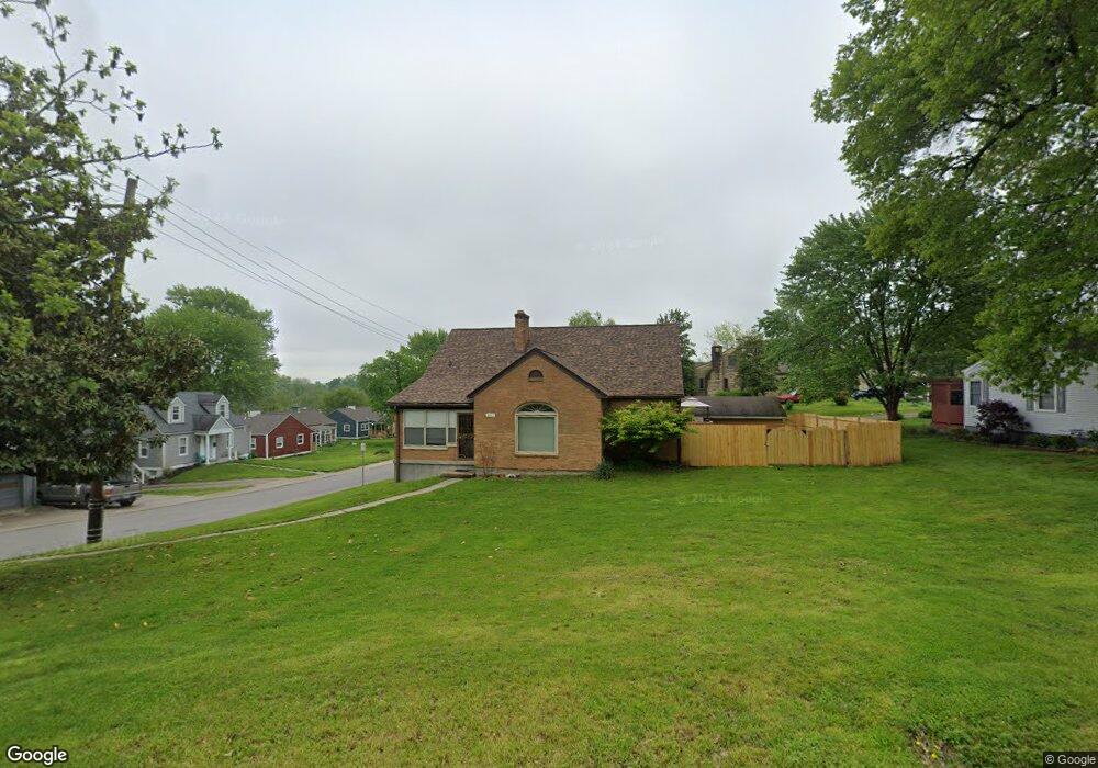
301 Captain Frank Rd New Albany, IN 47150
Estimated Value: $281,000 - $349,897
5
Beds
3
Baths
3,968
Sq Ft
$80/Sq Ft
Est. Value
About This Home
This home is located at 301 Captain Frank Rd, New Albany, IN 47150 and is currently estimated at $317,724, approximately $80 per square foot. 301 Captain Frank Rd is a home located in Floyd County with nearby schools including Green Valley Elementary School, Nathaniel Scribner Middle School, and New Albany Senior High School.
Ownership History
Date
Name
Owned For
Owner Type
Purchase Details
Closed on
Aug 24, 2023
Sold by
Mccaslin Investments Llc
Bought by
Mm & Ml Llc
Current Estimated Value
Purchase Details
Closed on
Mar 30, 2022
Sold by
Sword Alan R
Bought by
Mccasline Investments Llc
Home Financials for this Owner
Home Financials are based on the most recent Mortgage that was taken out on this home.
Original Mortgage
$230,000
Interest Rate
3.92%
Mortgage Type
Construction
Purchase Details
Closed on
Feb 26, 2021
Sold by
Sword Billy Joe
Bought by
Sword Alan R
Purchase Details
Closed on
Dec 4, 2007
Sold by
The Sword Asset Management Tr
Bought by
Sword Billy Joe
Purchase Details
Closed on
Oct 18, 2005
Sold by
Sword Billy Joe
Bought by
The Sword Asset Management Trust
Create a Home Valuation Report for This Property
The Home Valuation Report is an in-depth analysis detailing your home's value as well as a comparison with similar homes in the area
Home Values in the Area
Average Home Value in this Area
Purchase History
| Date | Buyer | Sale Price | Title Company |
|---|---|---|---|
| Mm & Ml Llc | -- | None Listed On Document | |
| Mccasline Investments Llc | $470,000 | None Listed On Document | |
| Sword Alan R | $44,000 | None Available | |
| Sword Billy Joe | -- | None Available | |
| The Sword Asset Management Trust | -- | None Available |
Source: Public Records
Mortgage History
| Date | Status | Borrower | Loan Amount |
|---|---|---|---|
| Previous Owner | Mccasline Investments Llc | $230,000 |
Source: Public Records
Tax History Compared to Growth
Tax History
| Year | Tax Paid | Tax Assessment Tax Assessment Total Assessment is a certain percentage of the fair market value that is determined by local assessors to be the total taxable value of land and additions on the property. | Land | Improvement |
|---|---|---|---|---|
| 2024 | $6,181 | $274,600 | $30,900 | $243,700 |
| 2023 | $9,979 | $242,100 | $30,900 | $211,200 |
| 2022 | $4,380 | $205,100 | $30,900 | $174,200 |
| 2021 | $1,967 | $183,500 | $30,900 | $152,600 |
| 2020 | $1,971 | $183,500 | $30,900 | $152,600 |
| 2019 | $1,837 | $171,300 | $30,900 | $140,400 |
| 2018 | $1,965 | $181,800 | $30,900 | $150,900 |
| 2017 | $1,719 | $157,300 | $30,900 | $126,400 |
| 2016 | $1,560 | $156,000 | $30,900 | $125,100 |
| 2014 | $1,385 | $138,500 | $30,900 | $107,600 |
| 2013 | -- | $144,300 | $30,900 | $113,400 |
Source: Public Records
Map
Nearby Homes
- 6 Valley View Ct
- 201 Virginia Ct
- 1519 Valley View Rd
- 131 Olive Ave
- 420 Sherley St
- 301 Country Club Dr
- 1202 Naghel St
- 2318 Coyle Dr
- 1021 Bluff Ridge Dr
- 1107 Griffin St
- 226 Sloemer Ave
- 1309 Vine St
- 810 Katie Lane (Lot 10)
- 929 Valley View Rd
- 210 Clay St
- 917 Valley View Rd
- 911 Cherry St
- 61 Wolfe Trace Ct
- 2424 Stover Dr
- 511 E Daisy Ln
- 229 Captain Frank Rd
- 1936 Olive St
- 2017 Olive St
- 305 Captain Frank Rd
- 33 Valley View Ct
- 225 Captain Frank Rd
- 2015 Olive St
- 309 Captain Frank Rd
- 228 Captain Frank Rd
- 32 Valley View Ct
- 223 Captain Frank Rd
- 31 Valley View Ct
- 310 Captain Frank Rd
- 2013 Olive St
- 302 Captain Frank Rd
- 30 Valley View Ct
- 221 Captain Frank Rd
- 401 Captain Frank Rd
- 220 Captain Frank Rd
- 24 Valley View Ct