301 Cedar Ave Demorest, GA 30535
Estimated Value: $384,000 - $613,000
4
Beds
3
Baths
1,983
Sq Ft
$245/Sq Ft
Est. Value
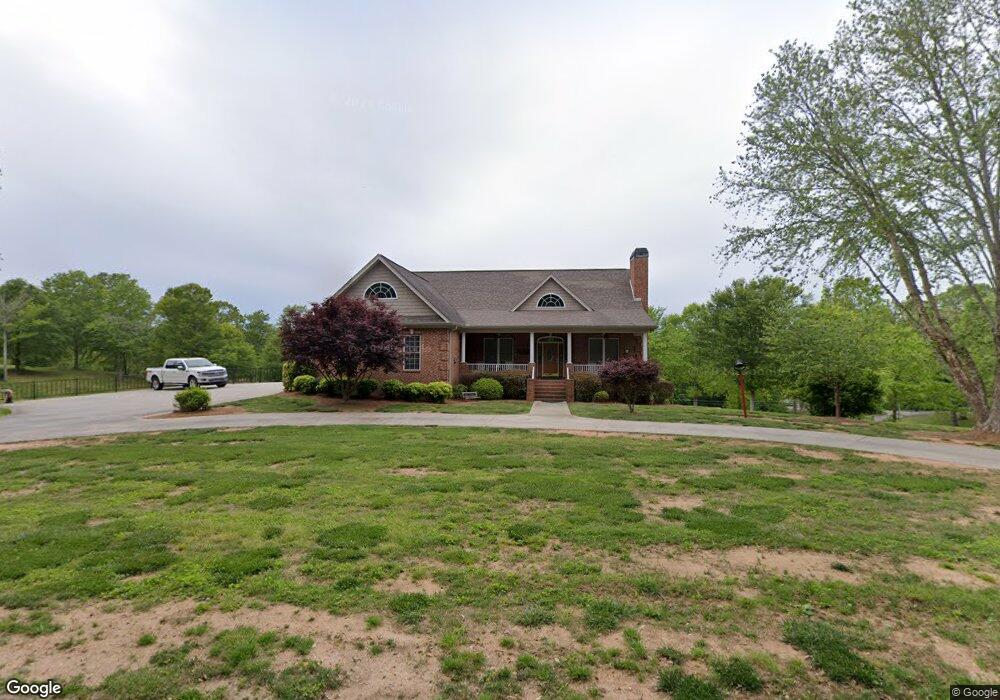
About This Home
This home is located at 301 Cedar Ave, Demorest, GA 30535 and is currently estimated at $485,601, approximately $244 per square foot. 301 Cedar Ave is a home with nearby schools including Demorest Elementary School, Wilbanks Middle School, and Habersham Success Academy.
Ownership History
Date
Name
Owned For
Owner Type
Purchase Details
Closed on
Sep 10, 2021
Sold by
Turpin Ann
Bought by
Turpin Peter A
Current Estimated Value
Home Financials for this Owner
Home Financials are based on the most recent Mortgage that was taken out on this home.
Original Mortgage
$240,000
Outstanding Balance
$218,382
Interest Rate
2.8%
Mortgage Type
New Conventional
Estimated Equity
$267,219
Purchase Details
Closed on
May 2, 2017
Sold by
Turpin Billy E
Bought by
Turpin Billy E and Turpin Ann
Create a Home Valuation Report for This Property
The Home Valuation Report is an in-depth analysis detailing your home's value as well as a comparison with similar homes in the area
Home Values in the Area
Average Home Value in this Area
Purchase History
| Date | Buyer | Sale Price | Title Company |
|---|---|---|---|
| Turpin Peter A | $300,000 | -- | |
| Turpin Billy E | $301,700 | -- |
Source: Public Records
Mortgage History
| Date | Status | Borrower | Loan Amount |
|---|---|---|---|
| Open | Turpin Peter A | $240,000 |
Source: Public Records
Tax History Compared to Growth
Tax History
| Year | Tax Paid | Tax Assessment Tax Assessment Total Assessment is a certain percentage of the fair market value that is determined by local assessors to be the total taxable value of land and additions on the property. | Land | Improvement |
|---|---|---|---|---|
| 2025 | $7,126 | $261,404 | $55,331 | $206,073 |
| 2024 | -- | $256,252 | $47,532 | $208,720 |
| 2023 | $4,534 | $219,780 | $47,532 | $172,248 |
| 2022 | $4,837 | $185,500 | $38,028 | $147,472 |
| 2021 | $3,486 | $165,008 | $34,224 | $130,784 |
| 2020 | $1,526 | $140,688 | $28,520 | $112,168 |
| 2019 | $1,528 | $140,688 | $28,520 | $112,168 |
| 2018 | $1,491 | $135,936 | $23,768 | $112,168 |
| 2017 | $1,401 | $120,680 | $19,012 | $101,668 |
| 2016 | $2,886 | $301,700 | $19,012 | $101,668 |
| 2015 | -- | $301,700 | $19,012 | $101,668 |
Source: Public Records
Map
Nearby Homes
- 160 Ohio St
- 274 & 278 N Hazel Ave
- 876 Central Ave
- 623 Maine St
- 523 Wauka Dr
- 539 Wauka Dr
- 545 Wauka Dr
- 515 Wauka Dr
- 536 Wauka Dr
- 544 Wauka Dr
- 1522 Central Ave
- 158 Saluda Dr
- Plan 1709 at Habersham Meadows
- Plan 1902 at Habersham Meadows
- Plan 2604 at Habersham Meadows
- Plan 1602-2 at Habersham Meadows
- Plan 3119 at Habersham Meadows
- Plan 2628 at Habersham Meadows
- Plan 2131 at Habersham Meadows
- Plan 2100 at Habersham Meadows
- 181 Mcmillan Ave
- 0 Blue Ridge Ave Unit 3112810
- 0 Blue Ridge Ave Unit 3193931
- 0 Blue Ridge Ave Unit 7366380
- 00 Blueridge Ave
- 0 Blue Ridge Ave Unit 5368006
- 0 Blue Ridge Ave Unit 8031015
- 0 Blue Ridge Ave Unit 8980613
- 0 Blue Ridge Ave Unit 8991196
- 0 Blue Ridge Ave Unit 9027825
- 0 Blue Ridge Ave Unit 3277783
- 0 Blue Ridge Ave Unit 7054116
- 0 Blue Ridge Ave Unit 7159767
- 0 Blue Ridge Ave Unit 7275591
- 0 Blue Ridge Ave Unit 7368165
- 0 Blue Ridge Ave Unit 7374846
- 0 Blue Ridge Ave Unit 7430723
- 0 Blue Ridge Ave Unit 8166516
- 297 Walnut Ave
- 0 Walnut St Unit 8136677