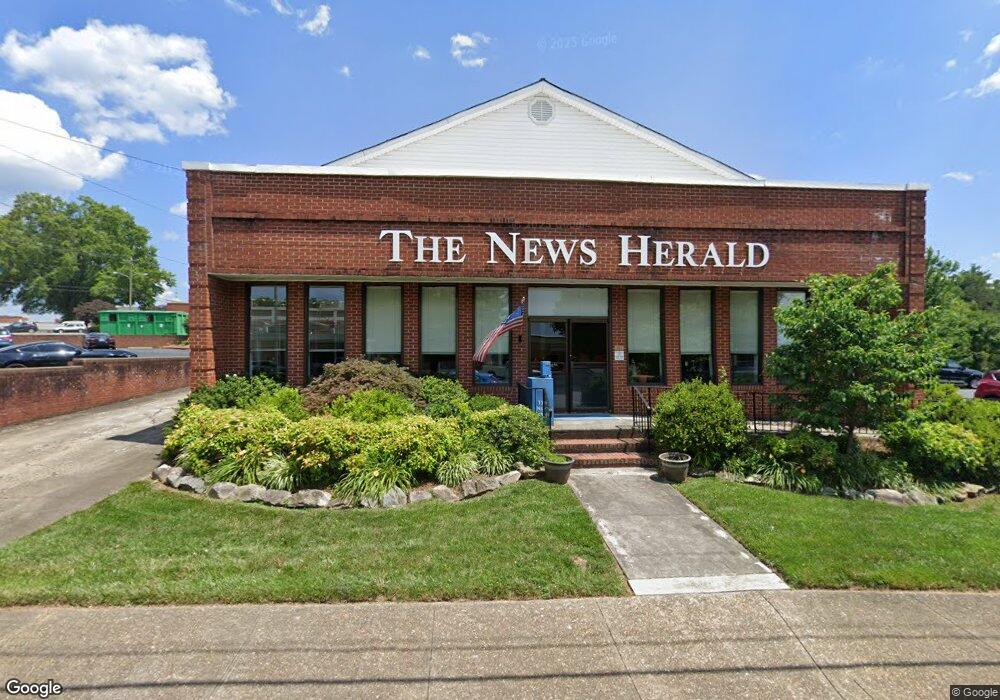
301 Collett St Morganton, NC 28655
Estimated Value: $579,000
Studio
--
Bath
--
Sq Ft
0.33
Acres
About This Home
This home is located at 301 Collett St, Morganton, NC 28655 and is currently estimated at $579,000. 301 Collett St is a home located in Burke County with nearby schools including Forest Hill Elementary School, Walter R. Johnson Middle School, and Robert L. Patton High School.
Ownership History
Date
Name
Owned For
Owner Type
Purchase Details
Closed on
Jun 18, 2012
Sold by
Media General Operations Inc
Bought by
World Media Enterprises Inc
Current Estimated Value
Purchase Details
Closed on
Feb 10, 2009
Sold by
Media General Communications Inc
Bought by
Media General Operations Inc
Home Financials for this Owner
Home Financials are based on the most recent Mortgage that was taken out on this home.
Original Mortgage
$701,332
Interest Rate
5.15%
Mortgage Type
Purchase Money Mortgage
Create a Home Valuation Report for This Property
The Home Valuation Report is an in-depth analysis detailing your home's value as well as a comparison with similar homes in the area
Home Values in the Area
Average Home Value in this Area
Purchase History
| Date | Buyer | Sale Price | Title Company |
|---|---|---|---|
| World Media Enterprises Inc | $403,500 | None Available | |
| Media General Operations Inc | -- | None Available |
Source: Public Records
Mortgage History
| Date | Status | Borrower | Loan Amount |
|---|---|---|---|
| Previous Owner | Media General Operations Inc | $701,332 |
Source: Public Records
Tax History Compared to Growth
Tax History
| Year | Tax Paid | Tax Assessment Tax Assessment Total Assessment is a certain percentage of the fair market value that is determined by local assessors to be the total taxable value of land and additions on the property. | Land | Improvement |
|---|---|---|---|---|
| 2025 | $587 | $105,694 | $99,444 | $6,250 |
| 2024 | $592 | $105,694 | $99,444 | $6,250 |
| 2023 | $592 | $105,694 | $99,444 | $6,250 |
| 2022 | $735 | $105,694 | $99,444 | $6,250 |
| 2021 | $735 | $105,694 | $99,444 | $6,250 |
| 2019 | $735 | $105,694 | $99,444 | $6,250 |
| 2018 | $778 | $111,944 | $99,444 | $12,500 |
| 2017 | $778 | $111,944 | $99,444 | $12,500 |
| 2016 | $761 | $111,944 | $99,444 | $12,500 |
| 2015 | $761 | $111,944 | $99,444 | $12,500 |
| 2014 | $761 | $111,944 | $99,444 | $12,500 |
| 2013 | $811 | $119,244 | $99,444 | $19,800 |
Source: Public Records
Map
Nearby Homes
- 118 W Union St Unit A
- 308 N Green St Unit 6
- 214 Howard St
- 203 Beacon Ave
- 710 Bouchelle St
- 218 Davis Dr
- 302 White St
- 212 Riverside Dr
- 203 Morehead St
- 231 Davis Dr
- VL E Concord St
- 103 Ramsey St
- 209 Park St
- 115 Riverside Ct
- 320 Morehead Street Extension
- 111 Kinwood St
- 106 Lane St Unit 6
- 115 Kinwood St
- 404 Patton St
- 0 Coal Shute Rd Unit CAR3935533
- 207 Queen St
- 404 N College St
- 107 Stoney Place
- 406 N College St Unit 406B
- 112 Terrace Place
- 107 Sycamore Cir
- 110 Terrace Place
- 104 Queen St
- 108 Terrace Place
- 102 Queen St
- 100 Queen St
- 400 N King St
- 307 N Sterling St
- 124 W Union St
- 118C W Union St
- 118 W Union St Unit B
- 118C W Union St
- 118 W Union St Unit B
- 118 W Union St
- 118 W Union St