Estimated Value: $262,000 - $335,000
4
Beds
4
Baths
1,692
Sq Ft
$181/Sq Ft
Est. Value
About This Home
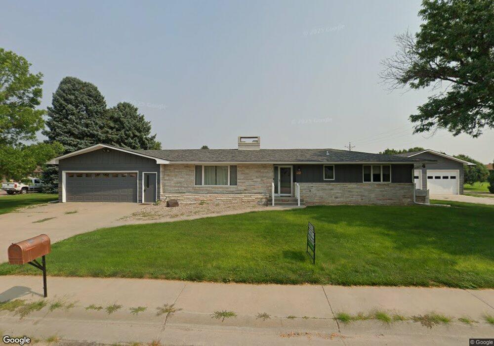
This home is located at 301 E 9th St, Grant, NE 69140 and is currently estimated at $306,856, approximately $181 per square foot. 301 E 9th St is a home located in Perkins County with nearby schools including Perkins County Elementary School and Perkins County Junior/Senior High School.
Ownership History
Date
Name
Owned For
Owner Type
Purchase Details
Closed on
Dec 22, 2023
Sold by
Smith David Robertson
Bought by
Thelander Wayne L and Thelander Kathy J
Current Estimated Value
Purchase Details
Closed on
Aug 23, 2021
Sold by
Darrell C Hagan Revocable Trust
Bought by
Smith David Robertson and Mclennan-Smith Barbara Ann
Purchase Details
Closed on
May 4, 2015
Sold by
Robert Mccormick and Robert Shirley
Bought by
Hagan Darrell and Hagan Helen
Purchase Details
Closed on
Sep 16, 2011
Bought by
Mccormick Robert and Mccormick Shirley
Create a Home Valuation Report for This Property
The Home Valuation Report is an in-depth analysis detailing your home's value as well as a comparison with similar homes in the area
Purchase History
| Date | Buyer | Sale Price | Title Company |
|---|---|---|---|
| Thelander Wayne L | $370,000 | -- | |
| Smith David Robertson | -- | None Listed On Document | |
| Hagan Darrell | $210,000 | -- | |
| Mccormick Robert | $135,000 | -- |
Source: Public Records
Tax History
| Year | Tax Paid | Tax Assessment Tax Assessment Total Assessment is a certain percentage of the fair market value that is determined by local assessors to be the total taxable value of land and additions on the property. | Land | Improvement |
|---|---|---|---|---|
| 2025 | $3,332 | $344,269 | $13,300 | $330,969 |
| 2024 | $2,606 | $259,332 | $13,300 | $246,032 |
| 2023 | $3,339 | $259,332 | $13,300 | $246,032 |
| 2022 | $3,342 | $228,730 | $13,300 | $215,430 |
| 2021 | $3,034 | $204,940 | $13,300 | $191,640 |
| 2020 | $2,545 | $176,000 | $9,800 | $166,200 |
| 2019 | $2,255 | $176,000 | $9,800 | $166,200 |
| 2018 | $2,140 | $176,000 | $9,800 | $166,200 |
| 2017 | $2,206 | $173,000 | $9,800 | $163,200 |
| 2016 | $1,933 | $150,000 | $9,800 | $140,200 |
| 2015 | $1,779 | $135,000 | $9,800 | $125,200 |
| 2014 | $2,032 | $135,000 | $9,800 | $125,200 |
Source: Public Records
Map
Nearby Homes
- 840 Elm Ave
- 13 Grassland Ridge Ct
- 521 Hancock Ave
- 305 Sherman Ave
- 32620 Hwy 23
- 0 Road 769
- 105 N Forbes Ave
- 0000 Hwy 23
- 302 S Ames Ave
- 412 S Ford Ave
- 306 Robinson St
- 75415 Road 337
- 290 W Road I S
- 181 Lawrence Rd
- Trs 9-10-11-12 Mueller & Mueller Corp
- 301 Chuckwagon Rd
- 609 E A St S
- 55 River Rd
- 216 Linnell St
- 303 Linnell St
- 845 Hancock Ave
- 219 E 9th St
- 937 Hancock Ave
- 939 Hancock Ave
- 854 Hancock Ave
- 304 E 9th St
- 938 Hancock Ave
- 836 Hancock Ave
- 844 Logan Ave
- 835 Hancock Ave
- 944 Hancock Ave
- 844 Hancock Ave
- 965 Hancock Ave
- 836 Logan Ave
- 940 Logan Ave
- 938 Logan Ave
- 821 Hancock Ave
- 832 Logan Ave
- 860 Hancock Ave
- 966 Hancock Ave
Your Personal Tour Guide
Ask me questions while you tour the home.