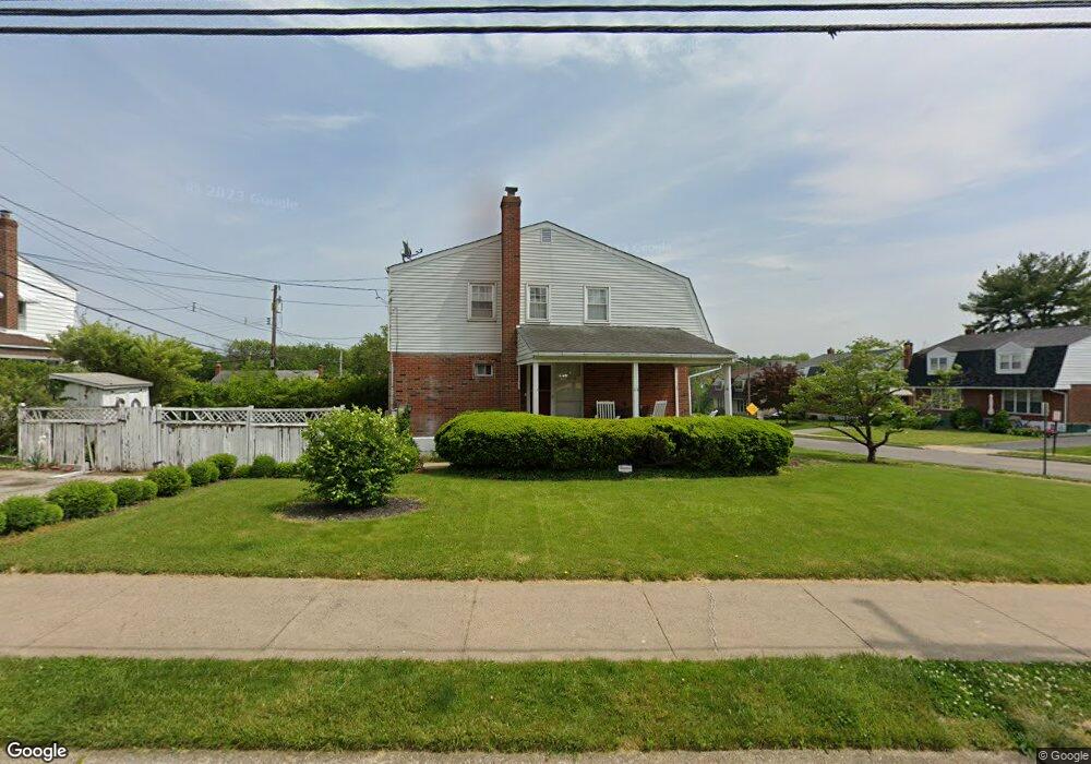
301 E Logan St Norristown, PA 19401
Estimated Value: $289,000 - $332,000
3
Beds
2
Baths
1,360
Sq Ft
$224/Sq Ft
Est. Value
About This Home
This home is located at 301 E Logan St, Norristown, PA 19401 and is currently estimated at $304,507, approximately $223 per square foot. 301 E Logan St is a home located in Montgomery County with nearby schools including Hancock Elementary School, Charles Blockson Middle School, and East Norriton Middle School.
Ownership History
Date
Name
Owned For
Owner Type
Purchase Details
Closed on
Nov 10, 2004
Sold by
Not Provided
Bought by
Schleppy Joyce E
Current Estimated Value
Purchase Details
Closed on
Oct 27, 2004
Sold by
Not Provided
Bought by
Schleppy Joyce E
Purchase Details
Closed on
Dec 26, 2001
Sold by
Bean John O
Bought by
Bean John O and Proud Jacqueline
Purchase Details
Closed on
May 20, 1999
Sold by
Bean John O and Bean Adeline M
Bought by
Bean John O
Create a Home Valuation Report for This Property
The Home Valuation Report is an in-depth analysis detailing your home's value as well as a comparison with similar homes in the area
Home Values in the Area
Average Home Value in this Area
Purchase History
| Date | Buyer | Sale Price | Title Company |
|---|---|---|---|
| Schleppy Joyce E | -- | -- | |
| Schleppy Joyce E | -- | -- | |
| Bean John O | -- | -- | |
| Bean John O | -- | -- |
Source: Public Records
Mortgage History
| Date | Status | Borrower | Loan Amount |
|---|---|---|---|
| Closed | Schleppy Joyce E | $0 |
Source: Public Records
Tax History Compared to Growth
Tax History
| Year | Tax Paid | Tax Assessment Tax Assessment Total Assessment is a certain percentage of the fair market value that is determined by local assessors to be the total taxable value of land and additions on the property. | Land | Improvement |
|---|---|---|---|---|
| 2025 | $5,491 | $89,450 | $26,730 | $62,720 |
| 2024 | $5,491 | $89,450 | $26,730 | $62,720 |
| 2023 | $5,442 | $89,450 | $26,730 | $62,720 |
| 2022 | $5,324 | $89,450 | $26,730 | $62,720 |
| 2021 | $5,298 | $89,450 | $26,730 | $62,720 |
| 2020 | $5,054 | $89,450 | $26,730 | $62,720 |
| 2019 | $4,962 | $89,450 | $26,730 | $62,720 |
| 2018 | $3,056 | $89,450 | $26,730 | $62,720 |
| 2017 | $4,556 | $89,450 | $26,730 | $62,720 |
| 2016 | $4,521 | $89,450 | $26,730 | $62,720 |
| 2015 | $4,332 | $89,450 | $26,730 | $62,720 |
| 2014 | $4,332 | $89,450 | $26,730 | $62,720 |
Source: Public Records
Map
Nearby Homes
- 1801 Arch St Unit 24W
- 1803 Arch St
- 1805 Arch St Unit 22E
- 236 Chapel Ct Unit 32E
- 1807 Arch St Unit 21E
- 1809 Arch St Unit 20S
- 1811 Arch St Unit 19W
- 1829 Arch St Unit 10S
- 247 Chapel Ct Unit 81C
- 1831 Arch St Unit 9W
- 249 Chapel Ct Dr Unit 82C
- 1838 Arbor Place Dr Unit 42S
- 1842 Arbor Place Dr Unit 44E
- 253 Chapel Ct Unit 84A
- 1840 Arbor Place Dr Unit 43E
- 268 Harmony Ct Unit 76C
- 1854 Arbor Place Dr Unit 50W
- 1846 Arbor Place Dr Unit 46S
- 1879 Harmony Ct Unit 72A
- 270 Harmony Ct Unit 77B
- 303 E Logan St
- 305 E Logan St
- 1800 Arch St
- The Surrey Honey Ln
- 307 E Logan St
- The Sutton Honey Ln
- The Sutton in Honey Honey Ln
- 1802 Arch St
- The Summerside Honey Ln
- The Summerside - Honey Ln
- 309 E Logan St
- 302 E Logan St
- 1804 Arch St
- 300 E Logan St
- The Sutton - Honey Ln
- 304 E Logan St
- The Surrey - Honey Ln
- 306 E Logan St
- 311 E Logan St
- 1806 Arch St