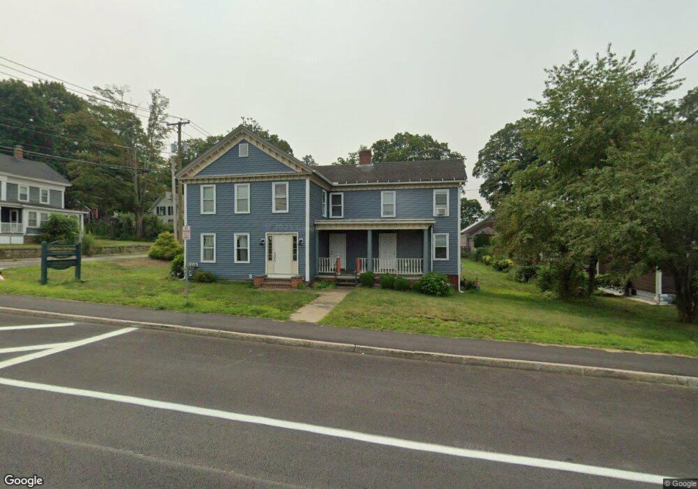
301 E Main St East Brookfield, MA 01515
Estimated Value: $436,000 - $715,000
6
Beds
5
Baths
4,800
Sq Ft
$127/Sq Ft
Est. Value
About This Home
This home is located at 301 E Main St, East Brookfield, MA 01515 and is currently estimated at $610,328, approximately $127 per square foot. 301 E Main St is a home located in Worcester County with nearby schools including David Prouty High School.
Ownership History
Date
Name
Owned For
Owner Type
Purchase Details
Closed on
Jun 30, 2025
Sold by
Roldan Roy and Roldan Lisa L
Bought by
Roldan Lisa
Current Estimated Value
Home Financials for this Owner
Home Financials are based on the most recent Mortgage that was taken out on this home.
Original Mortgage
$400,000
Interest Rate
6.5%
Mortgage Type
New Conventional
Purchase Details
Closed on
Sep 5, 2003
Sold by
Mosher Frank
Bought by
Mosher-Kohlstrom Lori and Kohlstrom Scott D
Home Financials for this Owner
Home Financials are based on the most recent Mortgage that was taken out on this home.
Original Mortgage
$40,274
Interest Rate
6.02%
Mortgage Type
Purchase Money Mortgage
Create a Home Valuation Report for This Property
The Home Valuation Report is an in-depth analysis detailing your home's value as well as a comparison with similar homes in the area
Home Values in the Area
Average Home Value in this Area
Purchase History
| Date | Buyer | Sale Price | Title Company |
|---|---|---|---|
| Roldan Lisa | -- | -- | |
| Mosher-Kohlstrom Lori | $42,000 | -- | |
| Mosher-Kohlstrom Lori J | $42,000 | -- |
Source: Public Records
Mortgage History
| Date | Status | Borrower | Loan Amount |
|---|---|---|---|
| Previous Owner | Roldan Lisa | $400,000 | |
| Previous Owner | Mosher-Kohlstrom Lori J | $40,274 |
Source: Public Records
Tax History
| Year | Tax Paid | Tax Assessment Tax Assessment Total Assessment is a certain percentage of the fair market value that is determined by local assessors to be the total taxable value of land and additions on the property. | Land | Improvement |
|---|---|---|---|---|
| 2025 | $6,986 | $544,100 | $73,500 | $470,600 |
| 2024 | $6,606 | $517,300 | $67,600 | $449,700 |
| 2023 | $5,789 | $441,600 | $62,100 | $379,500 |
| 2022 | $6,473 | $478,400 | $54,700 | $423,700 |
| 2021 | $5,675 | $382,700 | $54,700 | $328,000 |
| 2020 | $5,805 | $391,700 | $54,700 | $337,000 |
| 2019 | $5,993 | $363,900 | $54,700 | $309,200 |
| 2018 | $5,638 | $364,700 | $53,900 | $310,800 |
| 2017 | $4,604 | $282,800 | $49,800 | $233,000 |
| 2016 | $4,660 | $266,900 | $49,800 | $217,100 |
| 2015 | $4,618 | $266,000 | $49,800 | $216,200 |
| 2014 | $4,634 | $266,000 | $49,800 | $216,200 |
Source: Public Records
Map
Nearby Homes
- 301 E Main St
- 297 E Main St
- 05 Podunk Rd
- 1-8 Podunk & Adams
- 295 E Main St
- 305 E Main St
- 305 E Main St Unit 2
- 302 E Main St
- 304 E Main St
- 105 Cottage St
- 300 E Main St Unit 2
- 300 E Main St
- 298 E Main St
- 308 E Main St
- 296 E Main St
- 112 Pleasant St
- 293 E Main St
- 311 E Main St
- 311 E Main St Unit 1
- 311 E Main St Unit 2
Your Personal Tour Guide
Ask me questions while you tour the home.