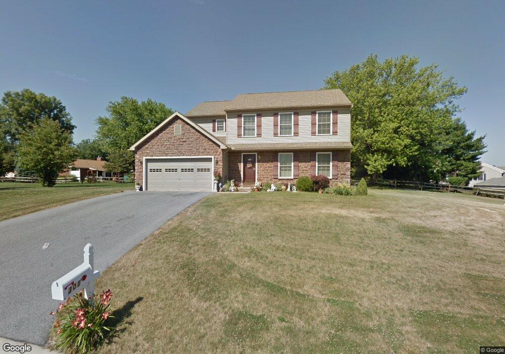
301 Fisher Ln Lebanon, PA 17042
North Cornwall NeighborhoodEstimated Value: $367,000 - $519,000
4
Beds
3
Baths
2,004
Sq Ft
$218/Sq Ft
Est. Value
About This Home
This home is located at 301 Fisher Ln, Lebanon, PA 17042 and is currently estimated at $436,636, approximately $217 per square foot. 301 Fisher Ln is a home located in Lebanon County with nearby schools including Ebenezer Elementary School, Cedar Crest Middle School, and Cedar Crest High School.
Ownership History
Date
Name
Owned For
Owner Type
Purchase Details
Closed on
Apr 7, 2006
Sold by
Ymes Llp
Bought by
Doricent Soeurette
Current Estimated Value
Home Financials for this Owner
Home Financials are based on the most recent Mortgage that was taken out on this home.
Original Mortgage
$165,900
Outstanding Balance
$94,786
Interest Rate
6.26%
Mortgage Type
New Conventional
Estimated Equity
$341,850
Create a Home Valuation Report for This Property
The Home Valuation Report is an in-depth analysis detailing your home's value as well as a comparison with similar homes in the area
Home Values in the Area
Average Home Value in this Area
Purchase History
| Date | Buyer | Sale Price | Title Company |
|---|---|---|---|
| Doricent Soeurette | $225,900 | None Available |
Source: Public Records
Mortgage History
| Date | Status | Borrower | Loan Amount |
|---|---|---|---|
| Open | Doricent Soeurette | $165,900 |
Source: Public Records
Tax History Compared to Growth
Tax History
| Year | Tax Paid | Tax Assessment Tax Assessment Total Assessment is a certain percentage of the fair market value that is determined by local assessors to be the total taxable value of land and additions on the property. | Land | Improvement |
|---|---|---|---|---|
| 2025 | $5,760 | $233,400 | $51,600 | $181,800 |
| 2024 | $5,252 | $233,400 | $51,600 | $181,800 |
| 2023 | $5,252 | $233,400 | $51,600 | $181,800 |
| 2022 | $5,084 | $233,400 | $51,600 | $181,800 |
| 2021 | $4,815 | $233,400 | $51,600 | $181,800 |
| 2020 | $4,779 | $233,400 | $51,600 | $181,800 |
| 2019 | $4,587 | $233,400 | $51,600 | $181,800 |
| 2018 | $4,503 | $233,400 | $51,600 | $181,800 |
| 2017 | $1,119 | $233,400 | $51,600 | $181,800 |
| 2016 | $4,421 | $233,400 | $51,600 | $181,800 |
| 2015 | -- | $233,400 | $51,600 | $181,800 |
| 2014 | -- | $233,400 | $51,600 | $181,800 |
Source: Public Records
Map
Nearby Homes
- 429 Bricker Ln
- 535 S Mill St
- 261 Kathy Ct
- 25 Walnut Mill Ln
- 538 W Locust St
- 208 S Center St
- 216 W Union Alley
- 27 and 27 Rear N Center St
- 27 N Center St
- 14 Betony Ln
- 217 Dahlia Cir
- 844 S Spruce St
- 01 Dahlia
- Brookfield Plan at Fox Bend
- Darien Plan at Fox Bend
- Charlotte Plan at Fox Bend
- Berkley Plan at Fox Bend
- Bridgemont Plan at Fox Bend
- Kingston Plan at Fox Bend
- Westbrooke Plan at Fox Bend
- 409 Davis Ln
- 424 Millbridge Dr
- 427 Millbridge Dr
- 300 Fisher Ln
- 413 Davis Ln
- 331 Davis Ln
- 422 Millbridge Dr
- 417 Davis Ln
- 433 Millbridge Dr
- 327 Davis Ln
- 502 Stonebridge Dr
- 421 Davis Ln
- 420 Millbridge Dr
- 425 Millbridge Dr
- 408 Davis Ln
- 410 Davis Ln
- 330 Davis Ln
- 435 Millbridge Dr
- 412 Davis Ln
- 504 Stonebridge Dr