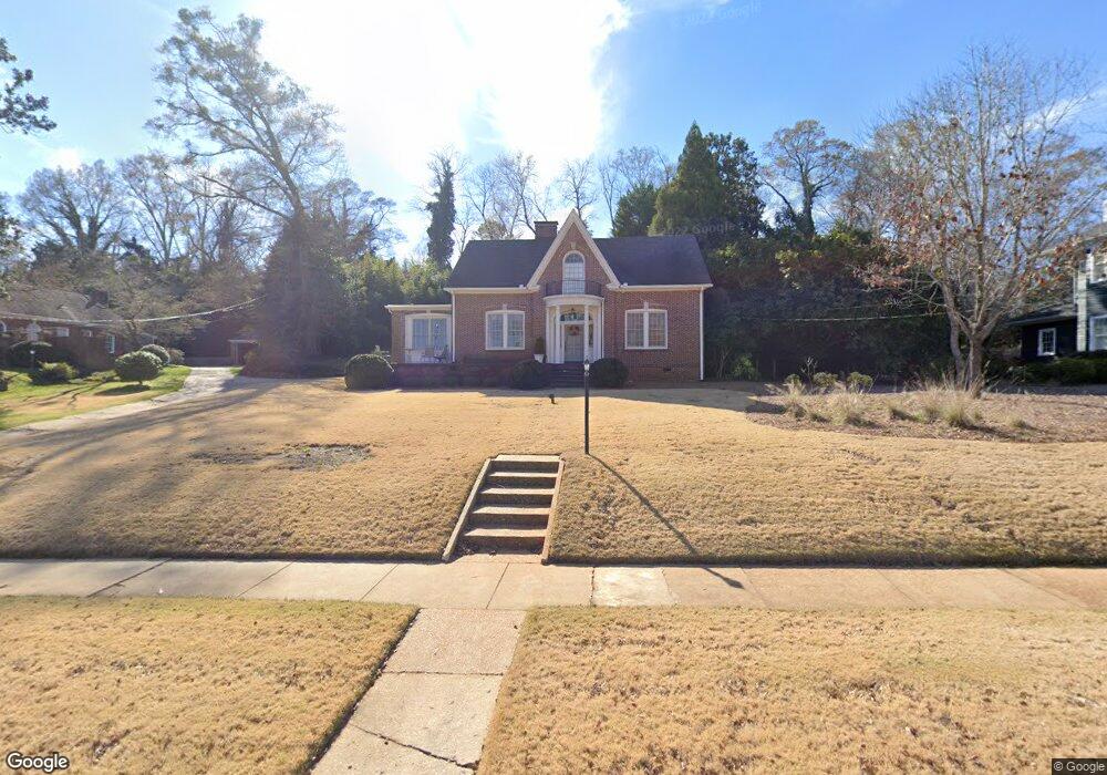
301 Gordon St Lagrange, GA 30240
Estimated Value: $328,680 - $542,000
3
Beds
2
Baths
2,381
Sq Ft
$169/Sq Ft
Est. Value
About This Home
This home is located at 301 Gordon St, Lagrange, GA 30240 and is currently estimated at $402,420, approximately $169 per square foot. 301 Gordon St is a home located in Troup County with nearby schools including Hollis Hand Elementary School, Franklin Forest Elementary School, and Ethel W. Kight Elementary School.
Ownership History
Date
Name
Owned For
Owner Type
Purchase Details
Closed on
Jan 30, 2012
Sold by
Fnma
Bought by
Herring Charles T
Current Estimated Value
Home Financials for this Owner
Home Financials are based on the most recent Mortgage that was taken out on this home.
Original Mortgage
$175,275
Outstanding Balance
$17,694
Interest Rate
3.99%
Mortgage Type
New Conventional
Estimated Equity
$384,726
Purchase Details
Closed on
Oct 21, 2011
Sold by
Wells Fargo Bank
Bought by
Federal National Mtg
Purchase Details
Closed on
Aug 8, 2011
Sold by
Robinson Lane W
Bought by
Wells Fargo Bank
Purchase Details
Closed on
Dec 18, 2007
Sold by
Kemp Brent K
Bought by
Robinson Lane W
Home Financials for this Owner
Home Financials are based on the most recent Mortgage that was taken out on this home.
Original Mortgage
$257,500
Interest Rate
6.15%
Mortgage Type
New Conventional
Purchase Details
Closed on
Jun 1, 2006
Sold by
Dolan Suellen
Bought by
Kemp Brent L and Kemp Kelly S
Purchase Details
Closed on
May 27, 1993
Sold by
Louis J Kirby
Bought by
Suellen M Dolan
Purchase Details
Closed on
Oct 30, 1990
Sold by
First Federal Savings Bank
Bought by
Louis J Kirby
Purchase Details
Closed on
Dec 22, 1987
Sold by
Holle Henry P and Holle Lynne B
Bought by
First Federal Savings Bank
Purchase Details
Closed on
Dec 21, 1987
Sold by
Norman P Loftin
Bought by
Holle Henry P and Holle Lynne B
Purchase Details
Closed on
Jan 22, 1985
Sold by
Barbara L Loftin
Bought by
Norman P Loftin
Purchase Details
Closed on
Jan 1, 1971
Sold by
Pruet Katheryn
Bought by
Barbara L Loftin
Purchase Details
Closed on
Jan 1, 1969
Sold by
Hunter Irma Hilt
Bought by
Pruet Katheryn
Purchase Details
Closed on
Oct 1, 1950
Sold by
O'Neal Dr and O'Neal R
Bought by
Hunter Irma Hilt
Create a Home Valuation Report for This Property
The Home Valuation Report is an in-depth analysis detailing your home's value as well as a comparison with similar homes in the area
Purchase History
| Date | Buyer | Sale Price | Title Company |
|---|---|---|---|
| Herring Charles T | $184,500 | -- | |
| Herring Charles T | $184,500 | -- | |
| Federal National Mtg | $257,500 | -- | |
| Wells Fargo Bank | $257,500 | -- | |
| Wells Fargo Bank | $257,500 | -- | |
| Robinson Lane W | $257,500 | -- | |
| Kemp Brent L | $250,000 | -- | |
| Suellen M Dolan | $149,000 | -- | |
| Louis J Kirby | $107,000 | -- | |
| First Federal Savings Bank | $110,000 | -- | |
| Holle Henry P | $125,000 | -- | |
| Norman P Loftin | -- | -- | |
| Barbara L Loftin | $20,000 | -- | |
| Pruet Katheryn | -- | -- | |
| Hunter Irma Hilt | -- | -- |
Source: Public Records
Mortgage History
| Date | Status | Borrower | Loan Amount |
|---|---|---|---|
| Open | Herring Charles T | $175,275 | |
| Previous Owner | Robinson Lane W | $257,500 |
Source: Public Records
Tax History
| Year | Tax Paid | Tax Assessment Tax Assessment Total Assessment is a certain percentage of the fair market value that is determined by local assessors to be the total taxable value of land and additions on the property. | Land | Improvement |
|---|---|---|---|---|
| 2025 | $3,403 | $138,000 | $18,000 | $120,000 |
| 2024 | $2,901 | $106,360 | $16,320 | $90,040 |
| 2023 | $2,804 | $102,800 | $16,320 | $86,480 |
| 2022 | $2,600 | $93,160 | $16,320 | $76,840 |
| 2021 | $2,416 | $80,120 | $16,320 | $63,800 |
| 2020 | $2,416 | $80,120 | $16,320 | $63,800 |
| 2019 | $2,391 | $79,264 | $18,144 | $61,120 |
| 2018 | $2,302 | $76,344 | $18,144 | $58,200 |
| 2017 | $2,152 | $71,344 | $18,144 | $53,200 |
| 2016 | $2,128 | $70,552 | $18,144 | $52,408 |
| 2015 | $2,275 | $75,298 | $22,890 | $52,408 |
| 2014 | $2,246 | $74,218 | $22,890 | $51,327 |
| 2013 | -- | $101,308 | $21,956 | $79,352 |
Source: Public Records
Map
Nearby Homes
- 206 Broad St
- 598 Edmondson Ave
- 105 Saynor Cir
- 120 Saynor Cir
- 405 W Broome St Unit 2
- 405 W Broome St Unit 3
- 405 W Broome St Unit 4
- 405 W Broome St Unit 1
- 405 W Broome St Unit 5
- 203 Waverly Way
- 208 Boulevard
- 216 E Lane Cir
- 119 College Ave
- 304 Boulevard
- 609 Ridley Ave
- 707 Ridley Ave
- 611 Ridley Ave
- 615 Ridley Ave
- 709 Ridley Ave
- 0 Ridley Ave Unit 10550104
- 303 Gordon St
- 207 Gordon St
- 228 Gordon St
- 228 Gordon St Unit 1
- 300 Gordon St
- 314 E Mclendon Cir
- 226 Gordon St
- 302 Gordon St
- 310 E Mclendon Cir
- 305 Gordon St
- 308 E Mclendon Cir
- 205 Gordon St
- 304 Gordon St
- 224 Gordon St
- 306 E Mclendon Cir
- 501 Sylvan Dr
- 216 Gordon St
- E E Mclendon Cir
- 214 Gordon St
- 320 E Mclendon Cir
Your Personal Tour Guide
Ask me questions while you tour the home.