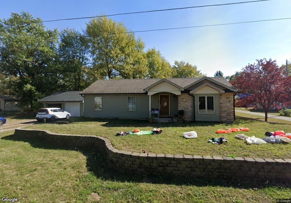
301 Griswold St Middle Point, OH 45863
Estimated Value: $124,000 - $168,000
3
Beds
1
Bath
1,432
Sq Ft
$98/Sq Ft
Est. Value
About This Home
This home is located at 301 Griswold St, Middle Point, OH 45863 and is currently estimated at $139,912, approximately $97 per square foot. 301 Griswold St is a home with nearby schools including Lincolnview Elementary School and Lincolnview Junior/Senior High School.
Ownership History
Date
Name
Owned For
Owner Type
Purchase Details
Closed on
Sep 22, 2022
Sold by
West Joy A
Bought by
Haynie Norman
Current Estimated Value
Purchase Details
Closed on
Oct 7, 2015
Sold by
West Joy A and Eversole Joy A
Bought by
West Thomas E
Create a Home Valuation Report for This Property
The Home Valuation Report is an in-depth analysis detailing your home's value as well as a comparison with similar homes in the area
Purchase History
| Date | Buyer | Sale Price | Title Company |
|---|---|---|---|
| Haynie Norman | $45,000 | -- | |
| West Thomas E | -- | Attorney |
Source: Public Records
Tax History
| Year | Tax Paid | Tax Assessment Tax Assessment Total Assessment is a certain percentage of the fair market value that is determined by local assessors to be the total taxable value of land and additions on the property. | Land | Improvement |
|---|---|---|---|---|
| 2024 | $1,329 | $38,560 | $2,180 | $36,380 |
| 2023 | $1,319 | $38,560 | $2,180 | $36,380 |
| 2022 | $1,343 | $28,940 | $2,000 | $26,940 |
| 2021 | $1,316 | $28,940 | $2,000 | $26,940 |
| 2020 | $1,313 | $28,940 | $2,000 | $26,940 |
| 2019 | $1,059 | $24,640 | $2,000 | $22,640 |
| 2018 | $1,032 | $24,640 | $2,000 | $22,640 |
| 2017 | $938 | $22,450 | $2,000 | $20,450 |
| 2016 | $627 | $17,210 | $2,000 | $15,210 |
| 2015 | $619 | $17,210 | $2,000 | $15,210 |
| 2014 | $641 | $17,210 | $2,000 | $15,210 |
| 2013 | $739 | $16,860 | $2,000 | $14,860 |
Source: Public Records
Map
Nearby Homes
- 112 W Railroad St
- TBD Dog Creek Rd
- 19357 Church Rd
- 14998 Middle Point Rd
- 18906 Bebb St
- 15044 Main St
- 19059 Wittington St
- 10429 Ohio 66
- 537 / 539 Toomey
- 709 W 4th St
- 708 W 1st St
- 409 N Bredeick St
- 21092 St Rt 224
- 1109 Mendon Rd
- 1047 Mendon Rd
- TBD Mendon Rd
- 420 S Cass St
- 629 N Main St
- 702 N Main St
- 424 S Canal St
Your Personal Tour Guide
Ask me questions while you tour the home.