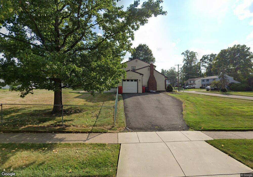
301 Kent Rd Warminster, PA 18974
Estimated Value: $465,000 - $594,000
--
Bed
2
Baths
2,119
Sq Ft
$243/Sq Ft
Est. Value
About This Home
This home is located at 301 Kent Rd, Warminster, PA 18974 and is currently estimated at $514,413, approximately $242 per square foot. 301 Kent Rd is a home located in Bucks County with nearby schools including Willow Dale El School, Log College Middle School, and William Tennent High School.
Ownership History
Date
Name
Owned For
Owner Type
Purchase Details
Closed on
Sep 26, 1996
Sold by
Bilodeau David C and Bilodeau Joan
Bought by
Steele James S and Steele Ruth E
Current Estimated Value
Home Financials for this Owner
Home Financials are based on the most recent Mortgage that was taken out on this home.
Original Mortgage
$130,400
Outstanding Balance
$11,771
Interest Rate
7.9%
Estimated Equity
$502,642
Purchase Details
Closed on
Nov 29, 1967
Bought by
Bilodeau David C and Bilodeau Joan
Create a Home Valuation Report for This Property
The Home Valuation Report is an in-depth analysis detailing your home's value as well as a comparison with similar homes in the area
Home Values in the Area
Average Home Value in this Area
Purchase History
| Date | Buyer | Sale Price | Title Company |
|---|---|---|---|
| Steele James S | $163,000 | -- | |
| Bilodeau David C | -- | -- |
Source: Public Records
Mortgage History
| Date | Status | Borrower | Loan Amount |
|---|---|---|---|
| Open | Steele James S | $130,400 |
Source: Public Records
Tax History Compared to Growth
Tax History
| Year | Tax Paid | Tax Assessment Tax Assessment Total Assessment is a certain percentage of the fair market value that is determined by local assessors to be the total taxable value of land and additions on the property. | Land | Improvement |
|---|---|---|---|---|
| 2025 | $6,585 | $31,200 | $6,520 | $24,680 |
| 2024 | $6,585 | $31,200 | $6,520 | $24,680 |
| 2023 | $6,383 | $31,200 | $6,520 | $24,680 |
| 2022 | $6,246 | $31,200 | $6,520 | $24,680 |
| 2021 | $6,101 | $31,200 | $6,520 | $24,680 |
| 2020 | $6,015 | $31,200 | $6,520 | $24,680 |
| 2019 | $5,696 | $31,200 | $6,520 | $24,680 |
| 2018 | $5,559 | $31,200 | $6,520 | $24,680 |
| 2017 | $5,396 | $31,200 | $6,520 | $24,680 |
| 2016 | $5,396 | $31,200 | $6,520 | $24,680 |
| 2015 | $5,253 | $31,200 | $6,520 | $24,680 |
| 2014 | $5,253 | $31,200 | $6,520 | $24,680 |
Source: Public Records
Map
Nearby Homes
- 1334 Mallard Cir
- 64 Villa Dr Unit 206
- 100 Villa Dr Unit 224
- 159 Villa Dr Unit 91
- 442 Acorn Dr
- 1277 Beverly Rd
- 1274 Beverly Rd
- 1309 Clyde Rd
- 1575 W Street Rd Unit 626
- 1575 W Street Rd Unit 812
- 1575 W Street Rd Unit 721
- 1130 Victoria Rd
- 254 Sassafras Ct Unit 254
- 735 Saint Davids Ave
- 244 Sassafras Ct Unit 244
- 223 Sassafras Ct Unit 223
- 13 Eagle Ct
- 192 Hackberry Ct
- L:26 Street Rd
- Faraday Plan at Liberty Ridge