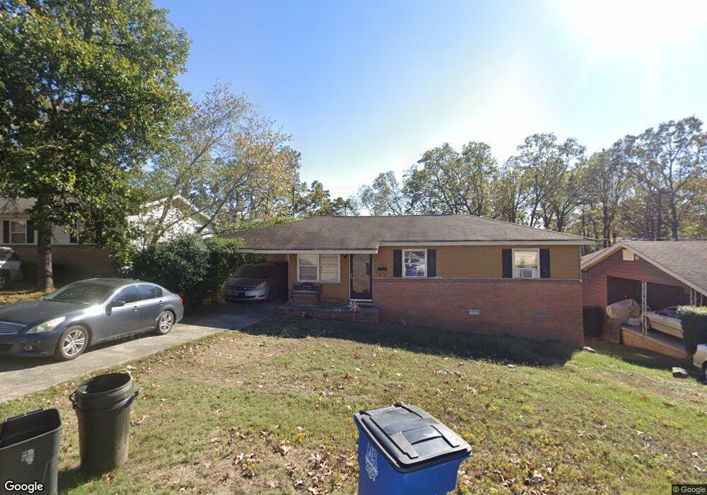
301 Lindenhurst Dr North Little Rock, AR 72118
Amboy NeighborhoodEstimated Value: $75,424 - $106,000
--
Bed
1
Bath
930
Sq Ft
$101/Sq Ft
Est. Value
About This Home
This home is located at 301 Lindenhurst Dr, North Little Rock, AR 72118 and is currently estimated at $94,356, approximately $101 per square foot. 301 Lindenhurst Dr is a home located in Pulaski County with nearby schools including Indian Hills Elementary School, North Little Rock Middle School 6th Grade Campus, and North Little Rock High School.
Ownership History
Date
Name
Owned For
Owner Type
Purchase Details
Closed on
Mar 27, 2007
Sold by
Lighthouse Partners Llc
Bought by
Esau Mary A
Current Estimated Value
Purchase Details
Closed on
Apr 24, 2006
Sold by
Swindle James and Swindle Stacey A
Bought by
Lighthouse Partners Llc
Purchase Details
Closed on
May 22, 2002
Sold by
Skrmetti Linda Kay and Gammel Linda Kay
Bought by
Swindle James and Swindle Stacey A
Home Financials for this Owner
Home Financials are based on the most recent Mortgage that was taken out on this home.
Original Mortgage
$25,200
Interest Rate
9.1%
Create a Home Valuation Report for This Property
The Home Valuation Report is an in-depth analysis detailing your home's value as well as a comparison with similar homes in the area
Home Values in the Area
Average Home Value in this Area
Purchase History
| Date | Buyer | Sale Price | Title Company |
|---|---|---|---|
| Esau Mary A | $70,000 | West Little Rock Title Co | |
| Lighthouse Partners Llc | $40,000 | West Little Rock Title Co | |
| Swindle James | $36,000 | First National Title Company |
Source: Public Records
Mortgage History
| Date | Status | Borrower | Loan Amount |
|---|---|---|---|
| Previous Owner | Swindle James | $25,200 |
Source: Public Records
Tax History Compared to Growth
Tax History
| Year | Tax Paid | Tax Assessment Tax Assessment Total Assessment is a certain percentage of the fair market value that is determined by local assessors to be the total taxable value of land and additions on the property. | Land | Improvement |
|---|---|---|---|---|
| 2025 | $637 | $12,727 | $1,300 | $11,427 |
| 2024 | $637 | $12,727 | $1,300 | $11,427 |
| 2023 | $637 | $12,727 | $1,300 | $11,427 |
| 2022 | $637 | $12,727 | $1,300 | $11,427 |
| 2021 | $637 | $9,530 | $1,600 | $7,930 |
| 2020 | $262 | $9,530 | $1,600 | $7,930 |
| 2019 | $262 | $9,530 | $1,600 | $7,930 |
| 2018 | $287 | $9,530 | $1,600 | $7,930 |
| 2017 | $287 | $9,530 | $1,600 | $7,930 |
| 2016 | $659 | $11,830 | $2,200 | $9,630 |
| 2015 | $659 | $9,858 | $2,200 | $7,658 |
| 2014 | $659 | $9,858 | $2,200 | $7,658 |
Source: Public Records
Map
Nearby Homes
- 104 Lindenhurst Dr
- 34 Jaynelle Place
- 5732 Camp Robinson Rd
- 60 Oakview Dr
- 5504 Allen St
- 901 W 58th St
- 9 Blackstone Cir
- 900 Donovan Briley Blvd
- 0 Timberline Dr
- 5315 Chandler St
- 5630 Foxboro Dr
- 0 W Hill Ct
- 1108 Nicole Dr
- 5321 Marion St
- 407 W 51st St
- 801 Green Hills Dr
- 412 W 51st St
- Lot 87 Foxboro Dr
- Lot 86 Foxboro Dr
- Lot 85 Foxboro Dr
- 213 Lindenhurst Dr
- 305 Lindenhurst Dr
- 209 Lindenhurst Dr
- 102 Somerset Dr
- 309 Lindenhurst Dr
- 209 Bluebell Dr
- 204 Lindenhurst Dr
- 205 Lindenhurst Dr
- 207 Bluebell Dr
- 5820 Wisteria Ct
- 98 Somerset Dr
- 6100 Whitby Ln
- 313 Lindenhurst Dr
- 5711 Bluebell Dr
- 97 Somerset Dr
- 1 Somerset Dr
- 205 Bluebell Dr
- 201 Lindenhurst Dr
- 5816 Wisteria Ct
- 6104 Whitby Ln