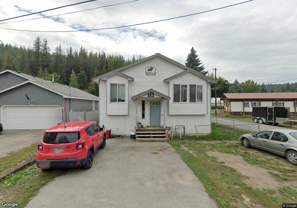
301 Maple St Pinehurst, ID 83850
Estimated Value: $298,000 - $396,000
4
Beds
2
Baths
1,862
Sq Ft
$189/Sq Ft
Est. Value
About This Home
This home is located at 301 Maple St, Pinehurst, ID 83850 and is currently estimated at $351,443, approximately $188 per square foot. 301 Maple St is a home located in Shoshone County with nearby schools including Pinehurst Elementary School, Kellogg Middle School, and Kellogg High School.
Ownership History
Date
Name
Owned For
Owner Type
Purchase Details
Closed on
Apr 13, 2012
Sold by
Homesales Inc
Bought by
Miller Sophie L
Current Estimated Value
Home Financials for this Owner
Home Financials are based on the most recent Mortgage that was taken out on this home.
Original Mortgage
$61,122
Outstanding Balance
$42,047
Interest Rate
3.9%
Mortgage Type
New Conventional
Estimated Equity
$309,396
Purchase Details
Closed on
Aug 20, 2008
Sold by
Schueller Troy L and Schueller Saprina
Bought by
Watson Kevin T and Watson Amy L
Home Financials for this Owner
Home Financials are based on the most recent Mortgage that was taken out on this home.
Original Mortgage
$145,350
Interest Rate
6.37%
Purchase Details
Closed on
Jul 12, 2006
Sold by
Schueller Troy L
Bought by
Schueller Troy L and Schueller Saprina
Home Financials for this Owner
Home Financials are based on the most recent Mortgage that was taken out on this home.
Original Mortgage
$155,000
Interest Rate
6.57%
Create a Home Valuation Report for This Property
The Home Valuation Report is an in-depth analysis detailing your home's value as well as a comparison with similar homes in the area
Home Values in the Area
Average Home Value in this Area
Purchase History
| Date | Buyer | Sale Price | Title Company |
|---|---|---|---|
| Miller Sophie L | -- | None Available | |
| Watson Kevin T | -- | -- | |
| Schueller Troy L | -- | -- |
Source: Public Records
Mortgage History
| Date | Status | Borrower | Loan Amount |
|---|---|---|---|
| Open | Miller Sophie L | $61,122 | |
| Previous Owner | Watson Kevin T | $145,350 | |
| Previous Owner | Schueller Troy L | $155,000 |
Source: Public Records
Tax History
| Year | Tax Paid | Tax Assessment Tax Assessment Total Assessment is a certain percentage of the fair market value that is determined by local assessors to be the total taxable value of land and additions on the property. | Land | Improvement |
|---|---|---|---|---|
| 2025 | $1,133 | $347,161 | $37,629 | $309,532 |
| 2024 | $1,667 | $347,161 | $37,629 | $309,532 |
| 2023 | $1,667 | $258,656 | $34,898 | $223,758 |
| 2022 | $1,386 | $255,269 | $31,093 | $224,176 |
| 2021 | $1,346 | $178,163 | $26,381 | $151,782 |
| 2020 | $1,266 | $163,000 | $24,690 | $138,310 |
| 2019 | $1,203 | $142,400 | $21,830 | $120,570 |
| 2018 | $994 | $101,196 | $19,846 | $81,350 |
| 2017 | $928 | $95,856 | $19,846 | $76,010 |
| 2016 | $954 | $96,216 | $19,846 | $76,370 |
| 2015 | -- | $99,683 | $18,713 | $80,970 |
| 2014 | -- | $99,682 | $18,712 | $80,970 |
Source: Public Records
Map
Nearby Homes
- 6 Maple Ave
- 1 Elsie Peak Ct Unit B1, BLDG B
- 301 Woodland Dr
- 207 S Division St
- 305 S 1st
- 208 S 6th St
- 608 Country Club Ln
- 502 Lewiston Ave
- 605 Lewiston Ave
- 754 Paradise Ln
- 202 Silver Saddle Ct
- 483 Paradise Ln
- 113 Trail Blazer Ct
- 111 Trail Blazer Ct
- 0 Lot J Frosty Ln Unit 25-9282
- NNA Frosty Lane Lot I
- 317 Power Ave
- 101 Happy Trails Ln
- 207 Palamino Ct
- 203 Palomino
Your Personal Tour Guide
Ask me questions while you tour the home.