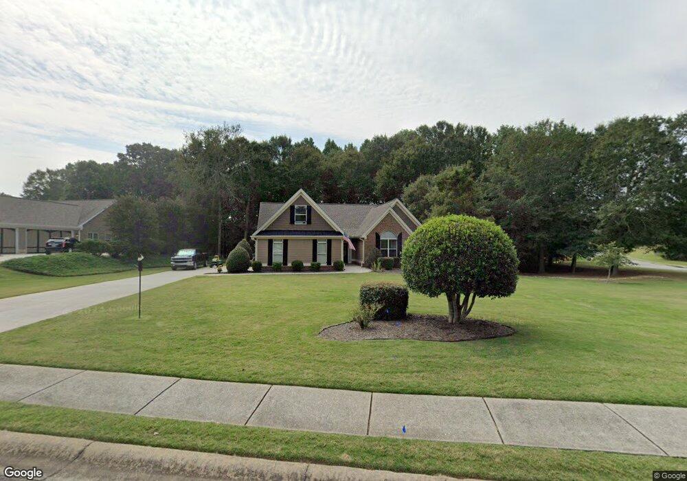
301 Molly Way Winder, GA 30680
Estimated Value: $399,071 - $455,000
--
Bed
3
Baths
2,183
Sq Ft
$199/Sq Ft
Est. Value
About This Home
This home is located at 301 Molly Way, Winder, GA 30680 and is currently estimated at $435,018, approximately $199 per square foot. 301 Molly Way is a home located in Barrow County with nearby schools including Bramlett Elementary School, Russell Middle School, and Winder-Barrow High School.
Ownership History
Date
Name
Owned For
Owner Type
Purchase Details
Closed on
Apr 2, 2025
Sold by
Winter Mark
Bought by
Winter Rita
Current Estimated Value
Purchase Details
Closed on
Jun 2, 2006
Sold by
Star Home Builders Inc
Bought by
Winter Mark And
Purchase Details
Closed on
Aug 1, 2005
Sold by
Montana Development Inc
Bought by
Star Home Builders Inc
Purchase Details
Closed on
Mar 4, 2004
Bought by
Montana Development Inc
Create a Home Valuation Report for This Property
The Home Valuation Report is an in-depth analysis detailing your home's value as well as a comparison with similar homes in the area
Home Values in the Area
Average Home Value in this Area
Purchase History
| Date | Buyer | Sale Price | Title Company |
|---|---|---|---|
| Winter Rita | -- | -- | |
| Winter Mark And | $236,900 | -- | |
| Star Home Builders Inc | $45,000 | -- | |
| Montana Development Inc | -- | -- |
Source: Public Records
Tax History Compared to Growth
Tax History
| Year | Tax Paid | Tax Assessment Tax Assessment Total Assessment is a certain percentage of the fair market value that is determined by local assessors to be the total taxable value of land and additions on the property. | Land | Improvement |
|---|---|---|---|---|
| 2024 | $3,274 | $146,676 | $33,600 | $113,076 |
| 2023 | $2,795 | $147,276 | $33,600 | $113,676 |
| 2022 | $2,665 | $108,360 | $28,800 | $79,560 |
| 2021 | $2,153 | $86,182 | $18,000 | $68,182 |
| 2020 | $2,144 | $86,182 | $18,000 | $68,182 |
| 2019 | $2,185 | $86,182 | $18,000 | $68,182 |
| 2018 | $2,154 | $86,268 | $18,000 | $68,268 |
| 2017 | $2,069 | $71,044 | $18,000 | $53,044 |
| 2016 | $1,376 | $61,112 | $18,000 | $43,112 |
| 2015 | $1,395 | $61,580 | $18,000 | $43,580 |
| 2014 | $1,118 | $52,875 | $8,820 | $44,055 |
| 2013 | -- | $48,112 | $8,820 | $39,292 |
Source: Public Records
Map
Nearby Homes
- 99 Mcmillian Ct
- 1931 Windstone Place
- 1929 Windstone Place
- 1557 Shadowstone Cir
- 1686 Shadowstone Ct
- 2839 Shadowstone Way
- 1202 Treemont Trace
- 2858 Shadowstone Way
- 1303 Windstone Ct
- 1224 Treemont Trace
- 852 Georgetown Dr
- 681 County Line Auburn Rd
- 137 New Cut Rd
- 787 Murphy Rd
- 629 Dee Kennedy Rd
- 731 Lincoln Dr
- 809 Custom Ln
- 303 Molly Way
- 408 Laythan Ct
- 305 Molly Way
- 410 Laythan Ct
- 833 Caleb Dr
- 404 Laythan Ct
- 829 Caleb Dr
- 0 Molly Way Unit 8695962
- 0 Molly Way Unit 8948443
- 412 Laythan Ct
- 307 Molly Way
- 302 Molly Way
- 0 Laythan Ct 0
- 412 Laythan Ct 0
- 412 Laythan Court 0
- 0 Laythan Ct Unit 7120328
- 0 Laythan Ct Unit 7593791
- 0 Laythan Ct Unit 7538782
- 0 Laythan Ct Unit 7479904
- 306 Molly Way