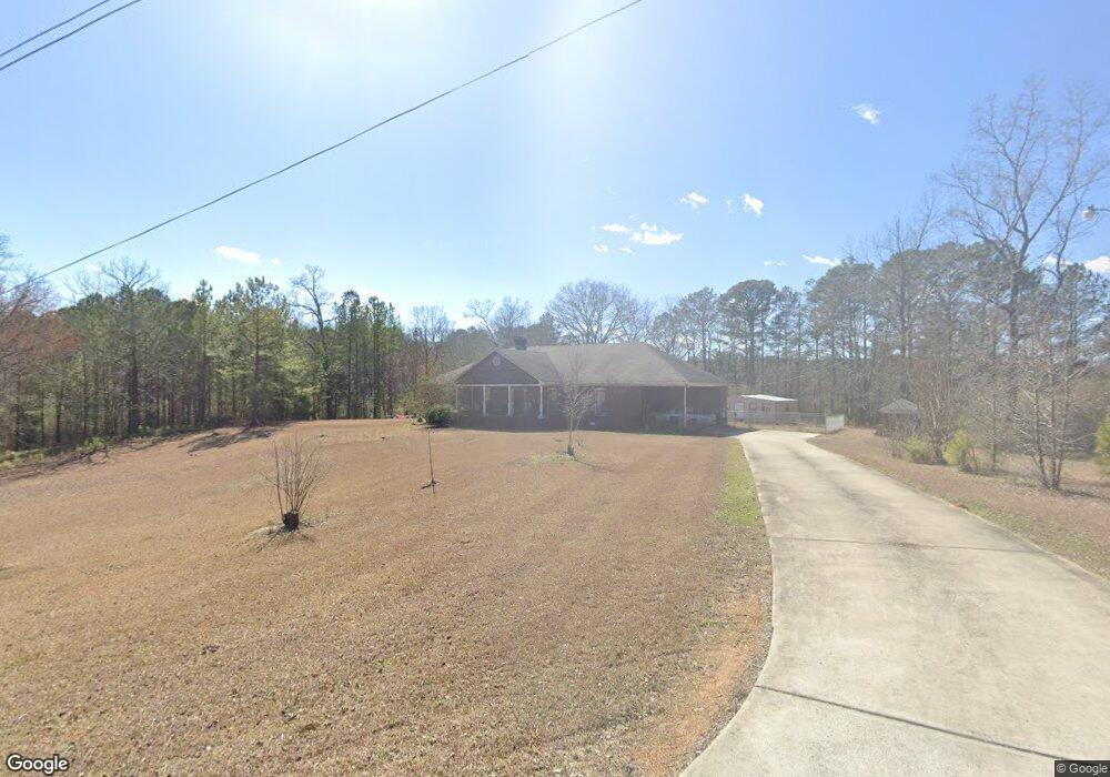
301 Moore Rd Locust Fork, AL 35097
Estimated Value: $305,000 - $376,986
3
Beds
2
Baths
2,428
Sq Ft
$142/Sq Ft
Est. Value
About This Home
This home is located at 301 Moore Rd, Locust Fork, AL 35097 and is currently estimated at $345,247, approximately $142 per square foot. 301 Moore Rd is a home located in Blount County with nearby schools including Locust Fork Elementary School and Locust Fork High School.
Ownership History
Date
Name
Owned For
Owner Type
Purchase Details
Closed on
Nov 1, 2019
Sold by
Martin Michael F and Shook Deborah L
Bought by
Pate Wesley Adam and Pate Trista Reasonover
Current Estimated Value
Home Financials for this Owner
Home Financials are based on the most recent Mortgage that was taken out on this home.
Original Mortgage
$206,196
Outstanding Balance
$181,580
Interest Rate
3.65%
Mortgage Type
New Conventional
Estimated Equity
$163,667
Purchase Details
Closed on
Aug 20, 2012
Sold by
West Bernice P
Bought by
Martin Michael F and Shook Deborah L
Create a Home Valuation Report for This Property
The Home Valuation Report is an in-depth analysis detailing your home's value as well as a comparison with similar homes in the area
Home Values in the Area
Average Home Value in this Area
Purchase History
| Date | Buyer | Sale Price | Title Company |
|---|---|---|---|
| Pate Wesley Adam | $210,000 | None Available | |
| Martin Michael F | $15,000 | -- |
Source: Public Records
Mortgage History
| Date | Status | Borrower | Loan Amount |
|---|---|---|---|
| Open | Pate Wesley Adam | $206,196 |
Source: Public Records
Tax History Compared to Growth
Tax History
| Year | Tax Paid | Tax Assessment Tax Assessment Total Assessment is a certain percentage of the fair market value that is determined by local assessors to be the total taxable value of land and additions on the property. | Land | Improvement |
|---|---|---|---|---|
| 2024 | $942 | $30,780 | $6,720 | $24,060 |
| 2023 | $942 | $28,900 | $6,720 | $22,180 |
| 2022 | $728 | $24,180 | $5,380 | $18,800 |
| 2021 | $587 | $19,840 | $4,360 | $15,480 |
| 2020 | $0 | $17,620 | $4,160 | $13,460 |
| 2019 | $440 | $17,620 | $4,160 | $13,460 |
| 2018 | $440 | $18,140 | $4,620 | $13,520 |
| 2017 | $0 | $18,400 | $0 | $0 |
| 2015 | -- | $18,400 | $0 | $0 |
| 2014 | -- | $19,460 | $0 | $0 |
| 2013 | -- | $19,480 | $0 | $0 |
Source: Public Records
Map
Nearby Homes
- 29542 Alabama 79
- 159 Ray Dr
- 89 Pine Tree Dr
- 4540 Spunky Hollow Rd
- #0 Shady Point Rd Unit 18, 18 & 19
- 178 Jerry Marsh Rd
- 380 Jerry Marsh Rd
- 55 Honeycutt Rd
- 3251 County Highway 13
- 496 Tawbush Rd
- 2898 County Highway 15
- 0 Center Hill Rd
- 31730 Alabama 79
- 25942 Alabama 79
- 707 Saint Andrews Pkwy
- 265 Riverview Dr
- Lot 104 Muirfield Cir Unit 104
- 1129 Baty Rd
- 32510 Alabama 79
- 25465 Alabama 79
- 222 Moore Rd
- 123 Moore Rd
- 00 Spunky Hollow Rd Unit 1
- Hwy 13 Highway 13
- 163 Azzilee Cir
- 175 Azzilee Cir
- 155 Azzilee Cir
- 199 Azzilee Cir
- 141 Azzilee Cir
- 26 Moore Rd
- 125 Azzilee Cir
- 170 Azzilee Cir
- 211 Azzilee Cir
- 138 Azzilee Cir
- 101 Azzilee Cir
- 120 Azzilee Cir
- 208 Azzilee Cir
- 89 Azzilee Cir
- 89 Azzilee Cir
- 100 Azzilee Cir